Estimated Value: $492,000 - $570,000
4
Beds
3
Baths
2,016
Sq Ft
$267/Sq Ft
Est. Value
About This Home
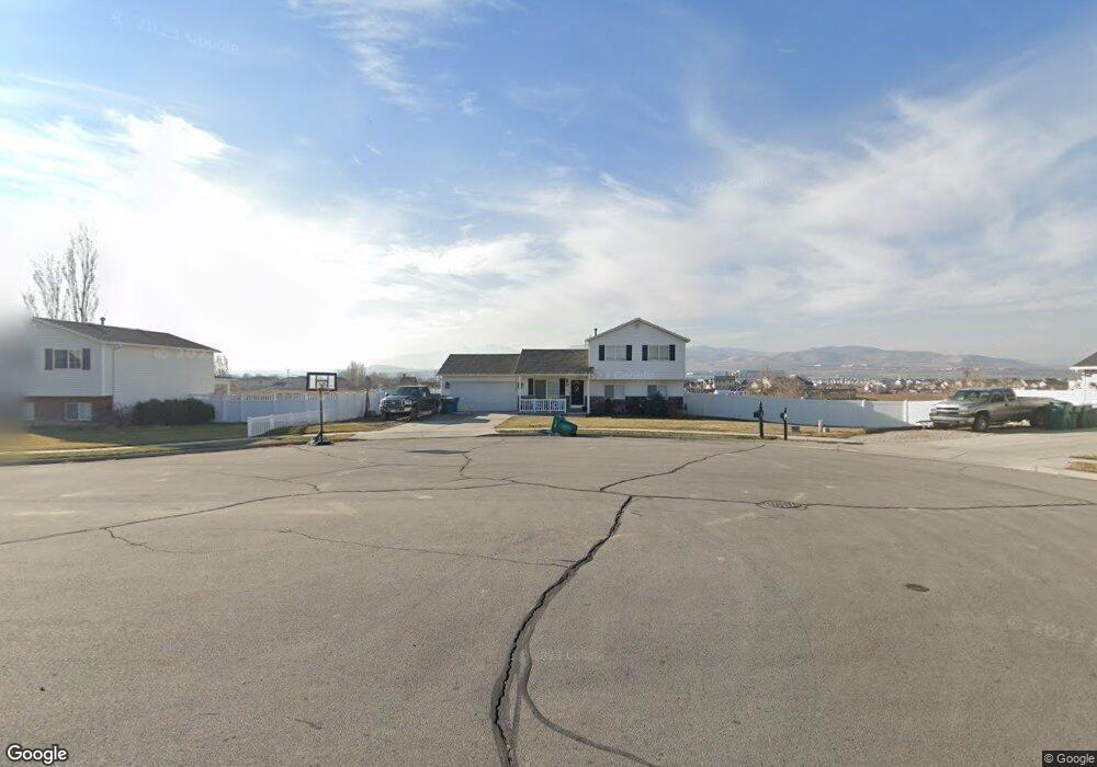
This home is located at 1887 N 2145 W, Lehi, UT 84043 and is currently estimated at $537,747, approximately $266 per square foot. 1887 N 2145 W is a home located in Utah County with nearby schools including North Point Elementary School, Willowcreek Middle School, and Lehi High School.
Ownership History
Date
Name
Owned For
Owner Type
Purchase Details
Closed on
Nov 21, 2014
Sold by
Smith Todd
Bought by
Brown Kristopher D
Current Estimated Value
Home Financials for this Owner
Home Financials are based on the most recent Mortgage that was taken out on this home.
Original Mortgage
$8,342
Outstanding Balance
$6,414
Interest Rate
4.1%
Mortgage Type
Stand Alone Second
Estimated Equity
$531,333
Purchase Details
Closed on
Aug 30, 2006
Sold by
Roberts Anthony and Roberts Megan
Bought by
Smith Todd
Purchase Details
Closed on
Jun 24, 1999
Sold by
Salisbury Development Llc
Bought by
Roberts Anthony and Roberts Megan
Home Financials for this Owner
Home Financials are based on the most recent Mortgage that was taken out on this home.
Original Mortgage
$123,850
Interest Rate
7.05%
Create a Home Valuation Report for This Property
The Home Valuation Report is an in-depth analysis detailing your home's value as well as a comparison with similar homes in the area
Home Values in the Area
Average Home Value in this Area
Purchase History
| Date | Buyer | Sale Price | Title Company |
|---|---|---|---|
| Brown Kristopher D | -- | Backman Title Services Ltd | |
| Smith Todd | -- | Monument Title Insurance I | |
| Roberts Anthony | -- | Provo Land Title Company |
Source: Public Records
Mortgage History
| Date | Status | Borrower | Loan Amount |
|---|---|---|---|
| Open | Brown Kristopher D | $8,342 | |
| Previous Owner | Roberts Anthony | $123,850 |
Source: Public Records
Tax History Compared to Growth
Tax History
| Year | Tax Paid | Tax Assessment Tax Assessment Total Assessment is a certain percentage of the fair market value that is determined by local assessors to be the total taxable value of land and additions on the property. | Land | Improvement |
|---|---|---|---|---|
| 2025 | $3,780 | $489,800 | $211,000 | $278,800 |
| 2024 | $3,780 | $442,400 | $0 | $0 |
| 2023 | $3,475 | $441,500 | $0 | $0 |
| 2022 | $3,688 | $454,300 | $195,400 | $258,900 |
| 2021 | $1,789 | $333,100 | $122,100 | $211,000 |
| 2020 | $1,686 | $310,300 | $113,100 | $197,200 |
| 2019 | $1,609 | $307,900 | $113,100 | $194,800 |
| 2018 | $1,534 | $277,500 | $100,800 | $176,700 |
| 2017 | $1,491 | $143,385 | $0 | $0 |
| 2016 | $1,503 | $134,145 | $0 | $0 |
| 2015 | $1,431 | $121,220 | $0 | $0 |
| 2014 | $1,328 | $111,870 | $0 | $0 |
Source: Public Records
Map
Nearby Homes
- 1896 N 2230 W
- 1970 N 2090 St W
- Palisade Plan at Pioneer Meadows
- Silver Lake Plan at Pioneer Meadows
- Summit Plan at Pioneer Meadows
- Huntington Plan at Pioneer Meadows
- 2012 N 2040 W
- 1990 N 2040 W
- 2013 N 2040 W
- 1968 N 2040 W
- 1991 N 2040 St W
- 1969 N 2040 St W
- 1542 N 1900 W
- 2191 N 2350 W
- 1898 W Pointe Meadow Loop
- 4380 W Bergen Ln
- 2280 N 2350 W
- 1696 N 2640 W
- 2209 W Swift Fox Way Unit 271
- 2184 W Cape Fox Way N Unit 220
- 1913 N 2145 W
- 1881 N 2145 W
- 1914 N 2145 W
- 1884 N 2145 W
- 1869 N 2145 W
- 1876 N 2145 W
- 1889 N 2060 W
- 1919 N 2060 W
- 1862 N 2145 W
- 1877 N 2060 W
- 1843 N 2145 W
- 1971 N 2090 St W
- 1863 N 2060 W
- 2240 W 2000 St N Unit 57
- 2246 W 2000 St N Unit 58
- 2232 W 2000 St N
- 2112 W 1835 N
- 1972 N 2160 St W
- 1994 N 2160 St W Unit 53
- 2016 N 2160 St W Unit 54