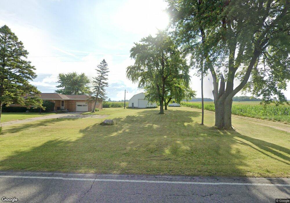
1887 S Portsmouth Rd Saginaw, MI 48601
Estimated Value: $156,000 - $199,000
2
Beds
1
Bath
1,171
Sq Ft
$152/Sq Ft
Est. Value
About This Home
This home is located at 1887 S Portsmouth Rd, Saginaw, MI 48601 and is currently estimated at $178,245, approximately $152 per square foot. 1887 S Portsmouth Rd is a home located in Saginaw County with nearby schools including List Elementary, E.F. Rittmueller Middle School, and Frankenmuth High School.
Ownership History
Date
Name
Owned For
Owner Type
Purchase Details
Closed on
Aug 11, 2015
Sold by
Wiegand Deborah
Bought by
Wiegand John and Wiegand Nancy M
Current Estimated Value
Purchase Details
Closed on
Feb 26, 2003
Sold by
Wiegand John and Wiegand Nancy M
Bought by
Wiegand John and Wiegand Nancy M
Purchase Details
Closed on
Jan 10, 2002
Sold by
Wiegand Nancy M
Bought by
Huber Lester L and Huber Marie L
Home Financials for this Owner
Home Financials are based on the most recent Mortgage that was taken out on this home.
Original Mortgage
$40,715
Interest Rate
7.07%
Create a Home Valuation Report for This Property
The Home Valuation Report is an in-depth analysis detailing your home's value as well as a comparison with similar homes in the area
Home Values in the Area
Average Home Value in this Area
Purchase History
| Date | Buyer | Sale Price | Title Company |
|---|---|---|---|
| Wiegand John | -- | None Available | |
| Wiegand John | -- | -- | |
| Huber Lester L | $57,240 | -- | |
| Wiegand John | -- | -- |
Source: Public Records
Mortgage History
| Date | Status | Borrower | Loan Amount |
|---|---|---|---|
| Closed | Huber Lester L | $40,715 |
Source: Public Records
Tax History Compared to Growth
Tax History
| Year | Tax Paid | Tax Assessment Tax Assessment Total Assessment is a certain percentage of the fair market value that is determined by local assessors to be the total taxable value of land and additions on the property. | Land | Improvement |
|---|---|---|---|---|
| 2025 | $3,372 | $90,100 | $0 | $0 |
| 2024 | $894 | $74,900 | $0 | $0 |
| 2023 | $850 | $65,000 | $0 | $0 |
| 2022 | $2,983 | $56,300 | $0 | $0 |
| 2021 | $2,907 | $51,000 | $0 | $0 |
| 2020 | $2,692 | $47,700 | $0 | $0 |
| 2019 | $2,594 | $47,900 | $5,100 | $42,800 |
| 2018 | $633 | $47,000 | $0 | $0 |
| 2017 | $2,368 | $46,700 | $0 | $0 |
| 2016 | $1,528 | $43,200 | $0 | $0 |
| 2014 | -- | $40,600 | $0 | $35,500 |
| 2013 | -- | $39,500 | $0 | $0 |
Source: Public Records
Map
Nearby Homes
- 4694 King Rd
- 5205 Baker Rd
- 1579 Joy St
- 5050 Carnegie St
- 5032 Akron St
- 4719 Baker Rd
- 1765 Ribble St
- 4051 Old King Rd
- 1840 Ribble St
- 1815 Mack Rd
- 3780 Mack Rd
- 3299 Mysylvia Dr
- 3172 Mysylvia Dr
- 3800 Jim Dr
- 3524 Chalmers Rd
- 3289 Westbrook St
- 6050 Wadsworth Rd
- 4764 Hess Rd
- 2950 Arlington Dr
- 1337 Woodside St
- 1910 S Portsmouth Rd
- 1840 S Portsmouth Rd
- 1800 S Portsmouth Rd
- 2055 S Portsmouth Rd
- 1695 S Portsmouth Rd
- 1670 S Portsmouth Rd
- 1650 S Portsmouth Rd
- 1605 S Portsmouth Rd
- 1565 S Portsmouth Rd
- 2240 S Portsmouth Rd
- 2245 S Portsmouth Rd
- 2245 S Portsmouth Rd
- 2260 S Portsmouth Rd
- 6544 Hess Rd
- 6560 Hess Rd
- 6560 Hess Rd
- 6572 Hess Rd
- 2388 S Portsmouth Rd
- 6495 Hess Rd
- 6404 Hess Rd