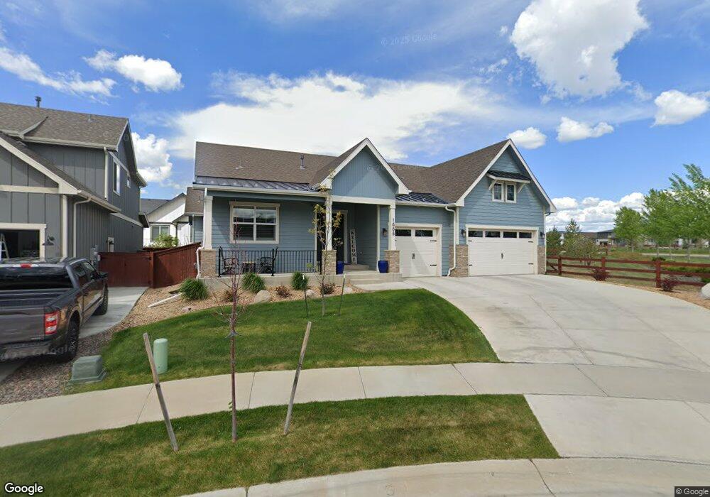
1888 Cloud Ct Windsor, CO 80550
RainDance NeighborhoodEstimated Value: $831,000 - $961,000
5
Beds
4
Baths
4,432
Sq Ft
$206/Sq Ft
Est. Value
About This Home
This home is located at 1888 Cloud Ct, Windsor, CO 80550 and is currently estimated at $914,929, approximately $206 per square foot. 1888 Cloud Ct is a home located in Weld County with nearby schools including Windsor Middle School, Windsor High School, and Resurrection Christian School.
Ownership History
Date
Name
Owned For
Owner Type
Purchase Details
Closed on
Nov 8, 2019
Sold by
Bridgewater Homes Llc
Bought by
Jones Michael L and Jones Julia
Current Estimated Value
Home Financials for this Owner
Home Financials are based on the most recent Mortgage that was taken out on this home.
Original Mortgage
$472,796
Outstanding Balance
$414,010
Interest Rate
3.37%
Mortgage Type
Adjustable Rate Mortgage/ARM
Estimated Equity
$500,919
Purchase Details
Closed on
Jun 3, 2019
Sold by
The Ridge At Harmony Road Lots 2017 Llc
Bought by
Bridgewater Homes Llc
Create a Home Valuation Report for This Property
The Home Valuation Report is an in-depth analysis detailing your home's value as well as a comparison with similar homes in the area
Home Values in the Area
Average Home Value in this Area
Purchase History
| Date | Buyer | Sale Price | Title Company |
|---|---|---|---|
| Jones Michael L | $697,746 | First American | |
| Bridgewater Homes Llc | -- | First American |
Source: Public Records
Mortgage History
| Date | Status | Borrower | Loan Amount |
|---|---|---|---|
| Open | Jones Michael L | $472,796 | |
| Closed | Bridgewater Homes Llc | $0 |
Source: Public Records
Tax History
| Year | Tax Paid | Tax Assessment Tax Assessment Total Assessment is a certain percentage of the fair market value that is determined by local assessors to be the total taxable value of land and additions on the property. | Land | Improvement |
|---|---|---|---|---|
| 2025 | $6,999 | $55,900 | $6,250 | $49,650 |
| 2024 | $6,999 | $55,900 | $6,250 | $49,650 |
| 2023 | $6,772 | $53,690 | $7,100 | $46,590 |
| 2022 | $6,655 | $46,940 | $6,260 | $40,680 |
| 2021 | $6,312 | $48,290 | $6,440 | $41,850 |
| 2020 | $4,075 | $31,400 | $5,360 | $26,040 |
| 2019 | $235 | $1,820 | $1,820 | $0 |
| 2018 | $6 | $10 | $10 | $0 |
Source: Public Records
Map
Nearby Homes
- 1937 Raindrop Dr
- 1653 Winter Glow Dr
- 1657 Winter Glow Dr
- 1956 Blossom Grove Dr
- 1876 Blossom Grove Dr
- 1585 Winter Glow Dr
- 1881 Blossom Grove Dr
- 1875 Blossom Grove Dr
- 1869 Blossom Grove Dr
- 1683 Sundown Run Dr
- 1648 Sundown Run Dr
- 1644 Sundown Run Dr
- 1685 Crystalline Dr
- 1881 Covered Bridge Pkwy
- 1825 Crisp Air Dr
- 1826 Frost Dr
- 1819 Vista Valley Dr
- 1501 Flowering Tree Ct
- 1508 Flowering Tree Ct
- 1962 Covered Bridge Pkwy
- 1888 Osprey Ct
- 1892 Cloud Ct
- 1919 Rolling Wind Dr
- 1923 Rolling Wind Dr
- 1927 Rolling Wind Dr
- 1887 Cloud Ct
- 1900 Cloud Ct
- 1913 Rolling Wind Dr
- 1885 Cloud Ct
- 1891 Cloud Ct
- 1931 Rolling Wind Dr
- 1912 Rolling Wind Dr
- 1935 Rolling Wind Dr
- 1901 Cloud Ct
- 1906 Cloud Ct
- 1909 Rollingwood Dr
- 1916 Rolling Wind Dr
- 1920 Osprey Ct
- 1922 Rolling Wind Dr
- 1629 Winter Glow Dr
Your Personal Tour Guide
Ask me questions while you tour the home.