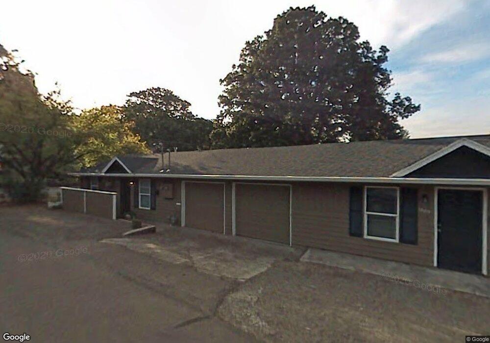
1889 Buse St West Linn, OR 97068
Bolton NeighborhoodEstimated Value: $453,013 - $671,000
6
Beds
2
Baths
1,440
Sq Ft
$402/Sq Ft
Est. Value
About This Home
This home is located at 1889 Buse St, West Linn, OR 97068 and is currently estimated at $578,753, approximately $401 per square foot. 1889 Buse St is a home with nearby schools including Bolton Primary School, West Linn High School, and Clackamas Academy of Industrial Sciences (CAIS).
Ownership History
Date
Name
Owned For
Owner Type
Purchase Details
Closed on
Jun 15, 2022
Sold by
Cavanagh Timothy P
Bought by
Fitts Charles A and Svendsen Christopher B
Current Estimated Value
Purchase Details
Closed on
Mar 26, 2003
Sold by
Zavoshy Shaw J and Blacketor Paula D
Bought by
Cavanagh Timothy P and Fitts Charles A
Home Financials for this Owner
Home Financials are based on the most recent Mortgage that was taken out on this home.
Original Mortgage
$137,850
Interest Rate
5.79%
Mortgage Type
Commercial
Create a Home Valuation Report for This Property
The Home Valuation Report is an in-depth analysis detailing your home's value as well as a comparison with similar homes in the area
Home Values in the Area
Average Home Value in this Area
Purchase History
| Date | Buyer | Sale Price | Title Company |
|---|---|---|---|
| Fitts Charles A | -- | Fidelity National Title | |
| Cavanagh Timothy P | $172,350 | Multiple |
Source: Public Records
Mortgage History
| Date | Status | Borrower | Loan Amount |
|---|---|---|---|
| Previous Owner | Cavanagh Timothy P | $137,850 |
Source: Public Records
Tax History Compared to Growth
Tax History
| Year | Tax Paid | Tax Assessment Tax Assessment Total Assessment is a certain percentage of the fair market value that is determined by local assessors to be the total taxable value of land and additions on the property. | Land | Improvement |
|---|---|---|---|---|
| 2025 | $3,717 | $192,900 | -- | -- |
| 2024 | $3,578 | $187,282 | -- | -- |
| 2023 | $3,578 | $181,828 | $0 | $0 |
| 2022 | $3,378 | $176,533 | $0 | $0 |
| 2021 | $3,206 | $171,392 | $0 | $0 |
| 2020 | $3,228 | $166,400 | $0 | $0 |
| 2019 | $3,078 | $161,554 | $0 | $0 |
| 2018 | $2,941 | $156,849 | $0 | $0 |
| 2017 | $2,827 | $152,281 | $0 | $0 |
| 2016 | $2,754 | $147,846 | $0 | $0 |
| 2015 | $2,675 | $143,540 | $0 | $0 |
| 2014 | $2,516 | $139,359 | $0 | $0 |
Source: Public Records
Map
Nearby Homes
- 5390 Grove St
- 5089 Territorial Dr
- 5687 River St
- 5910 W A St
- 4711 Alder St
- 4645 Pine St
- 909 Center St
- 22691 Oregon City Loop
- 1870 Hemlock St
- 22881 Oregon City Loop
- 824 Center St
- 401 4th St
- 411 4th St
- 1954 Buck St
- 312 High St
- 709 10th St
- 5062 Prospect St
- 5128 Firwood Dr
- 2530 Cambridge St
- 4405 Grant St
- 5447 Broadway St
- 1795 Buse St
- 5395 Broadway St
- 1781 Buse St
- 1921 Buse St
- 5426 Broadway St
- 5375 Broadway St Unit C
- 1788 Buse St
- 5462 Broadway St
- 5491 Broadway St
- 1776 Buse St
- 1931 Buse St
- 1816 McKillican St
- 1771 Buse St
- 5494 Broadwayst
- 1820 McKillican St
- 5345 Broadway St
- 1766 Buse St
- 5494 Broadway St