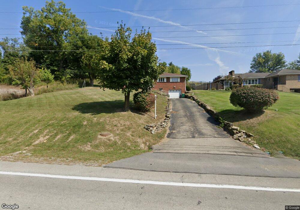
1889 Route 519 Canonsburg, PA 15317
Estimated Value: $276,000 - $299,000
3
Beds
2
Baths
1,402
Sq Ft
$206/Sq Ft
Est. Value
About This Home
This home is located at 1889 Route 519, Canonsburg, PA 15317 and is currently estimated at $289,254, approximately $206 per square foot. 1889 Route 519 is a home located in Washington County with nearby schools including Canon-Mcmillan Senior High School and Central Christian Academy.
Ownership History
Date
Name
Owned For
Owner Type
Purchase Details
Closed on
Jan 9, 2019
Sold by
Krysko Tamara C
Bought by
Lohm Marissa M and Lohm Laxmi M
Current Estimated Value
Home Financials for this Owner
Home Financials are based on the most recent Mortgage that was taken out on this home.
Original Mortgage
$202,894
Outstanding Balance
$178,924
Interest Rate
4.75%
Mortgage Type
FHA
Estimated Equity
$110,330
Purchase Details
Closed on
Jun 9, 2000
Sold by
Vinton Stanley R
Bought by
Krysko Tamara C
Home Financials for this Owner
Home Financials are based on the most recent Mortgage that was taken out on this home.
Original Mortgage
$97,750
Interest Rate
8.24%
Create a Home Valuation Report for This Property
The Home Valuation Report is an in-depth analysis detailing your home's value as well as a comparison with similar homes in the area
Home Values in the Area
Average Home Value in this Area
Purchase History
| Date | Buyer | Sale Price | Title Company |
|---|---|---|---|
| Lohm Marissa M | $209,900 | Colonial Title Llc | |
| Krysko Tamara C | $115,000 | -- |
Source: Public Records
Mortgage History
| Date | Status | Borrower | Loan Amount |
|---|---|---|---|
| Open | Lohm Marissa M | $202,894 | |
| Previous Owner | Krysko Tamara C | $97,750 |
Source: Public Records
Tax History Compared to Growth
Tax History
| Year | Tax Paid | Tax Assessment Tax Assessment Total Assessment is a certain percentage of the fair market value that is determined by local assessors to be the total taxable value of land and additions on the property. | Land | Improvement |
|---|---|---|---|---|
| 2025 | $3,224 | $188,600 | $43,300 | $145,300 |
| 2024 | $3,010 | $188,600 | $43,300 | $145,300 |
| 2023 | $3,010 | $188,600 | $43,300 | $145,300 |
| 2022 | $3,001 | $188,600 | $43,300 | $145,300 |
| 2021 | $3,001 | $188,600 | $43,300 | $145,300 |
| 2020 | $2,850 | $188,600 | $43,300 | $145,300 |
| 2019 | $2,226 | $188,600 | $43,300 | $145,300 |
| 2018 | $2,180 | $149,800 | $43,300 | $106,500 |
| 2017 | $525 | $149,800 | $43,300 | $106,500 |
| 2016 | $525 | $15,038 | $1,077 | $13,961 |
| 2015 | $1,676 | $15,038 | $1,077 | $13,961 |
| 2014 | $547 | $15,038 | $1,077 | $13,961 |
| 2013 | $547 | $15,038 | $1,077 | $13,961 |
Source: Public Records
Map
Nearby Homes
- 226 Chubbic Rd
- Lot 1 Linden Rd
- 207 Linden Rd
- 119 Linden Rd
- 104 Linden Rd
- 215 Sierra Dr
- 53 Linden Rd
- 10 Marie St
- 31 Smith Place
- 249 Persimmon Ln
- 0 Route 519 Unit 1706095
- 215 Persimmon Ln
- 0 Sassafras Ln
- 1049 Bayberry Dr
- Rockford Plan at Magnolia Ridge
- Tucson Plan at Magnolia Ridge
- Truman Plan at Magnolia Ridge
- Cleveland Plan at Magnolia Ridge
- Birmingham Plan at Magnolia Ridge
- Chattanooga Plan at Magnolia Ridge
- 1889 Route 519
- 1885 Pennsylvania 519
- 1867 Route 519
- 1867 Route 519
- 1900 Route 519
- 1819 Route 519
- 1894 Route 519
- 1910 Route 519
- 1811 Route 519
- 1811 Route 519
- 1914 Route 519
- 1779 Route 519
- 1920 Route 519
- 1775 Route 519
- 1775 Pennsylvania 519
- 1772 Route 519
- 1771 Route 519
- LOT 201 Recreation Way
- 1762 Route 519
- 201 Linden Rd