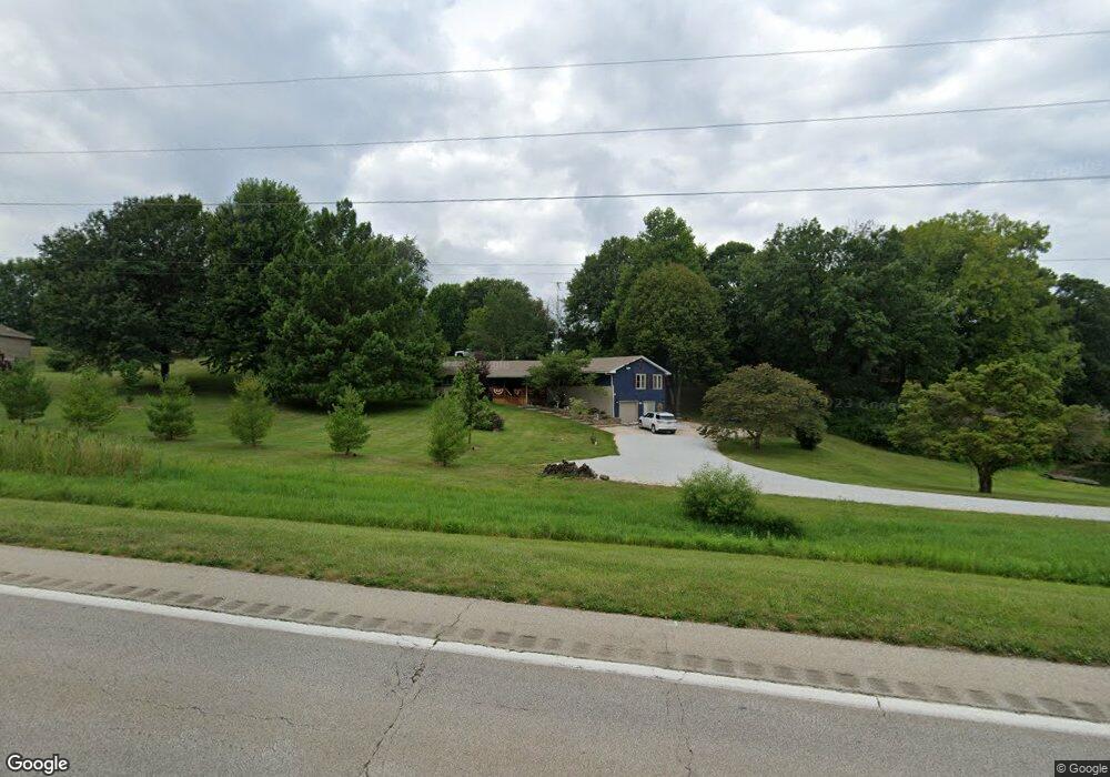
1889 State Highway 78 None Jacksonville, IL 62650
Estimated Value: $221,000 - $257,000
--
Bed
3
Baths
--
Sq Ft
1.57
Acres
About This Home
This home is located at 1889 State Highway 78 None, Jacksonville, IL 62650 and is currently estimated at $243,325. 1889 State Highway 78 None is a home located in Morgan County with nearby schools including Jacksonville High School, Salem Lutheran School, and Salem Lutheran School.
Ownership History
Date
Name
Owned For
Owner Type
Purchase Details
Closed on
Jan 7, 2020
Sold by
Stewart Gregory D and Stewart Kimberly D
Bought by
Stewart Gregory D and Stewart Kimberly D
Current Estimated Value
Home Financials for this Owner
Home Financials are based on the most recent Mortgage that was taken out on this home.
Original Mortgage
$151,200
Outstanding Balance
$136,952
Interest Rate
5%
Mortgage Type
Commercial
Estimated Equity
$106,373
Purchase Details
Closed on
Aug 24, 2018
Sold by
Overturf Sharon L
Bought by
Hill Michael A and Hill Toni L
Home Financials for this Owner
Home Financials are based on the most recent Mortgage that was taken out on this home.
Original Mortgage
$110,461
Interest Rate
4.5%
Mortgage Type
FHA
Purchase Details
Closed on
Nov 15, 2012
Sold by
Overturf Larry L
Bought by
Overturf Sharon L
Purchase Details
Closed on
Sep 18, 2006
Sold by
Overturf Sharon L
Bought by
Overturf Larry L and Overturf Sharon L
Create a Home Valuation Report for This Property
The Home Valuation Report is an in-depth analysis detailing your home's value as well as a comparison with similar homes in the area
Home Values in the Area
Average Home Value in this Area
Purchase History
| Date | Buyer | Sale Price | Title Company |
|---|---|---|---|
| Stewart Gregory D | $168,000 | None Available | |
| Hill Michael A | $112,500 | None Available | |
| Overturf Sharon L | -- | None Available | |
| Overturf Larry L | -- | None Available |
Source: Public Records
Mortgage History
| Date | Status | Borrower | Loan Amount |
|---|---|---|---|
| Open | Stewart Gregory D | $151,200 | |
| Previous Owner | Hill Michael A | $110,461 |
Source: Public Records
Tax History Compared to Growth
Tax History
| Year | Tax Paid | Tax Assessment Tax Assessment Total Assessment is a certain percentage of the fair market value that is determined by local assessors to be the total taxable value of land and additions on the property. | Land | Improvement |
|---|---|---|---|---|
| 2024 | $4,321 | $64,070 | $7,340 | $56,730 |
| 2023 | $4,260 | $58,240 | $6,670 | $51,570 |
| 2022 | $3,883 | $58,240 | $6,670 | $51,570 |
| 2021 | $3,531 | $54,910 | $8,500 | $46,410 |
| 2020 | $3,465 | $52,700 | $8,500 | $44,200 |
| 2019 | $3,423 | $52,260 | $8,500 | $43,760 |
| 2018 | $3,658 | $50,740 | $8,250 | $42,490 |
| 2017 | $3,548 | $49,750 | $8,090 | $41,660 |
| 2016 | $3,574 | $49,750 | $8,090 | $41,660 |
| 2015 | $3,103 | $41,810 | $6,800 | $35,010 |
| 2014 | $3,103 | $49,830 | $6,910 | $42,920 |
| 2013 | $3,615 | $49,830 | $6,910 | $42,920 |
Source: Public Records
Map
Nearby Homes
- 2 Springwater Dr
- 17 Springwater Dr
- 12 Quail Ln
- 6 Fernwood Blvd
- 70 Applebee Farms Dr
- 1001 Cox St
- 840 W Walnut St
- 0 Gray Rd
- 68 Applebee Farms Dr Unit Apple
- 64 Applebee Farms Dr
- 66 Applebee Farms Dr
- 72 Applebee Farms Dr
- 8 Wadsworth Dr
- 754 Freedman St
- None None Ave
- 1 Wadsworth Dr
- 858 N Diamond St
- 617 N East St
- 610 Sandusky St
- 636 N East St
- 1889 State Highway 78 N
- 6 Springwater Dr
- 5 Springwater Dr
- 10 Springwater Dr
- 4 Springwater Dr
- 18 Springwater Dr
- 12 Springwater Dr
- 20 Springwater Dr
- 4 Valevue Acres Dr
- 14 Springwater Dr
- 19 Springwater Dr
- 8 Valevue Acres Dr
- 1 Valevue Acres Dr
- 10 Valevue Acres Dr
- 3 Valevue Acres Dr
- 5 Valevue Acres Dr
- 10 Quail Ln
- 8 Quail Ln
- 12 Valevue Acres Dr
- 7 Valevue Acres Dr