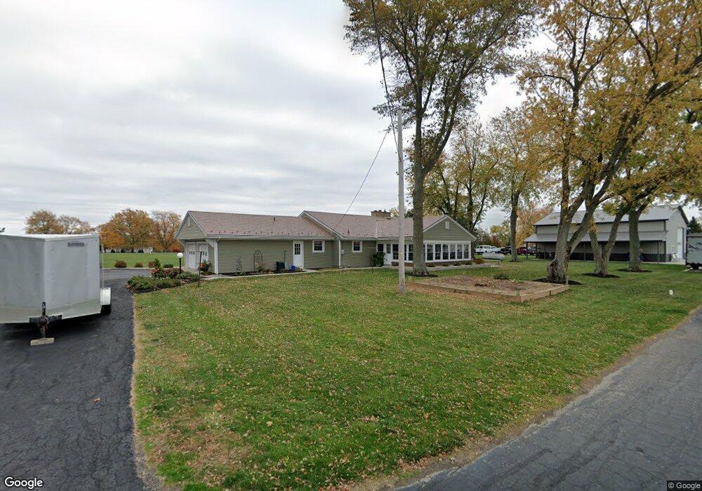
18891 State Route 501 Wapakoneta, OH 45895
Estimated Value: $324,000 - $415,000
3
Beds
2
Baths
2,534
Sq Ft
$153/Sq Ft
Est. Value
About This Home
This home is located at 18891 State Route 501, Wapakoneta, OH 45895 and is currently estimated at $388,143, approximately $153 per square foot. 18891 State Route 501 is a home located in Auglaize County with nearby schools including Wapakoneta Elementary School, Wapakoneta High School, and Wapakoneta Middle School.
Ownership History
Date
Name
Owned For
Owner Type
Purchase Details
Closed on
Jul 8, 2013
Sold by
Will Curt D and Will Barbara A
Bought by
Peterson Construction Company
Current Estimated Value
Purchase Details
Closed on
May 11, 1998
Sold by
White Robert J
Bought by
Will Curt D
Purchase Details
Closed on
Oct 19, 1992
Bought by
Katterhenry Patricia L
Create a Home Valuation Report for This Property
The Home Valuation Report is an in-depth analysis detailing your home's value as well as a comparison with similar homes in the area
Home Values in the Area
Average Home Value in this Area
Purchase History
| Date | Buyer | Sale Price | Title Company |
|---|---|---|---|
| Peterson Construction Company | -- | Attorney | |
| Will Curt D | $127,000 | -- | |
| Katterhenry Patricia L | $103,000 | -- |
Source: Public Records
Tax History Compared to Growth
Tax History
| Year | Tax Paid | Tax Assessment Tax Assessment Total Assessment is a certain percentage of the fair market value that is determined by local assessors to be the total taxable value of land and additions on the property. | Land | Improvement |
|---|---|---|---|---|
| 2024 | $6,018 | $120,980 | $17,140 | $103,840 |
| 2023 | $4,028 | $120,980 | $17,140 | $103,840 |
| 2022 | $3,024 | $83,400 | $14,280 | $69,120 |
| 2021 | $3,002 | $83,400 | $14,280 | $69,120 |
| 2020 | $1,514 | $83,675 | $14,284 | $69,391 |
| 2019 | $2,571 | $68,583 | $11,708 | $56,875 |
| 2018 | $2,579 | $68,583 | $11,708 | $56,875 |
| 2017 | $2,564 | $68,583 | $11,708 | $56,875 |
| 2016 | $1,993 | $53,582 | $11,151 | $42,431 |
| 2015 | $1,991 | $53,582 | $11,151 | $42,431 |
| 2014 | $1,977 | $53,582 | $11,151 | $42,431 |
| 2013 | $2,029 | $53,582 | $11,151 | $42,431 |
Source: Public Records
Map
Nearby Homes
- 17054 State Route 198
- 17092 Hauss Rd
- 1020 Timber Trail
- 18609 County Road 25a
- 0 Wapakoneta Cridersville Rd
- 1028 Stonegate Ct
- 920 Primrose Dr
- 924 Poppy Dr
- 808 Aster Dr
- 906 Aster Dr
- 322 Cole Dr
- 601 Warren St
- 420 Hoopengarner St
- 311 Marcella Ln
- 310 W Main St
- 9 E Silver St
- 106 Valleyview Dr
- 0 Ohio 67
- 414 W Auglaize St
- 307 W Auglaize St
- 18911 State Route 501
- 18931 State Route 501
- 18855 State Route 501
- 18933 State Route 501
- 18935 State Route 501
- 18939 Ohio 501
- 18939 State Route 501
- 18941 S Wapakoneta Rd
- 18941 State Route 501
- 18941 St Rt 501
- 18850 State Route 501
- 18850 Ohio 501
- 18890 State Route 501
- 12998 Buckland Holden Rd
- 18954 S Wapakoneta Rd
- 18731 State Route 501
- 13008 Buckland Holden Rd