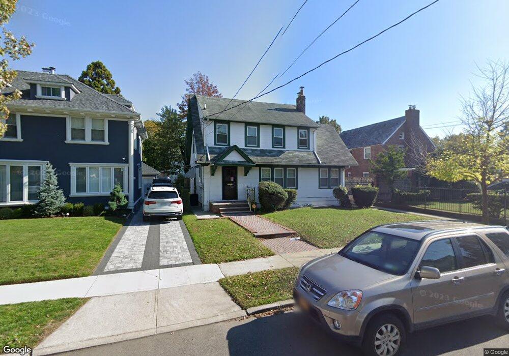
189-08 Lewiston Ave Saint Albans, NY 11412
Hollis NeighborhoodEstimated Value: $786,000 - $1,016,000
3
Beds
2
Baths
2,025
Sq Ft
$440/Sq Ft
Est. Value
About This Home
This home is located at 189-08 Lewiston Ave, Saint Albans, NY 11412 and is currently estimated at $890,628, approximately $439 per square foot. 189-08 Lewiston Ave is a home located in Queens County with nearby schools including P.S. 118 Lorraine Hansberry, I.S. 192 The Linden, and Riverton Street Charter School.
Ownership History
Date
Name
Owned For
Owner Type
Purchase Details
Closed on
Mar 31, 2015
Sold by
Estate Of Cleve Rawlerson and % Karen Ali Administratrix 45 East
Bought by
Hart Tallance F
Current Estimated Value
Home Financials for this Owner
Home Financials are based on the most recent Mortgage that was taken out on this home.
Original Mortgage
$358,400
Interest Rate
4.09%
Mortgage Type
New Conventional
Purchase Details
Closed on
Oct 9, 1998
Sold by
Rawlerson James
Bought by
Rawlerson Cleve
Create a Home Valuation Report for This Property
The Home Valuation Report is an in-depth analysis detailing your home's value as well as a comparison with similar homes in the area
Home Values in the Area
Average Home Value in this Area
Purchase History
| Date | Buyer | Sale Price | Title Company |
|---|---|---|---|
| Hart Tallance F | $448,000 | -- | |
| Hart Tallance F | $448,000 | -- | |
| Rawlerson Cleve | -- | -- | |
| Rawlerson Cleve | -- | -- |
Source: Public Records
Mortgage History
| Date | Status | Borrower | Loan Amount |
|---|---|---|---|
| Previous Owner | Hart Tallance F | $358,400 |
Source: Public Records
Tax History Compared to Growth
Tax History
| Year | Tax Paid | Tax Assessment Tax Assessment Total Assessment is a certain percentage of the fair market value that is determined by local assessors to be the total taxable value of land and additions on the property. | Land | Improvement |
|---|---|---|---|---|
| 2025 | $5,997 | $31,650 | $8,079 | $23,571 |
| 2024 | $5,997 | $29,860 | $9,133 | $20,727 |
| 2023 | $5,848 | $29,117 | $8,586 | $20,531 |
| 2022 | $5,484 | $43,020 | $13,800 | $29,220 |
| 2021 | $5,781 | $40,860 | $13,800 | $27,060 |
| 2020 | $5,583 | $41,100 | $13,800 | $27,300 |
| 2019 | $5,205 | $38,160 | $13,800 | $24,360 |
| 2018 | $4,946 | $24,264 | $9,411 | $14,853 |
| 2017 | $4,666 | $22,891 | $9,696 | $13,195 |
| 2016 | $4,576 | $22,891 | $9,696 | $13,195 |
| 2015 | $2,385 | $21,979 | $13,095 | $8,884 |
| 2014 | $2,385 | $20,736 | $11,203 | $9,533 |
Source: Public Records
Map
Nearby Homes
- 18833 Keeseville Ave
- 18914 114th Rd
- 188-07 Mangin Ave
- 188-25 Mangin Ave
- 18823 Mangin Ave
- 189-18 114th Dr
- 187-44 Jordan Ave
- 188-45 Quencer Rd
- 114-13 203rd st 203rd St
- 191-40 112th Rd
- 19022 111th Rd
- 191-16 114th Rd
- 111-06 Farmers Blvd
- 191-34 114th Rd
- 186-16 Hilburn Ave
- 190-59 112th Ave
- 190-63 112th Ave
- 191-47 114th Dr
- 194-16 112th Ave
- 19427 Murdock Ave
- 18908 Lewiston Ave
- 18914 Lewiston Ave
- 18914 Lewiston Ave
- 18902 Lewiston Ave
- 18920 Lewiston Ave
- 18920 Lewiston Ave
- 18915 113th Ave
- 18907 Lewiston Ave
- 18903 113th Ave
- 18911 Lewiston Ave
- 18903 Lewiston Ave
- 18919 113th Ave
- 18932 Lewiston Ave
- 11332 Mayville St
- 189-32 Lewiston Ave
- 18919 Lewiston Ave
- 18925 113th Ave
- 18925 Lewiston Ave
- 11342 Mayville St
- 18831 Lewiston Ave