189 Apremont Hwy Holyoke, MA 01040
Estimated Value: $591,000 - $911,134
--
Bed
1
Bath
4,789
Sq Ft
$161/Sq Ft
Est. Value
About This Home
This home is located at 189 Apremont Hwy, Holyoke, MA 01040 and is currently estimated at $769,045, approximately $160 per square foot. 189 Apremont Hwy is a home located in Hampden County with nearby schools including Harriet Bishop Elementary School, Lt. Elmer J. McMahon Elementary School, and Holyoke High School.
Ownership History
Date
Name
Owned For
Owner Type
Purchase Details
Closed on
Jun 16, 2009
Sold by
Proulx Robert C and Armstead Marshalynne
Bought by
Proulx Robert C
Current Estimated Value
Purchase Details
Closed on
Aug 13, 2003
Sold by
Gerhardt Edith B and Tauscher Greta H
Bought by
Armstead Marshalynne and Proulx Robert C
Home Financials for this Owner
Home Financials are based on the most recent Mortgage that was taken out on this home.
Original Mortgage
$322,000
Interest Rate
5.46%
Mortgage Type
Purchase Money Mortgage
Create a Home Valuation Report for This Property
The Home Valuation Report is an in-depth analysis detailing your home's value as well as a comparison with similar homes in the area
Home Values in the Area
Average Home Value in this Area
Purchase History
| Date | Buyer | Sale Price | Title Company |
|---|---|---|---|
| Proulx Robert C | -- | -- | |
| Armstead Marshalynne | $125,000 | -- |
Source: Public Records
Mortgage History
| Date | Status | Borrower | Loan Amount |
|---|---|---|---|
| Previous Owner | Armstead Marshalynne | $322,000 |
Source: Public Records
Tax History Compared to Growth
Tax History
| Year | Tax Paid | Tax Assessment Tax Assessment Total Assessment is a certain percentage of the fair market value that is determined by local assessors to be the total taxable value of land and additions on the property. | Land | Improvement |
|---|---|---|---|---|
| 2025 | $11,560 | $662,100 | $123,500 | $538,600 |
| 2024 | $11,245 | $593,400 | $117,300 | $476,100 |
| 2023 | $10,729 | $571,900 | $117,300 | $454,600 |
| 2022 | $10,329 | $536,300 | $117,300 | $419,000 |
| 2021 | $9,907 | $514,100 | $114,200 | $399,900 |
| 2020 | $9,376 | $491,400 | $114,200 | $377,200 |
| 2019 | $9,435 | $489,100 | $114,200 | $374,900 |
| 2018 | $8,982 | $469,500 | $114,200 | $355,300 |
| 2017 | $9,000 | $469,500 | $114,200 | $355,300 |
| 2016 | $8,799 | $460,200 | $116,400 | $343,800 |
| 2015 | $8,762 | $460,200 | $116,400 | $343,800 |
Source: Public Records
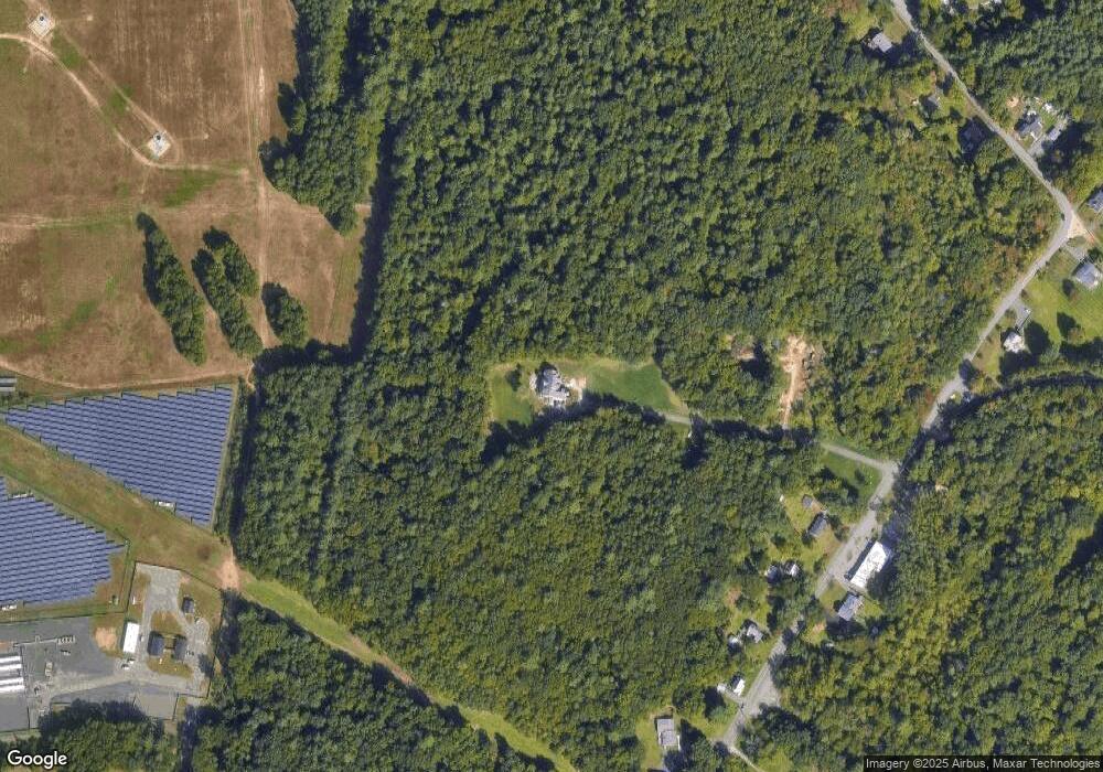
Map
Nearby Homes
- 405 Rock Valley Rd
- 103 Dupuis Rd
- 4 Fitch Farm Way
- 94 Pequot Rd (Rear)
- 36 County Rd
- 150 Middle Rd
- Lot 57 White Loaf Rd
- Lot A Homestead Ave
- 64 Old Stage Rd
- 794 Homestead Ave
- 33 Maple Crest Cir Unit D
- 15 Maple Crest Cir Unit D
- 34 Maple Crest Cir Unit B
- lot b Homestead Ave
- 7 Western View Rd
- 0 Char Dr
- 84 Woodland St
- 53 Farnum Dr Unit 53
- 43 King St
- 70-72 Westfield Rd
- 193 Apremont Hwy
- 197 Apremont Hwy
- 203 Apremont Hwy
- 211 Apremont Hwy
- 190 Apremont Hwy
- 217 Apremont Hwy
- 200 Apremont Hwy
- 592 Rock Valley Rd
- 210 Apremont Hwy
- 511 Rock Valley Rd
- 501 Rock Valley Rd
- 527 Rock Valley Rd
- 220 Apremont Hwy
- 0 Rock Valley Rd
- 562 Rock Valley Rd
- 241 Apremont Hwy
- 45 Mueller Rd
- 467 Rock Valley Rd
- 37 Mueller Rd
- 485 Mountain Rd