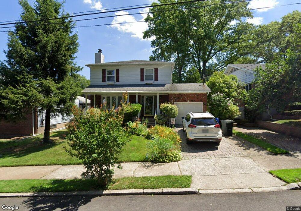
189 City Blvd Staten Island, NY 10301
West Brighton NeighborhoodEstimated Value: $930,536 - $1,029,000
--
Bed
4
Baths
2,112
Sq Ft
$466/Sq Ft
Est. Value
About This Home
This home is located at 189 City Blvd, Staten Island, NY 10301 and is currently estimated at $983,634, approximately $465 per square foot. 189 City Blvd is a home located in Richmond County with nearby schools including P.S. 45 John Tyler, Is 61 William A Morris, and Curtis High School.
Ownership History
Date
Name
Owned For
Owner Type
Purchase Details
Closed on
Aug 16, 2002
Sold by
Druback Sandra N
Bought by
Druback Sandra N
Current Estimated Value
Create a Home Valuation Report for This Property
The Home Valuation Report is an in-depth analysis detailing your home's value as well as a comparison with similar homes in the area
Home Values in the Area
Average Home Value in this Area
Purchase History
| Date | Buyer | Sale Price | Title Company |
|---|---|---|---|
| Druback Sandra N | -- | Custom Title Services Inc |
Source: Public Records
Tax History Compared to Growth
Tax History
| Year | Tax Paid | Tax Assessment Tax Assessment Total Assessment is a certain percentage of the fair market value that is determined by local assessors to be the total taxable value of land and additions on the property. | Land | Improvement |
|---|---|---|---|---|
| 2025 | $8,715 | $59,940 | $14,257 | $45,683 |
| 2024 | $8,727 | $54,000 | $14,930 | $39,070 |
| 2023 | $8,812 | $44,789 | $14,204 | $30,585 |
| 2022 | $8,586 | $57,240 | $18,000 | $39,240 |
| 2021 | $8,522 | $47,400 | $18,000 | $29,400 |
| 2020 | $8,078 | $52,380 | $18,000 | $34,380 |
| 2019 | $7,515 | $47,340 | $18,000 | $29,340 |
| 2018 | $7,311 | $37,324 | $15,339 | $21,985 |
| 2017 | $7,251 | $37,041 | $16,939 | $20,102 |
| 2016 | $6,676 | $34,945 | $16,588 | $18,357 |
| 2015 | $5,664 | $32,970 | $19,397 | $13,573 |
| 2014 | $5,664 | $31,104 | $15,552 | $15,552 |
Source: Public Records
Map
Nearby Homes
- 1 Sunset Hill Dr
- 1 Whitewood Ave
- 34 Harvest Ave
- 605 Bard Ave
- 372 Sharon Ave
- 100 Lawrence Ave
- 54 City Blvd
- 20 Baker Place
- 58-62 University Place
- 215 Hart Blvd Unit 3L
- 710 Oakland Ave
- 152 Harvest Ave
- 751 Oakland Ave
- 677 Bement Ave
- 72 Gregg Place
- 244 Delafield Ave
- 64 Greenway Dr
- 112 Delafield Ave
- 40 Greenway Dr
- 26 Fairway Ln