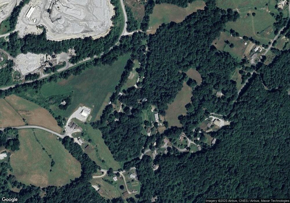
189 Dills Ln Rabun Gap, GA 30568
Estimated Value: $341,000 - $454,000
3
Beds
3
Baths
1,840
Sq Ft
$215/Sq Ft
Est. Value
About This Home
This home is located at 189 Dills Ln, Rabun Gap, GA 30568 and is currently estimated at $396,278, approximately $215 per square foot. 189 Dills Ln is a home with nearby schools including Rabun County Primary School, Rabun County High School, and Rabun Gap Nacoochee School.
Ownership History
Date
Name
Owned For
Owner Type
Purchase Details
Closed on
Oct 2, 2008
Sold by
Not Provided
Bought by
Chastain Michael Lee and Chastain Emily Beth
Current Estimated Value
Home Financials for this Owner
Home Financials are based on the most recent Mortgage that was taken out on this home.
Original Mortgage
$100,000
Interest Rate
6.34%
Mortgage Type
New Conventional
Create a Home Valuation Report for This Property
The Home Valuation Report is an in-depth analysis detailing your home's value as well as a comparison with similar homes in the area
Home Values in the Area
Average Home Value in this Area
Purchase History
| Date | Buyer | Sale Price | Title Company |
|---|---|---|---|
| Chastain Michael Lee | $10,000 | -- | |
| Chastain Michael Lee | $10,000 | -- |
Source: Public Records
Mortgage History
| Date | Status | Borrower | Loan Amount |
|---|---|---|---|
| Closed | Chastain Michael Lee | $100,000 |
Source: Public Records
Tax History Compared to Growth
Tax History
| Year | Tax Paid | Tax Assessment Tax Assessment Total Assessment is a certain percentage of the fair market value that is determined by local assessors to be the total taxable value of land and additions on the property. | Land | Improvement |
|---|---|---|---|---|
| 2025 | $1,726 | $107,548 | $10,200 | $97,348 |
| 2024 | $1,629 | $101,487 | $10,200 | $91,287 |
| 2023 | $1,513 | $82,652 | $9,600 | $73,052 |
| 2022 | $1,454 | $79,454 | $9,000 | $70,454 |
| 2021 | $1,331 | $70,994 | $8,400 | $62,594 |
| 2020 | $1,278 | $65,915 | $8,400 | $57,515 |
| 2019 | $1,288 | $65,915 | $8,400 | $57,515 |
| 2018 | $1,292 | $65,915 | $8,400 | $57,515 |
| 2017 | $1,239 | $65,915 | $8,400 | $57,515 |
| 2016 | $1,243 | $65,915 | $8,400 | $57,515 |
| 2015 | $1,204 | $62,496 | $8,400 | $54,096 |
| 2014 | $1,210 | $62,496 | $8,400 | $54,096 |
Source: Public Records
Map
Nearby Homes
- 68 Acres Ponderosa Rd
- 0 Shake Hollow Dr Unit 22681373
- 0 Ponderosa Rd Unit 10552920
- 0 Shake Hollow Rd Unit 10619107
- LOT 205 Shake Hollow Dr
- 27 Shake Hollow Dr
- LOT 204 Shake Hollow Dr
- LOT 22 Shake Hollow Dr
- 0 Deep Woods Ln Unit LOT 9 8796010
- LOT 67 N Woods Point Unit 3
- 0 LOT 25 Alex Mountain
- 0 Winter Ct Unit 35 10139164
- LOT 113 Mountain Ridge Dr
- LOT 112 Mountain Ridge Dr
- 2379 Ridgepole Dr
- 0 Edwards Way Unit 10422587
- 0 Edwards Way Unit 10422516
- 0 Edwards Way Unit LOT 0 10422553
- 0 Bluff Mountain Unit 10529106
- 0 Ridgepole Covered Bridge Unit LOT 150 10358416
- 157 Dills Ln
- 78 Sweet Home Ln
- 429 Ponderosa Rd
- 459 Ponderosa Rd
- 523 Ponderosa Rd
- 438 Ponderosa Rd
- 552 Ponderosa Rd
- 580 Ponderosa Rd
- 402 Ponderosa Rd
- 474 Ponderosa Rd
- 510 Ponderosa Rd
- 582 Ponderosa Rd
- 376 Ponderosa Rd
- 344 Ponderosa Rd
- 314 Ponderosa Rd
- 380 Ponderosa Rd
- 648 Ponderosa Rd
- 668 Ponderosa Rd
- 378 Ponderosa Rd
- 769 Ponderosa Rd
