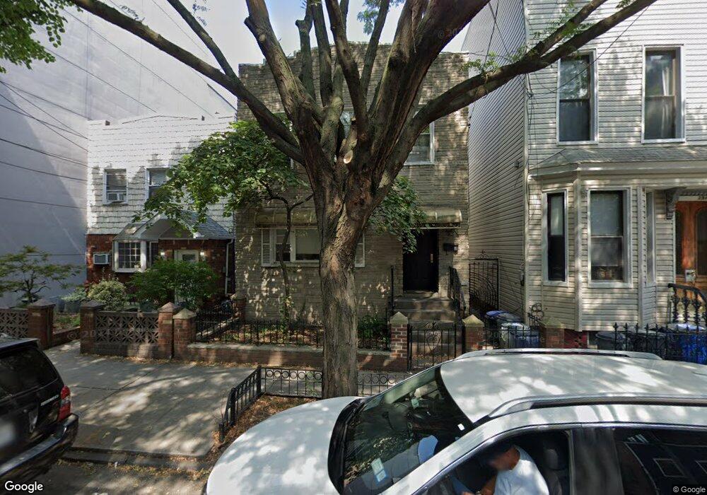
189 Freeman St Brooklyn, NY 11222
Greenpoint NeighborhoodEstimated Value: $1,751,000 - $3,086,000
Studio
--
Bath
1,460
Sq Ft
$1,467/Sq Ft
Est. Value
About This Home
This home is located at 189 Freeman St, Brooklyn, NY 11222 and is currently estimated at $2,142,375, approximately $1,467 per square foot. 189 Freeman St is a home located in Kings County with nearby schools including PS 31 Samuel F Dupont, Yeshiva Bnos Ahavas Israel, and St. Stanislaus Kostka Catholic Academy.
Ownership History
Date
Name
Owned For
Owner Type
Purchase Details
Closed on
Jun 16, 2000
Sold by
Hoffman Eleanor
Bought by
Bajuk Mark
Current Estimated Value
Home Financials for this Owner
Home Financials are based on the most recent Mortgage that was taken out on this home.
Original Mortgage
$200,000
Outstanding Balance
$72,164
Interest Rate
8.55%
Mortgage Type
Seller Take Back
Estimated Equity
$2,070,211
Create a Home Valuation Report for This Property
The Home Valuation Report is an in-depth analysis detailing your home's value as well as a comparison with similar homes in the area
Home Values in the Area
Average Home Value in this Area
Purchase History
| Date | Buyer | Sale Price | Title Company |
|---|---|---|---|
| Bajuk Mark | $250,000 | Commonwealth Land Title Ins |
Source: Public Records
Mortgage History
| Date | Status | Borrower | Loan Amount |
|---|---|---|---|
| Open | Bajuk Mark | $200,000 |
Source: Public Records
Tax History
| Year | Tax Paid | Tax Assessment Tax Assessment Total Assessment is a certain percentage of the fair market value that is determined by local assessors to be the total taxable value of land and additions on the property. | Land | Improvement |
|---|---|---|---|---|
| 2025 | $4,663 | $127,740 | $15,900 | $111,840 |
| 2024 | $4,663 | $119,400 | $15,900 | $103,500 |
| 2023 | $4,671 | $130,800 | $15,900 | $114,900 |
| 2022 | $3,449 | $107,040 | $15,900 | $91,140 |
| 2021 | $4,016 | $89,640 | $15,900 | $73,740 |
| 2019 | $3,754 | $93,360 | $15,900 | $77,460 |
| 2018 | $3,609 | $19,166 | $3,557 | $15,609 |
| 2017 | $3,389 | $18,093 | $5,298 | $12,795 |
| 2016 | $3,104 | $17,076 | $6,754 | $10,322 |
| 2015 | $1,839 | $17,067 | $7,604 | $9,463 |
| 2014 | $1,839 | $16,123 | $7,184 | $8,939 |
Source: Public Records
Map
Nearby Homes
- 132 Eagle St
- 190 Green St Unit 401
- 175 Huron St Unit 1
- 175 Huron St Unit 3A
- 175 Huron St Unit 2
- 1110 Manhattan Ave Unit 1
- 1110 Manhattan Ave Unit 5
- 1110 Manhattan Ave Unit 3
- 1110 Manhattan Ave Unit 4
- 184 Huron St Unit 2B
- 44 Box St Unit 2C
- 44 Box St Unit 2R
- 78 Eagle St Unit 3
- 54 Dupont St Unit 4-A
- 54 Dupont St Unit 3-B
- 54 Dupont St Unit 1-A
- 54 Dupont St Unit 2-F
- 54 Dupont St Unit 3-A
- 199 Java St
- 68 Commercial St Unit PENTHOUSE
- 189 Freeman St Unit HOUSE
- 187 Freeman St
- 191 Freeman St
- 185 Freeman St
- 193-197 Freeman St
- 183 Freeman St
- 197 Freeman St Unit 4E
- 197 Freeman St Unit 2E
- 164 Eagle St
- 181 Freeman St Unit 1
- 181 Freeman St
- 181 Freeman St Unit 3F
- 181 Freeman St Unit 3R
- 181 Freeman St Unit 1F
- 181 Freeman St Unit 1R
- 162 Eagle St
- 162 Eagle St Unit 3R
- 168 Eagle St
- 199 Freeman St
- 170 Eagle St
Your Personal Tour Guide
Ask me questions while you tour the home.