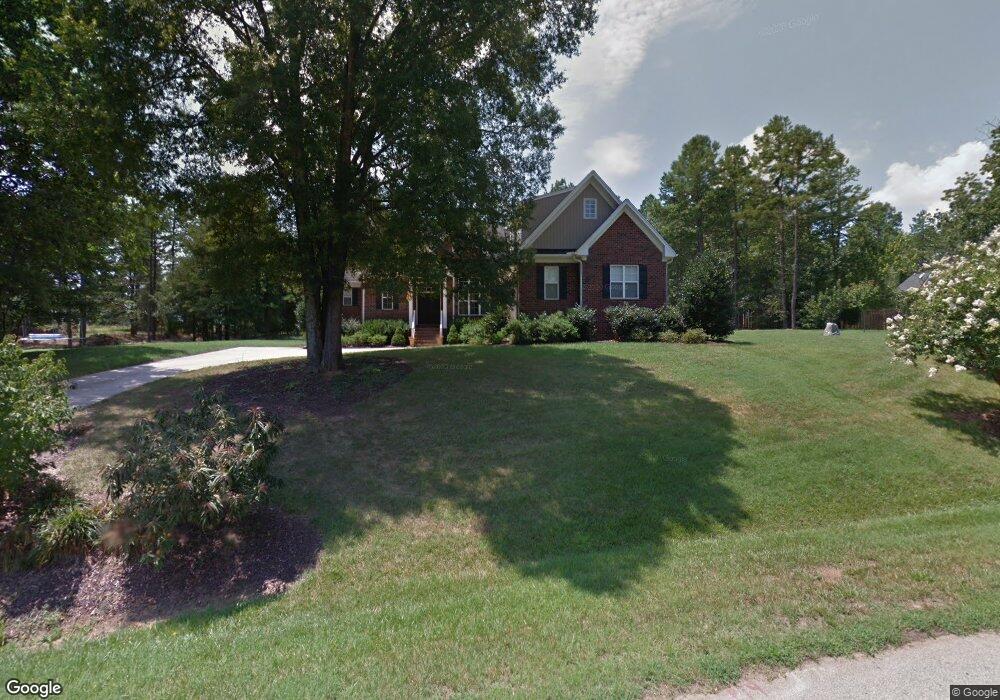
189 Laurel Crest Dr Kannapolis, NC 28081
Estimated Value: $482,079 - $669,000
4
Beds
3
Baths
2,236
Sq Ft
$261/Sq Ft
Est. Value
About This Home
This home is located at 189 Laurel Crest Dr, Kannapolis, NC 28081 and is currently estimated at $582,520, approximately $260 per square foot. 189 Laurel Crest Dr is a home located in Rowan County with nearby schools including Landis Elementary School, Corriher Lipe Middle School, and South Rowan High School.
Ownership History
Date
Name
Owned For
Owner Type
Purchase Details
Closed on
May 30, 2008
Sold by
Galea Andrew and Galea Julie M
Bought by
Nowack Keary F and Nowack Wendy L Wolf
Current Estimated Value
Home Financials for this Owner
Home Financials are based on the most recent Mortgage that was taken out on this home.
Original Mortgage
$253,600
Interest Rate
5.86%
Mortgage Type
Purchase Money Mortgage
Purchase Details
Closed on
Apr 7, 2006
Sold by
Finger David A and Finger Maxine B
Bought by
Galea Andrew Nmi and Galea Julie M
Home Financials for this Owner
Home Financials are based on the most recent Mortgage that was taken out on this home.
Original Mortgage
$235,000
Interest Rate
6%
Mortgage Type
Construction
Create a Home Valuation Report for This Property
The Home Valuation Report is an in-depth analysis detailing your home's value as well as a comparison with similar homes in the area
Home Values in the Area
Average Home Value in this Area
Purchase History
| Date | Buyer | Sale Price | Title Company |
|---|---|---|---|
| Nowack Keary F | $317,000 | None Available | |
| Galea Andrew Nmi | $36,000 | None Available |
Source: Public Records
Mortgage History
| Date | Status | Borrower | Loan Amount |
|---|---|---|---|
| Previous Owner | Nowack Keary F | $253,600 | |
| Previous Owner | Nowack Keary F | $250,000 | |
| Previous Owner | Galea Andrew Nmi | $235,000 |
Source: Public Records
Tax History Compared to Growth
Tax History
| Year | Tax Paid | Tax Assessment Tax Assessment Total Assessment is a certain percentage of the fair market value that is determined by local assessors to be the total taxable value of land and additions on the property. | Land | Improvement |
|---|---|---|---|---|
| 2025 | $2,730 | $413,625 | $43,000 | $370,625 |
| 2024 | $2,730 | $413,625 | $43,000 | $370,625 |
| 2023 | $2,730 | $413,625 | $43,000 | $370,625 |
| 2022 | $2,448 | $331,966 | $39,000 | $292,966 |
| 2021 | $2,448 | $331,966 | $39,000 | $292,966 |
| 2020 | $2,448 | $331,966 | $39,000 | $292,966 |
| 2019 | $2,448 | $331,966 | $39,000 | $292,966 |
| 2018 | $2,145 | $293,312 | $39,000 | $254,312 |
| 2017 | $2,145 | $293,312 | $39,000 | $254,312 |
| 2016 | $2,116 | $293,312 | $39,000 | $254,312 |
| 2015 | $2,150 | $293,312 | $39,000 | $254,312 |
| 2014 | $2,011 | $279,291 | $39,000 | $240,291 |
Source: Public Records
Map
Nearby Homes
- 268 Laurel Crest Dr
- 2280 Cannon Farm Rd
- 3796 Enochville Rd
- 0 Smith Rd
- 2218 Woodcrest Dr
- 1725 Saw Rd
- 2603 Mcgill St
- 2307 Pritchard St
- 255 Wilson St
- 0 Winona Ave
- 206 Winona Ave
- 0 Enochville Ave Unit CAR4275012
- 110 White Ave
- 113 Hilton Ave
- 991 Fairway Dr
- 110 Tanglewood Dr
- 400 Forest View Ln
- 2319 Tullymore Dr Unit 39
- 2274 Tullymore Dr Unit 14
- 843 Fairway Dr Unit 44
- 151 Laurel Crest Dr
- 225 Laurel Crest Dr
- 140 McField Dr
- 206 Laurel Crest Dr
- 267 Laurel Crest Dr
- 130 McField Dr
- 164 Laurel Crest Dr
- 166 Dusty Oaks Trail
- 293 Laurel Crest Dr
- 227 Dusty Oaks Trail
- 115 McField Dr
- 335 Knight Farm Rd
- 315 Knight Farm Rd
- 125 Mcwood Dr
- 320 Laurel Crest Dr
- 351 Laurel Crest Dr
- 345 Knight Farm Rd
- 383 Laurel Crest Dr
- 364 Laurel Crest Dr
- 125 Knight Farm Rd