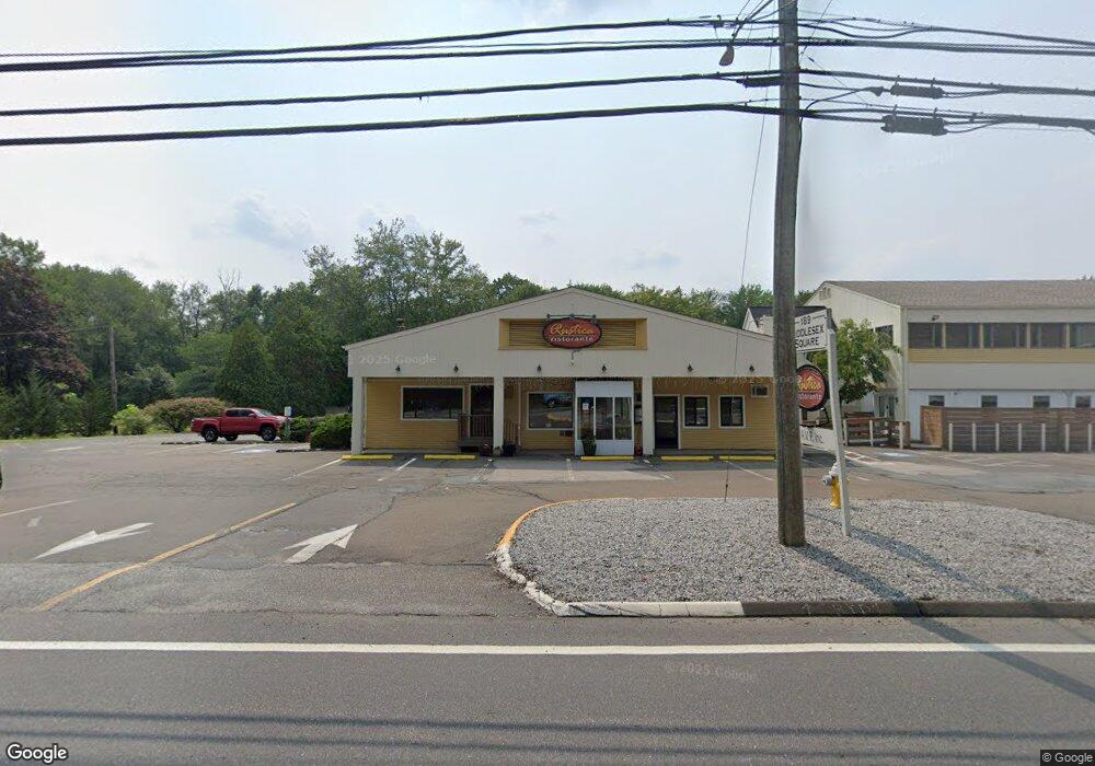
189 Middlesex Ave Unit 191 Chester, CT 06412
Estimated Value: $2,264,315
--
Bed
--
Bath
21,905
Sq Ft
$103/Sq Ft
Est. Value
About This Home
This home is located at 189 Middlesex Ave Unit 191, Chester, CT 06412 and is currently estimated at $2,264,315, approximately $103 per square foot. 189 Middlesex Ave Unit 191 is a home located in Middlesex County with nearby schools including Valley Regional High School.
Ownership History
Date
Name
Owned For
Owner Type
Purchase Details
Closed on
Oct 11, 2006
Sold by
Dva Llc
Bought by
Pettis Prop Llc
Current Estimated Value
Home Financials for this Owner
Home Financials are based on the most recent Mortgage that was taken out on this home.
Original Mortgage
$1,000,000
Interest Rate
6.47%
Mortgage Type
Commercial
Purchase Details
Closed on
Dec 27, 1994
Sold by
Timbro Alfonzo
Bought by
Property Mgmnt Inc
Create a Home Valuation Report for This Property
The Home Valuation Report is an in-depth analysis detailing your home's value as well as a comparison with similar homes in the area
Home Values in the Area
Average Home Value in this Area
Purchase History
| Date | Buyer | Sale Price | Title Company |
|---|---|---|---|
| Pettis Prop Llc | $1,460,000 | -- | |
| Pettis Prop Llc | $1,460,000 | -- | |
| Property Mgmnt Inc | $1,261,567 | -- | |
| Property Mgmnt Inc | $1,261,567 | -- |
Source: Public Records
Mortgage History
| Date | Status | Borrower | Loan Amount |
|---|---|---|---|
| Closed | Property Mgmnt Inc | $1,000,000 | |
| Previous Owner | Property Mgmnt Inc | $315,880 |
Source: Public Records
Tax History Compared to Growth
Tax History
| Year | Tax Paid | Tax Assessment Tax Assessment Total Assessment is a certain percentage of the fair market value that is determined by local assessors to be the total taxable value of land and additions on the property. | Land | Improvement |
|---|---|---|---|---|
| 2025 | $40,545 | $1,497,230 | $203,420 | $1,293,810 |
| 2024 | $53,033 | $2,169,020 | $203,420 | $1,965,600 |
| 2023 | $19,160 | $645,130 | $98,520 | $546,610 |
| 2022 | $19,031 | $645,130 | $98,520 | $546,610 |
| 2021 | $17,925 | $607,630 | $98,520 | $509,110 |
| 2020 | $17,390 | $607,630 | $98,520 | $509,110 |
| 2019 | $17,494 | $607,630 | $98,520 | $509,110 |
| 2018 | $19,428 | $716,650 | $122,950 | $593,700 |
| 2017 | $18,891 | $716,650 | $122,950 | $593,700 |
| 2016 | $14,448 | $716,650 | $122,950 | $593,700 |
| 2015 | $18,146 | $716,650 | $122,950 | $593,700 |
| 2014 | $17,787 | $716,650 | $122,950 | $593,700 |
Source: Public Records
Map
Nearby Homes
- 36 Kings Hwy
- 60 Goose Hill Rd
- 11 Kings Hwy
- 47 Ferry Rd
- 131 Middlesex Ave
- 153 Ferry Rd
- 79 Middlesex Ave
- 288 Middlesex Ave
- 12 Deep Hollow Rd
- 6 W Main St
- 9 Hickory Hill Dr
- 35 Maple St
- 53 Selden Rd
- 5 Mitchell Ln
- 7 Shelter Rock Rd
- 496 Joshuatown Rd
- 11 Winter Ave
- 43 Bokum Rd
- 11 Phelps Rd
- 92 Main St Unit 101
- 189 Middlesex Ave
- 191 Middlesex Ave
- 189 Middlesex Turnpike Unit A
- 187 Middlesex Ave
- 194 Middlesex Ave
- 200 Middlesex Ave
- 57 Castle View Dr
- 183 Middlesex Ave
- 190 Middlesex Ave
- 55 Castle View Dr
- 53 Castle View Dr
- 52 Castle View Dr
- 184 Middlesex Ave Unit 2
- 184 Middlesex Ave Unit 1
- 199 Middlesex 2nd Floor Ave
- 199 Middlesex Ave
- 181 Middlesex Ave
- 204 Middlesex Ave
- 4 Castle View Dr
- 192A Middlesex Ave