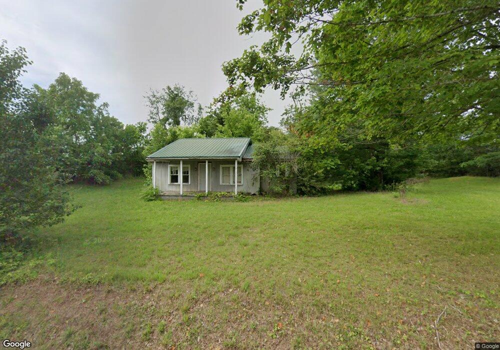
189 Oak Rd Rutledge, TN 37861
Estimated Value: $98,533 - $215,000
Studio
1
Bath
990
Sq Ft
$155/Sq Ft
Est. Value
About This Home
This home is located at 189 Oak Rd, Rutledge, TN 37861 and is currently estimated at $153,383, approximately $154 per square foot. 189 Oak Rd is a home located in Grainger County with nearby schools including Rutledge Primary School, Rutledge Elementary School, and Rutledge Middle School.
Ownership History
Date
Name
Owned For
Owner Type
Purchase Details
Closed on
Feb 29, 2012
Sold by
Davis Jason Allen
Bought by
Bridgewater Clarence and Bridgewater Wayne
Current Estimated Value
Purchase Details
Closed on
Dec 11, 2002
Sold by
Davis Johnny
Bought by
Davis Patti
Purchase Details
Closed on
Feb 5, 2002
Sold by
Davis Jason
Bought by
Whitt J P
Purchase Details
Closed on
Jan 7, 2000
Sold by
Davis Johnnie L
Bought by
Davis Elizabeth
Purchase Details
Closed on
Jul 31, 1998
Bought by
Davis Johnnie L Le Davis Jason Rm
Create a Home Valuation Report for This Property
The Home Valuation Report is an in-depth analysis detailing your home's value as well as a comparison with similar homes in the area
Purchase History
We collect this data history from publicly available records. To have your information removed, we recommend requesting removal directly through your county’s website.
| Date | Buyer | Sale Price | Title Company |
|---|---|---|---|
| Bridgewater Clarence | $25,000 | -- | |
| Davis Patti | -- | -- | |
| Whitt J P | $70,762 | -- | |
| Davis Elizabeth | -- | -- | |
| Davis Johnnie L Le Davis Jason Rm | $38,800 | -- |
Source: Public Records
Tax History
| Year | Tax Paid | Tax Assessment Tax Assessment Total Assessment is a certain percentage of the fair market value that is determined by local assessors to be the total taxable value of land and additions on the property. | Land | Improvement |
|---|---|---|---|---|
| 2025 | $280 | $11,925 | $2,550 | $9,375 |
| 2024 | $280 | $11,925 | $2,550 | $9,375 |
| 2023 | $280 | $11,925 | $2,550 | $9,375 |
| 2022 | $274 | $11,925 | $2,550 | $9,375 |
| 2021 | $274 | $11,925 | $2,550 | $9,375 |
| 2020 | $197 | $11,925 | $2,550 | $9,375 |
| 2019 | $197 | $7,050 | $2,550 | $4,500 |
| 2018 | $171 | $7,050 | $2,550 | $4,500 |
| 2017 | $171 | $7,050 | $2,550 | $4,500 |
| 2016 | $171 | $7,050 | $2,550 | $4,500 |
| 2015 | $191 | $7,050 | $2,550 | $4,500 |
| 2014 | $191 | $7,625 | $0 | $0 |
Source: Public Records
Map
Nearby Homes
- 292 Burkhart Rd
- 14630 Lakeshore Dr
- 311 Alberts Cove
- 211 Sequoyah Trail
- 233 Sequoyah Trail
- 139 Buffalo Springs Rd
- 1612 Howell River Rd
- 1946 Spoon Hollow Rd
- 501 Wa Ni Village Rd
- 1445 River Rd
- 7366 Circle Point Dr
- 7713 Melanie Cir
- 1405 River Rd
- Lot 136 Tumbleweed Trail
- Lot 77 Shiloh Springs Rd
- Lot 11 Pocahontas Ln
- Lot 8 Waterway Dr
- 1151 Wa Ni Village Rd
- 7574 W Pierce Dr
- 345 Charlie Greenlee Rd
Your Personal Tour Guide
Ask me questions while you tour the home.