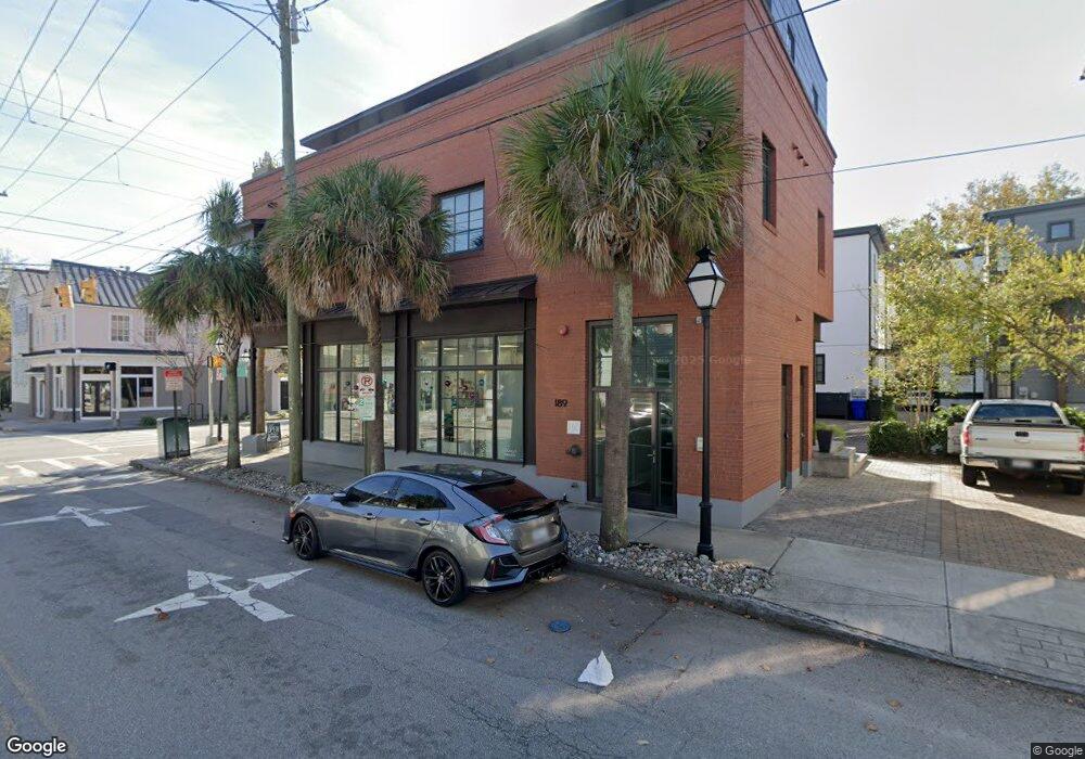
189 St Philip St Unit A Charleston, SC 29403
Cannonborough-Elliotborough NeighborhoodEstimated Value: $780,000 - $1,159,000
2
Beds
2
Baths
1,159
Sq Ft
$844/Sq Ft
Est. Value
About This Home
This home is located at 189 St Philip St Unit A, Charleston, SC 29403 and is currently estimated at $978,655, approximately $844 per square foot. 189 St Philip St Unit A is a home located in Charleston County with nearby schools including Mitchell Elementary School, James Simons Elementary School, and Simmons Pinckney Middle.
Ownership History
Date
Name
Owned For
Owner Type
Purchase Details
Closed on
Sep 16, 2016
Sold by
Austin Kenneth W
Bought by
Austin Kenneth Wayne and The Kenneth Wayne Austin Revocable Trust
Current Estimated Value
Purchase Details
Closed on
Jan 9, 2009
Sold by
Midtown Of Charleston Inc
Bought by
Austin Kenneth W and Austin Ashleigh Brooke
Home Financials for this Owner
Home Financials are based on the most recent Mortgage that was taken out on this home.
Original Mortgage
$372,000
Interest Rate
5.95%
Mortgage Type
Purchase Money Mortgage
Create a Home Valuation Report for This Property
The Home Valuation Report is an in-depth analysis detailing your home's value as well as a comparison with similar homes in the area
Home Values in the Area
Average Home Value in this Area
Purchase History
| Date | Buyer | Sale Price | Title Company |
|---|---|---|---|
| Austin Kenneth Wayne | -- | -- | |
| Austin Kenneth W | $465,000 | -- |
Source: Public Records
Mortgage History
| Date | Status | Borrower | Loan Amount |
|---|---|---|---|
| Closed | Austin Kenneth W | $372,000 |
Source: Public Records
Tax History Compared to Growth
Tax History
| Year | Tax Paid | Tax Assessment Tax Assessment Total Assessment is a certain percentage of the fair market value that is determined by local assessors to be the total taxable value of land and additions on the property. | Land | Improvement |
|---|---|---|---|---|
| 2024 | $10,529 | $0 | $0 | $0 |
| 2023 | $9,554 | $33,160 | $0 | $0 |
| 2022 | $8,855 | $33,160 | $0 | $0 |
| 2021 | $8,746 | $33,160 | $0 | $0 |
| 2020 | $8,682 | $33,160 | $0 | $0 |
| 2019 | $7,932 | $28,840 | $0 | $0 |
| 2017 | $7,576 | $28,840 | $0 | $0 |
| 2016 | $2,405 | $19,230 | $0 | $0 |
| 2015 | $2,486 | $19,230 | $0 | $0 |
| 2014 | $2,125 | $0 | $0 | $0 |
| 2011 | -- | $0 | $0 | $0 |
Source: Public Records
Map
Nearby Homes
- 199 Saint Philip St Unit B
- 207 St Philip St
- 609 King St Unit 607
- 609 King St Unit 331
- 609 King St Unit 443
- 609 King St Unit 745
- 609 King St Unit 334
- 609 King St Unit 704
- 609 King St Unit 548
- 609 King St Unit 701
- 609 King St Unit 543
- 609 King St Unit 515
- 609 King St Unit 348
- 609 King St Unit Gf3
- 609 King St Unit 732
- 609 King St Unit 730
- 609 King St Unit 608
- 609 King St Unit 630
- 609 King St Unit 335
- 609 King St Unit 744
- 189 Saint Philip St Unit B
- 189 Saint Philip St Unit A
- 189 St Philip St Unit B
- 189 St Phillip St Unit B
- 22 Cannon St
- 193 St Philip St
- 193 Saint Philip St
- 24 Cannon St Unit B
- 24 Cannon St Unit A
- 195 St Philip St
- 17 Brewster Ct
- 16 Cannon St Unit B
- 16 Cannon St Unit 205
- 16 Cannon St Unit 204
- 16 Cannon St Unit 101
- 16 Cannon St Unit 201
- 16 Cannon St Unit 202
- 16 Cannon St Unit 105
- 16 Cannon St Unit 103
- 19 Brewster Ct