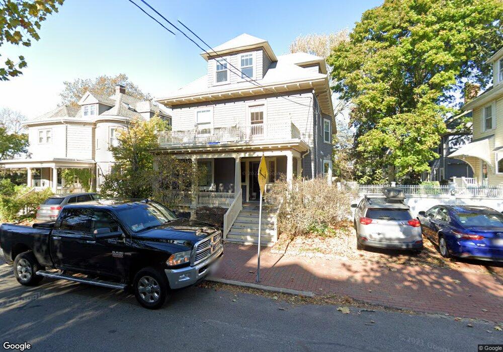
189 Upland Rd Unit 2 Cambridge, MA 02140
Neighborhood Nine NeighborhoodEstimated Value: $1,714,000 - $2,531,000
3
Beds
2
Baths
2,616
Sq Ft
$748/Sq Ft
Est. Value
About This Home
This home is located at 189 Upland Rd Unit 2, Cambridge, MA 02140 and is currently estimated at $1,956,683, approximately $747 per square foot. 189 Upland Rd Unit 2 is a home located in Middlesex County with nearby schools including Benjamin Banneker Charter Public School, Cambridge Montessori School, and Cambridge Friends School.
Ownership History
Date
Name
Owned For
Owner Type
Purchase Details
Closed on
Aug 29, 2019
Sold by
Defilippi Richard P and Arrington Lucy
Bought by
Richard P Defilippi Ret
Current Estimated Value
Purchase Details
Closed on
Jun 21, 2011
Sold by
189 Upland Road Condo and Arrington Lucy
Bought by
Defilippi Richard P and Arrington Lucy
Create a Home Valuation Report for This Property
The Home Valuation Report is an in-depth analysis detailing your home's value as well as a comparison with similar homes in the area
Home Values in the Area
Average Home Value in this Area
Purchase History
| Date | Buyer | Sale Price | Title Company |
|---|---|---|---|
| Richard P Defilippi Ret | -- | -- | |
| Defilippi Richard P | -- | -- |
Source: Public Records
Tax History Compared to Growth
Tax History
| Year | Tax Paid | Tax Assessment Tax Assessment Total Assessment is a certain percentage of the fair market value that is determined by local assessors to be the total taxable value of land and additions on the property. | Land | Improvement |
|---|---|---|---|---|
| 2025 | $10,649 | $1,677,000 | $0 | $1,677,000 |
| 2024 | $10,533 | $1,779,200 | $0 | $1,779,200 |
| 2023 | $9,509 | $1,622,700 | $0 | $1,622,700 |
| 2022 | $9,325 | $1,600,600 | $0 | $1,600,600 |
| 2021 | $9,325 | $1,594,100 | $0 | $1,594,100 |
| 2020 | $8,670 | $1,507,800 | $0 | $1,507,800 |
| 2019 | $8,324 | $1,401,300 | $0 | $1,401,300 |
| 2018 | $6,135 | $1,288,800 | $0 | $1,288,800 |
| 2017 | $8,171 | $1,259,000 | $0 | $1,259,000 |
| 2016 | $8,035 | $1,149,500 | $0 | $1,149,500 |
| 2015 | $7,963 | $1,018,300 | $0 | $1,018,300 |
| 2014 | $7,864 | $938,400 | $0 | $938,400 |
Source: Public Records
Map
Nearby Homes
- 178 Richdale Ave
- 24 Cambridge Terrace Unit 2
- 273 Walden St Unit 2
- 7 Cypress St
- 11 Cogswell Ave Unit 13
- 84 Garden St
- 12 Gray Gardens W Unit 14
- 61 Bolton St Unit 304
- 204 Garden St
- 18 Upland Rd Unit 1
- 187 Concord Ave Unit 5
- 7 Russell St Unit 1
- 202 Garden St
- 281 Concord Ave
- 7 Beech St Unit 319
- 7 Beech St Unit 211
- 32 Copley St Unit 2
- 14-16 Field St
- 318 Concord Ave Unit 2
- 32-40 White St
- 189 Upland Rd Unit 3
- 189 Upland Rd Unit 1
- 195 Upland Rd
- 181 Upland Rd
- 8 Whittier St
- 121 Raymond St Unit W
- 121 Raymond St Unit E
- 121 Raymond St Unit EAST
- 12 Whittier St
- 123 Raymond St Unit WEST
- 192 Upland Rd
- 188 Upland Rd Unit 3
- 188 Upland Rd Unit 6
- 186 Upland Rd Unit 5
- 188 Upland Rd Unit 4
- 186 Upland Rd Unit 3
- 188 Upland Rd Unit 2
- 186 Upland Rd Unit 1
- 188 Upland Rd Unit 6,188
- 105 Raymond St