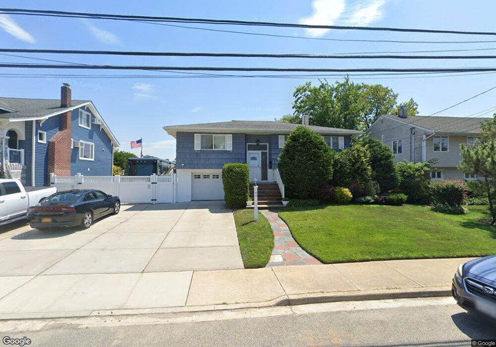
189 Westside Ave Freeport, NY 11520
Estimated Value: $567,000 - $736,543
4
Beds
2
Baths
1,234
Sq Ft
$528/Sq Ft
Est. Value
About This Home
This home is located at 189 Westside Ave, Freeport, NY 11520 and is currently estimated at $651,772, approximately $528 per square foot. 189 Westside Ave is a home located in Nassau County with nearby schools including Columbus Avenue School, Caroline G. Atkinson Intermediate School, and John W Dodd Middle School.
Ownership History
Date
Name
Owned For
Owner Type
Purchase Details
Closed on
Jan 27, 2017
Sold by
Sansone Peter
Bought by
Bender Martin J
Current Estimated Value
Home Financials for this Owner
Home Financials are based on the most recent Mortgage that was taken out on this home.
Original Mortgage
$231,643
Outstanding Balance
$191,360
Interest Rate
4.12%
Mortgage Type
New Conventional
Estimated Equity
$460,412
Purchase Details
Closed on
Jan 25, 2007
Sold by
Gardner Antonette
Purchase Details
Closed on
Sep 25, 2006
Sold by
Gardner Antonette
Create a Home Valuation Report for This Property
The Home Valuation Report is an in-depth analysis detailing your home's value as well as a comparison with similar homes in the area
Home Values in the Area
Average Home Value in this Area
Purchase History
| Date | Buyer | Sale Price | Title Company |
|---|---|---|---|
| Bender Martin J | $325,000 | Old Republic Title Insurance | |
| -- | -- | -- | |
| -- | -- | -- | |
| -- | -- | -- |
Source: Public Records
Mortgage History
| Date | Status | Borrower | Loan Amount |
|---|---|---|---|
| Open | Bender Martin J | $231,643 |
Source: Public Records
Tax History Compared to Growth
Tax History
| Year | Tax Paid | Tax Assessment Tax Assessment Total Assessment is a certain percentage of the fair market value that is determined by local assessors to be the total taxable value of land and additions on the property. | Land | Improvement |
|---|---|---|---|---|
| 2025 | $9,789 | $454 | $221 | $233 |
| 2024 | $1,017 | $454 | $221 | $233 |
| 2023 | $10,012 | $454 | $221 | $233 |
| 2022 | $10,012 | $454 | $221 | $233 |
| 2021 | $15,011 | $451 | $220 | $231 |
| 2020 | $11,146 | $750 | $591 | $159 |
| 2019 | $11,037 | $837 | $660 | $177 |
| 2018 | $12,120 | $1,015 | $0 | $0 |
| 2017 | $10,815 | $1,015 | $800 | $215 |
| 2016 | $12,338 | $1,015 | $800 | $215 |
| 2015 | $864 | $1,015 | $800 | $215 |
| 2014 | $864 | $1,015 | $800 | $215 |
| 2013 | $678 | $1,015 | $800 | $215 |
Source: Public Records
Map
Nearby Homes
- 171 Westside Ave
- 226 Westside Ave Unit B
- 159 Branch Ave
- 31 Casino St Unit PH
- 587 S Bayview Ave
- 232 Nassau Ave
- 209 Nassau Ave
- 292 Westside Ave
- 479 Roosevelt Ave
- 374 Miller Ave
- 173 Cedar St
- 322 Miller Ave
- 65 Adams St
- 310 Miller Ave
- 536 S Ocean Ave
- 570 S Ocean Ave
- 119 S Bay Ave
- 470 Miller Ave
- 494 S Ocean Ave Unit 1H
- 494 S Ocean Ave Unit 3A
- 195 Westside Ave
- 187 Westside Ave
- 185 Westside Ave
- 199 Westside Ave
- 181 Westside Ave
- 194 Westside Ave
- 170 Westside Ave
- 190 Westside Ave
- 205 Westside Ave
- 177 Westside Ave
- 186 Westside Ave
- 175 Westside Ave
- 206 Westside Ave
- 211 Westside Ave
- 162 Westside Ave
- 195 Saint Marks Ave
- 191 Saint Marks Ave
- 197 Saint Marks Ave
- 210 Westside Ave
- 189 Saint Marks Ave