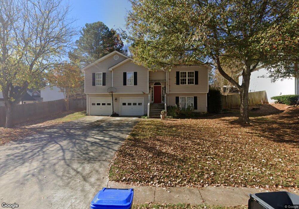
1890 Foster Trace Ct Unit 3 Lawrenceville, GA 30043
Estimated Value: $359,187 - $379,000
3
Beds
2
Baths
1,295
Sq Ft
$287/Sq Ft
Est. Value
About This Home
This home is located at 1890 Foster Trace Ct Unit 3, Lawrenceville, GA 30043 and is currently estimated at $372,047, approximately $287 per square foot. 1890 Foster Trace Ct Unit 3 is a home located in Gwinnett County with nearby schools including Taylor Elementary School, Creekland Middle School, and Collins Hill High School.
Ownership History
Date
Name
Owned For
Owner Type
Purchase Details
Closed on
Feb 12, 1998
Sold by
Wendell Construction
Bought by
Hardy Michael C and Hardy Ruth A
Current Estimated Value
Home Financials for this Owner
Home Financials are based on the most recent Mortgage that was taken out on this home.
Original Mortgage
$109,850
Outstanding Balance
$19,257
Interest Rate
6.89%
Mortgage Type
New Conventional
Estimated Equity
$352,790
Create a Home Valuation Report for This Property
The Home Valuation Report is an in-depth analysis detailing your home's value as well as a comparison with similar homes in the area
Home Values in the Area
Average Home Value in this Area
Purchase History
| Date | Buyer | Sale Price | Title Company |
|---|---|---|---|
| Hardy Michael C | $115,700 | -- |
Source: Public Records
Mortgage History
| Date | Status | Borrower | Loan Amount |
|---|---|---|---|
| Open | Hardy Michael C | $109,850 |
Source: Public Records
Tax History Compared to Growth
Tax History
| Year | Tax Paid | Tax Assessment Tax Assessment Total Assessment is a certain percentage of the fair market value that is determined by local assessors to be the total taxable value of land and additions on the property. | Land | Improvement |
|---|---|---|---|---|
| 2024 | $3,580 | $133,760 | $28,800 | $104,960 |
| 2023 | $3,580 | $133,760 | $28,800 | $104,960 |
| 2022 | $3,198 | $117,080 | $26,800 | $90,280 |
| 2021 | $2,580 | $85,440 | $18,000 | $67,440 |
| 2020 | $2,454 | $78,720 | $18,000 | $60,720 |
| 2019 | $2,299 | $74,040 | $14,000 | $60,040 |
| 2018 | $2,298 | $74,040 | $14,000 | $60,040 |
| 2016 | $1,595 | $41,960 | $13,600 | $28,360 |
| 2015 | $1,607 | $41,960 | $13,600 | $28,360 |
| 2014 | $1,708 | $44,914 | $11,900 | $33,014 |
Source: Public Records
Map
Nearby Homes
- 1930 Collins Hill Rd
- 340 Rosedown Way
- 1931 Abinger Way
- 260 Wildcat Lake Dr
- 2050 Fortuna St
- 1955 Watson Falls Ct
- 1909 McLennon Ct
- 1870 Wildcat Trace Cir
- 275 Rose Ivy Ct
- 12 Jacobs Farm Ln Unit 6
- 1767 Tidewell Trace
- 385 Sweet Ivy Ln
- 1908 Prince Dr
- 1795 Laurel Creek Dr
- 2402 Malster Ln
- 2205 Parliament Dr
- 205 Camden Creek Ct
- 110 Foster Trace Dr
- 100 Foster Trace Dr
- 1970 Foster Trace Ct
- 1980 Foster Trace Ct
- 0 Foster Trace Ct Unit 7529160
- 0 Foster Trace Ct Unit 7017343
- 0 Foster Trace Ct Unit 8466479
- 0 Foster Trace Ct Unit 8244264
- 0 Foster Trace Ct
- 1950 Foster Trace Ct
- 90 Foster Trace Dr
- 1885 Foster Trace Ct
- 1895 Foster Trace Ct Unit 1895
- 1895 Foster Trace Ct Unit 3
- 1895 Foster Trace Ct
- 1895 Foster Trace Ct
- 1905 Foster Trace Ct Unit 3
- 2000 Foster Trace Ct
- 1875 Foster Trace Ct
- 0 Foster Trace Dr Unit 8558972