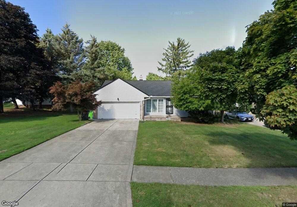
1890 Kapel Dr Euclid, OH 44117
Estimated Value: $151,000 - $173,899
3
Beds
2
Baths
1,210
Sq Ft
$138/Sq Ft
Est. Value
About This Home
This home is located at 1890 Kapel Dr, Euclid, OH 44117 and is currently estimated at $166,725, approximately $137 per square foot. 1890 Kapel Dr is a home located in Cuyahoga County with nearby schools including Thomas Jefferson Elementary School, Euclid Middle School, and Euclid High School.
Ownership History
Date
Name
Owned For
Owner Type
Purchase Details
Closed on
May 17, 2002
Sold by
Allison Annie B
Bought by
Allison Annie B
Current Estimated Value
Purchase Details
Closed on
Oct 3, 1994
Sold by
Spisak Francis Paul
Bought by
Smith Samuel and Smith Eunice
Purchase Details
Closed on
Mar 29, 1985
Sold by
Spisak Francis P and Spisak Joanne L
Bought by
Spisak Francis Paul
Purchase Details
Closed on
Nov 13, 1975
Sold by
Dorn Lydia
Bought by
Spisak Francis P and Spisak Joanne L
Purchase Details
Closed on
Jan 1, 1975
Bought by
Dorn Lydia
Create a Home Valuation Report for This Property
The Home Valuation Report is an in-depth analysis detailing your home's value as well as a comparison with similar homes in the area
Home Values in the Area
Average Home Value in this Area
Purchase History
| Date | Buyer | Sale Price | Title Company |
|---|---|---|---|
| Allison Annie B | -- | -- | |
| Allison Annie B | -- | -- | |
| Smith Samuel | $102,000 | -- | |
| Spisak Francis Paul | -- | -- | |
| Spisak Francis P | $40,000 | -- | |
| Dorn Lydia | -- | -- |
Source: Public Records
Tax History
| Year | Tax Paid | Tax Assessment Tax Assessment Total Assessment is a certain percentage of the fair market value that is determined by local assessors to be the total taxable value of land and additions on the property. | Land | Improvement |
|---|---|---|---|---|
| 2024 | $3,708 | $54,145 | $10,745 | $43,400 |
| 2023 | $3,426 | $39,910 | $8,370 | $31,540 |
| 2022 | $3,348 | $39,900 | $8,370 | $31,540 |
| 2021 | $3,732 | $39,900 | $8,370 | $31,540 |
| 2020 | $3,539 | $34,410 | $7,210 | $27,200 |
| 2019 | $3,184 | $98,300 | $20,600 | $77,700 |
| 2018 | $3,215 | $34,410 | $7,210 | $27,200 |
| 2017 | $3,413 | $30,520 | $5,810 | $24,710 |
| 2016 | $3,420 | $30,520 | $5,810 | $24,710 |
| 2015 | $3,111 | $30,520 | $5,810 | $24,710 |
| 2014 | $3,111 | $30,520 | $5,810 | $24,710 |
Source: Public Records
Map
Nearby Homes
- 25550 Glenbrook Blvd
- 1865 Idlehurst Dr
- 1864 Glen Oval
- 1790 Skyline Dr
- 25031 Glenbrook Blvd
- 25321 Chatworth Dr
- 24691 Hawthorne Dr
- 1620 E 243rd St
- 24991 Euclid Ave
- 145 Richmond Rd
- 25161 Euclid Ave
- 1552 E 254th St
- 24105 Chardon Rd
- 1530 E 254th St
- 1437 E 252nd St
- 1554 E 256th St
- 1765 E 238th St
- 1685 Oakham Rd
- 1471 Hall Ct
- 363 Balmoral Dr
- 1884 Kapel Dr
- 1905 Braeburn Park Dr
- 1880 Kapel Dr
- 1911 Braeburn Park Dr
- 1897 Braeburn Park Dr
- 1891 Braeburn Park Dr
- 1887 Braeburn Park Dr
- 1874 Kapel Dr
- 1881 Braeburn Park Dr
- 1881 Braeburn Park Dr Unit D
- 1889 Kapel Dr
- 1893 Kapel Dr
- 1883 Kapel Dr
- 1897 Kapel Dr
- 1875 Braeburn Park Dr
- 1879 Kapel Dr
- 1870 Kapel Dr
- 1901 Kapel Dr
- 1873 Kapel Dr
- 1871 Braeburn Park Dr
