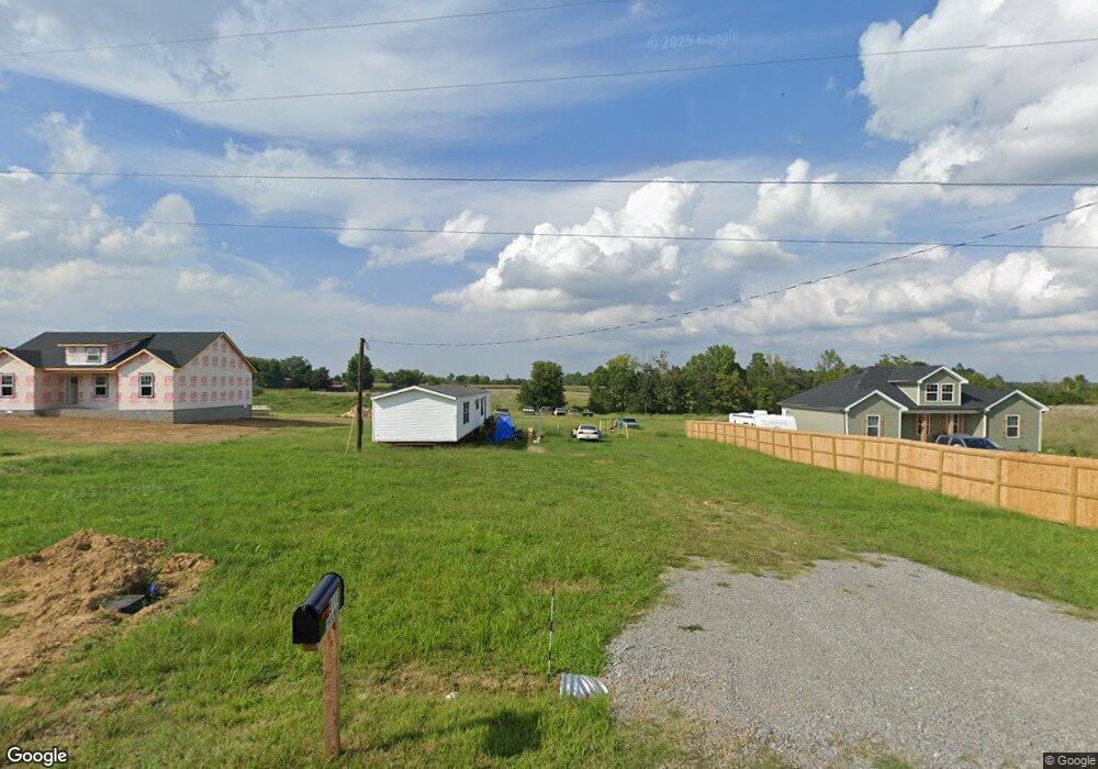
1890 Stringtown Rd Elkton, KY 42220
Estimated Value: $126,000 - $216,000
3
Beds
2
Baths
1,152
Sq Ft
$142/Sq Ft
Est. Value
About This Home
This home is located at 1890 Stringtown Rd, Elkton, KY 42220 and is currently estimated at $163,279, approximately $141 per square foot. 1890 Stringtown Rd is a home located in Todd County with nearby schools including Todd County Middle School and Todd County Central High School.
Ownership History
Date
Name
Owned For
Owner Type
Purchase Details
Closed on
Mar 10, 2025
Sold by
And Scot M Blake and Revoc Or Sandra
Bought by
Vernon O Whitfield And Maria Luisa D Whitfiel and Whitfield
Current Estimated Value
Purchase Details
Closed on
Jun 21, 2023
Sold by
B & B Builders Llc
Bought by
Blake Scot and Blake Sandra
Home Financials for this Owner
Home Financials are based on the most recent Mortgage that was taken out on this home.
Original Mortgage
$240,052
Interest Rate
0.67%
Mortgage Type
Construction
Purchase Details
Closed on
Jun 1, 2005
Bought by
Blake Scot & Sandra Trust
Create a Home Valuation Report for This Property
The Home Valuation Report is an in-depth analysis detailing your home's value as well as a comparison with similar homes in the area
Purchase History
| Date | Buyer | Sale Price | Title Company |
|---|---|---|---|
| Vernon O Whitfield And Maria Luisa D Whitfiel | $30,000 | None Listed On Document | |
| Blake Scot | $235,000 | Tennessee Title Svcs Llc-Clark | |
| Blake Scot & Sandra Trust | $50,714 | -- |
Source: Public Records
Mortgage History
| Date | Status | Borrower | Loan Amount |
|---|---|---|---|
| Previous Owner | Blake Scot | $240,052 |
Source: Public Records
Tax History
| Year | Tax Paid | Tax Assessment Tax Assessment Total Assessment is a certain percentage of the fair market value that is determined by local assessors to be the total taxable value of land and additions on the property. | Land | Improvement |
|---|---|---|---|---|
| 2025 | $291 | $35,000 | $0 | $0 |
| 2024 | $292 | $35,000 | $0 | $0 |
| 2023 | $293 | $35,000 | $0 | $0 |
| 2022 | $255 | $30,898 | $0 | $0 |
| 2021 | $256 | $30,898 | $0 | $0 |
| 2020 | $256 | $30,898 | $0 | $0 |
| 2019 | $254 | $30,898 | $0 | $0 |
| 2018 | $245 | $30,898 | $0 | $0 |
| 2017 | $245 | $30,898 | $0 | $0 |
| 2016 | $241 | $30,898 | $10,898 | $20,000 |
| 2015 | -- | $30,898 | $0 | $20,000 |
| 2013 | -- | $75,388 | $0 | $0 |
Source: Public Records
Map
Nearby Homes
- 210 Moe Ln
- 1275 W Jeff Davis Hwy
- 0 Joiner Ave
- 106 Riverbend Dr
- 112 Joiner Ave
- 114 Joiner Ave
- 110 Joiner Ave
- 106 Joiner Ave
- 6 Joiner Ave
- 108 Joiner Ave
- 710 W Shelby Ave
- 707 W Shelby Ave
- 708 W Shelby Ave
- 4412 Butler Rd
- 325 Davis Mill Rd
- 138 Foggy Ln
- 211 Elk Fork Rd
- 1410 Blue and Gray Park Rd
- 0 Main St N
- 0 Allegre Rd
- 1960 Stringtown Rd
- 3125 Stokes Chapel Rd
- 1980 Stringtown Rd
- 3120 Stokes Chapel Rd
- 3100 Stokes Chapel Rd
- 3160 Stokes Chapel Rd
- 3150 Stokes Chapel Rd
- 1816 Stringtown Rd
- 2010 Stringtown Rd
- 1995 Stringtown Rd
- 2985 Stokes Chapel Rd
- 1775 Stringtown Rd
- 2100 Stringtown Rd
- 116 Riverbend Dr
- 124 Riverbend Dr
- 145 Riverbend Dr
- 143 Riverbend Dr
- 140 Riverbend Dr
- 131 Riverbend Dr
- 127 Riverbend Dr
Your Personal Tour Guide
Ask me questions while you tour the home.