Estimated Value: $333,592 - $379,000
3
Beds
2
Baths
1,828
Sq Ft
$194/Sq Ft
Est. Value
About This Home
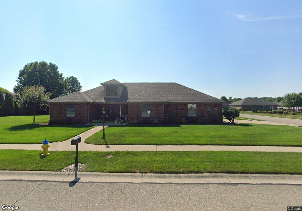
This home is located at 1891 Kitty Hawk Dr, Xenia, OH 45385 and is currently estimated at $353,898, approximately $193 per square foot. 1891 Kitty Hawk Dr is a home located in Greene County with nearby schools including Xenia High School, Summit Academy Community School for Alternative Learners - Xenia, and Legacy Christian Academy.
Ownership History
Date
Name
Owned For
Owner Type
Purchase Details
Closed on
Aug 15, 2003
Sold by
Be Am Co Inc
Bought by
Ruby Charles B and Ruby Kimberly L
Current Estimated Value
Home Financials for this Owner
Home Financials are based on the most recent Mortgage that was taken out on this home.
Original Mortgage
$164,825
Outstanding Balance
$66,641
Interest Rate
4.5%
Mortgage Type
Unknown
Estimated Equity
$287,257
Purchase Details
Closed on
Apr 12, 2002
Sold by
P F D Development P L L
Bought by
Be Am Co Inc
Home Financials for this Owner
Home Financials are based on the most recent Mortgage that was taken out on this home.
Original Mortgage
$32,900
Interest Rate
6.82%
Mortgage Type
Seller Take Back
Create a Home Valuation Report for This Property
The Home Valuation Report is an in-depth analysis detailing your home's value as well as a comparison with similar homes in the area
Home Values in the Area
Average Home Value in this Area
Purchase History
| Date | Buyer | Sale Price | Title Company |
|---|---|---|---|
| Ruby Charles B | $173,500 | -- | |
| Be Am Co Inc | $32,900 | -- |
Source: Public Records
Mortgage History
| Date | Status | Borrower | Loan Amount |
|---|---|---|---|
| Open | Ruby Charles B | $164,825 | |
| Previous Owner | Be Am Co Inc | $32,900 |
Source: Public Records
Tax History Compared to Growth
Tax History
| Year | Tax Paid | Tax Assessment Tax Assessment Total Assessment is a certain percentage of the fair market value that is determined by local assessors to be the total taxable value of land and additions on the property. | Land | Improvement |
|---|---|---|---|---|
| 2024 | $3,696 | $88,640 | $18,700 | $69,940 |
| 2023 | $3,696 | $88,640 | $18,700 | $69,940 |
| 2022 | $3,262 | $66,690 | $12,460 | $54,230 |
| 2021 | $3,306 | $66,690 | $12,460 | $54,230 |
| 2020 | $3,163 | $66,690 | $12,460 | $54,230 |
| 2019 | $3,123 | $61,970 | $14,740 | $47,230 |
| 2018 | $3,135 | $61,970 | $14,740 | $47,230 |
| 2017 | $2,990 | $61,970 | $14,740 | $47,230 |
| 2016 | $2,991 | $58,040 | $14,740 | $43,300 |
| 2015 | $2,999 | $58,040 | $14,740 | $43,300 |
| 2014 | $2,869 | $58,040 | $14,740 | $43,300 |
Source: Public Records
Map
Nearby Homes
- 2102 High Wheel Dr
- 920 Wright Cycle Blvd
- 926 Wright Cycle Blvd
- 1348 Berkshire Dr
- 2499 Jenny Marie Dr
- 2421 Louisiana Dr
- 0 Berkshire Dr Unit 949217
- 1255 Colorado Dr
- 1750 Roxbury Dr
- 2784 Greystoke Dr
- 1403 Texas Dr
- 2821 Raxit Ct
- 1829 Gayhart Dr
- 1778 Arapaho Dr
- 1358 Shannon Ln
- 1318 Prem Place
- 1272 Bellbrook Ave
- 1248 Prem Place
- 1304 Baybury Ave
- 1298 Baybury Ave
- 996 Wright Ave
- 989 Orville Way
- 1911 Kitty Hawk Dr
- 988 Wright Ave
- 1890 Kitty Hawk Dr
- 1900 Kitty Hawk Dr
- 977 Orville Way
- 1880 Kitty Hawk Dr
- 1910 Kitty Hawk Dr
- 1910 Lakeview Dr
- 969 Orville Way
- 1921 Kitty Hawk Dr
- 980 Wright Ave
- 1920 Kitty Hawk Dr
- 1920 Lakeview Dr
- 1870 Kitty Hawk Dr
- 961 Orville Way
- 970 Wright Ave
- 1931 Kitty Hawk Dr
- 992 Orville Way