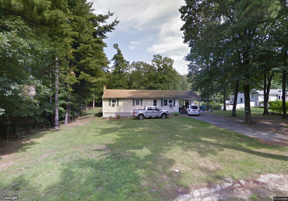
1891 Shirley Rd Lancaster, MA 01523
Estimated Value: $454,000 - $540,000
3
Beds
2
Baths
1,297
Sq Ft
$383/Sq Ft
Est. Value
About This Home
This home is located at 1891 Shirley Rd, Lancaster, MA 01523 and is currently estimated at $496,478, approximately $382 per square foot. 1891 Shirley Rd is a home located in Worcester County with nearby schools including Mary Rowlandson Elementary School, Luther Burbank Middle School, and Nashoba Regional High School.
Ownership History
Date
Name
Owned For
Owner Type
Purchase Details
Closed on
Dec 9, 2016
Sold by
Smith Dennis and Smith June Kathy
Bought by
Munroe Dennis C and Munroe Kristine M
Current Estimated Value
Purchase Details
Closed on
Dec 16, 2008
Sold by
Smith Dennis and Smith Jenna L
Bought by
Smith Dennis and Smith June Kathy
Home Financials for this Owner
Home Financials are based on the most recent Mortgage that was taken out on this home.
Original Mortgage
$225,885
Interest Rate
6.49%
Mortgage Type
FHA
Purchase Details
Closed on
Jun 28, 2002
Sold by
Weber Adam J and Weber Nancy B
Bought by
Smith Dennis and Smith Jenna L
Purchase Details
Closed on
Aug 13, 1992
Sold by
Defranza Michael A and Defranza Arlene
Bought by
Weber Adam J and Weber Nancy
Create a Home Valuation Report for This Property
The Home Valuation Report is an in-depth analysis detailing your home's value as well as a comparison with similar homes in the area
Home Values in the Area
Average Home Value in this Area
Purchase History
| Date | Buyer | Sale Price | Title Company |
|---|---|---|---|
| Munroe Dennis C | -- | -- | |
| Smith Dennis | -- | -- | |
| Smith Dennis | $198,000 | -- | |
| Weber Adam J | $127,000 | -- |
Source: Public Records
Mortgage History
| Date | Status | Borrower | Loan Amount |
|---|---|---|---|
| Previous Owner | Weber Adam J | $236,292 | |
| Previous Owner | Smith Dennis | $225,885 | |
| Previous Owner | Weber Adam J | $100,000 | |
| Previous Owner | Weber Adam J | $80,000 |
Source: Public Records
Tax History
| Year | Tax Paid | Tax Assessment Tax Assessment Total Assessment is a certain percentage of the fair market value that is determined by local assessors to be the total taxable value of land and additions on the property. | Land | Improvement |
|---|---|---|---|---|
| 2025 | $7,240 | $448,000 | $103,300 | $344,700 |
| 2024 | $7,304 | $418,300 | $94,000 | $324,300 |
| 2023 | $6,716 | $390,700 | $85,500 | $305,200 |
| 2022 | $6,070 | $312,100 | $79,600 | $232,500 |
| 2021 | $5,892 | $294,900 | $79,600 | $215,300 |
| 2020 | $6,120 | $308,300 | $79,700 | $228,600 |
| 2019 | $5,615 | $284,300 | $79,700 | $204,600 |
| 2018 | $5,125 | $256,500 | $79,700 | $176,800 |
| 2016 | $4,682 | $239,500 | $78,800 | $160,700 |
| 2015 | $4,463 | $237,900 | $78,800 | $159,100 |
| 2014 | $4,327 | $228,800 | $78,800 | $150,000 |
Source: Public Records
Map
Nearby Homes
- 0 Windsor Rd
- 12 Meditation Ln Unit 12
- 7 Lawson Ave
- 10 Nashua St
- 4 Davis St
- 25 Front St
- 30 Ayer Rd
- 11 Ambrose Way Unit 9
- 43 Ambrose Way Unit 43
- 10 Ambrose Way Unit 10
- 31 Ambrose Way Unit 31
- 34 Ambrose Way Unit 34
- 12 Ambrose Way Unit 12
- 6 Ambrose Way Unit 3
- 2 Ambrose Way Unit 2
- 9 Ambrose Way Unit 9
- 41 Ambrose Way Unit 41
- 1 Ambrose Way Unit 1
- 30 Ambrose Way Unit 30
- 29 Ambrose Way Unit 29
- 1883 Shirley Rd
- 1907 Shirley Rd
- 1871 Shirley Rd
- 14 Chisholm Trail
- 1870 Shirley Rd
- 1857 Shirley Rd
- 29 Chisholm Trail
- 1858 Shirley Rd
- 25 Chisholm Trail
- 255 Grant Way
- 1843 Shirley Rd
- 1922 Shirley Rd
- 1930 Shirley Rd
- Lot 49 Chisholm Trail
- 1842 Shirley Rd
- 49 Chisholm Trail
- 227 Grant Way
- 258 Grant Way
- 1832 Shirley Rd
- 1813 Shirley Rd
Your Personal Tour Guide
Ask me questions while you tour the home.