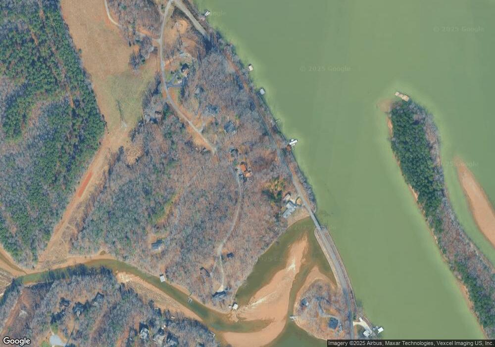
1892 Goat Rd Catawba, NC 28609
Estimated Value: $520,000 - $709,000
2
Beds
2
Baths
1,311
Sq Ft
$486/Sq Ft
Est. Value
About This Home
This home is located at 1892 Goat Rd, Catawba, NC 28609 and is currently estimated at $637,692, approximately $486 per square foot. 1892 Goat Rd is a home located in Catawba County with nearby schools including Catawba Elementary School, Bandys High School, and Mill Creek Middle School.
Ownership History
Date
Name
Owned For
Owner Type
Purchase Details
Closed on
Jun 28, 2012
Sold by
Sperow Daniel T and Sperow Lisa K
Bought by
Lowery Frank
Current Estimated Value
Purchase Details
Closed on
Apr 26, 2007
Sold by
Cannone Victoria Rose and Malinovsky Thomas G
Bought by
Sperow Daniel T and Sperow Lisa K
Home Financials for this Owner
Home Financials are based on the most recent Mortgage that was taken out on this home.
Original Mortgage
$334,800
Interest Rate
6.1%
Mortgage Type
Unknown
Purchase Details
Closed on
Sep 29, 2006
Sold by
Rudisill John C and Rudisill Cynthia T
Bought by
Cannone Victoria Rose and Malinovsky Thomas G
Home Financials for this Owner
Home Financials are based on the most recent Mortgage that was taken out on this home.
Original Mortgage
$280,350
Interest Rate
6.87%
Mortgage Type
Unknown
Purchase Details
Closed on
May 20, 1999
Purchase Details
Closed on
Jul 1, 1998
Create a Home Valuation Report for This Property
The Home Valuation Report is an in-depth analysis detailing your home's value as well as a comparison with similar homes in the area
Home Values in the Area
Average Home Value in this Area
Purchase History
| Date | Buyer | Sale Price | Title Company |
|---|---|---|---|
| Lowery Frank | $190,000 | The Title Company Of Nc | |
| Sperow Daniel T | $355,000 | None Available | |
| Cannone Victoria Rose | $281,000 | None Available | |
| -- | $164,500 | -- | |
| -- | $154,000 | -- |
Source: Public Records
Mortgage History
| Date | Status | Borrower | Loan Amount |
|---|---|---|---|
| Previous Owner | Sperow Daniel T | $334,800 | |
| Previous Owner | Cannone Victoria Rose | $280,350 |
Source: Public Records
Tax History Compared to Growth
Tax History
| Year | Tax Paid | Tax Assessment Tax Assessment Total Assessment is a certain percentage of the fair market value that is determined by local assessors to be the total taxable value of land and additions on the property. | Land | Improvement |
|---|---|---|---|---|
| 2025 | $2,999 | $593,300 | $144,500 | $448,800 |
| 2024 | $2,999 | $593,300 | $144,500 | $448,800 |
| 2023 | $2,999 | $324,700 | $102,000 | $222,700 |
| 2022 | $2,289 | $324,700 | $102,000 | $222,700 |
| 2021 | $2,174 | $308,400 | $102,000 | $206,400 |
| 2020 | $2,174 | $308,400 | $102,000 | $206,400 |
| 2019 | $2,174 | $308,400 | $0 | $0 |
| 2018 | $1,921 | $284,600 | $102,000 | $182,600 |
| 2017 | $1,921 | $0 | $0 | $0 |
| 2016 | $1,921 | $0 | $0 | $0 |
| 2015 | $1,939 | $284,580 | $102,000 | $182,580 |
| 2014 | $1,939 | $323,100 | $102,000 | $221,100 |
Source: Public Records
Map
Nearby Homes
- 7668 Long Bay Pkwy
- 1684 Parkside Dr
- 1676 Parkside Dr
- 105 Southern Horizon Dr
- 227 Windingwood Dr
- Lot 1 Windingwood Dr Unit 1
- 122 Huntcliff Dr
- 155 Windingwood Dr
- 221 Grayrock Dr
- 204 S Harbor Watch Dr
- 193 Windingwood Dr
- Lt 161 Windbluff Ct
- 8207 Long Island Rd
- 243 S Harbor Watch Dr
- 243 S Harbor Watch Dr Unit 22
- 8225 Long Island Rd
- 123 High Shoals Ln Unit 19
- 122 High Lake Dr
- 139 N Harbor Watch Dr
- 00 N Harbor Watch Dr Unit 167
