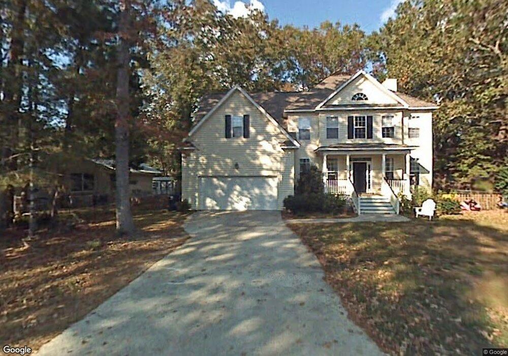
1892 Halo Ln Charleston, SC 29407
Dupont Station NeighborhoodEstimated Value: $613,772 - $702,000
3
Beds
3
Baths
2,677
Sq Ft
$243/Sq Ft
Est. Value
About This Home
This home is located at 1892 Halo Ln, Charleston, SC 29407 and is currently estimated at $651,193, approximately $243 per square foot. 1892 Halo Ln is a home located in Charleston County with nearby schools including Stono Park Elementary School, West Ashley High School, and Carolina Voyager Charter.
Ownership History
Date
Name
Owned For
Owner Type
Purchase Details
Closed on
May 18, 2004
Sold by
Wewil Inc
Bought by
Clark Marybeth Y and Clark Victor L
Current Estimated Value
Purchase Details
Closed on
Oct 10, 2003
Sold by
Sykes Philip A
Bought by
Wewil Inc
Purchase Details
Closed on
Sep 26, 2003
Sold by
Mcdowell Harley H and Mcdowell Clara L
Bought by
Sykes Ii Philip A
Purchase Details
Closed on
Dec 27, 2002
Sold by
Bond Frank Kirby
Bought by
Callahan Pamela F
Create a Home Valuation Report for This Property
The Home Valuation Report is an in-depth analysis detailing your home's value as well as a comparison with similar homes in the area
Home Values in the Area
Average Home Value in this Area
Purchase History
| Date | Buyer | Sale Price | Title Company |
|---|---|---|---|
| Clark Marybeth Y | $220,000 | -- | |
| Wewil Inc | $29,000 | -- | |
| Sykes Ii Philip A | $20,000 | -- | |
| Callahan Pamela F | $80,000 | -- |
Source: Public Records
Tax History Compared to Growth
Tax History
| Year | Tax Paid | Tax Assessment Tax Assessment Total Assessment is a certain percentage of the fair market value that is determined by local assessors to be the total taxable value of land and additions on the property. | Land | Improvement |
|---|---|---|---|---|
| 2024 | $2,094 | $12,090 | $0 | $0 |
| 2023 | $2,094 | $12,090 | $0 | $0 |
| 2022 | $1,985 | $12,090 | $0 | $0 |
| 2021 | $2,052 | $12,090 | $0 | $0 |
| 2020 | $2,075 | $12,090 | $0 | $0 |
| 2019 | $1,792 | $10,510 | $0 | $0 |
| 2017 | $1,699 | $10,510 | $0 | $0 |
| 2016 | $1,631 | $10,510 | $0 | $0 |
| 2015 | $1,653 | $10,510 | $0 | $0 |
| 2014 | $1,545 | $0 | $0 | $0 |
| 2011 | -- | $0 | $0 | $0 |
Source: Public Records
Map
Nearby Homes
- 439 Geddes Ave
- 447 Geddes Ave
- 323 Millcreek Dr
- 511 Mansfield St
- 244 Marsh Oaks Dr
- 2007 Boeing Ave
- 396 Culver Ave
- 507 Stinson Dr Unit 8d
- 507 Stinson Dr Unit 7f
- 507 Stinson Dr Unit 10d
- 413 Hoff Ave
- 1866 Capri Dr
- 486 Cessna Ave
- 301 Culver Ave
- 375 Hoff Ave
- 374 Culver Ave
- 9 Sallys Alley
- 498 Cessna Ave
- 132 River Breeze Dr Unit M132
- 198 River Breeze Dr Unit 75