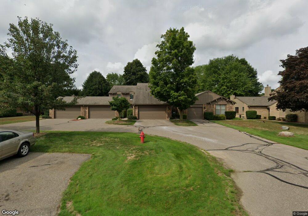
1894 Burning Bush Ct Unit Bldg-Unit Rochester Hills, MI 48309
Estimated Value: $330,000 - $339,000
3
Beds
3
Baths
1,730
Sq Ft
$194/Sq Ft
Est. Value
About This Home
This home is located at 1894 Burning Bush Ct Unit Bldg-Unit, Rochester Hills, MI 48309 and is currently estimated at $335,997, approximately $194 per square foot. 1894 Burning Bush Ct Unit Bldg-Unit is a home located in Oakland County with nearby schools including Deerfield Elementary School, Avondale Middle School, and Avondale High School.
Ownership History
Date
Name
Owned For
Owner Type
Purchase Details
Closed on
Mar 5, 2018
Sold by
Mcdermit Michael C and Mcdermit Revocable T Michael C
Bought by
Coronado Jose Tito and Coronado Julie
Current Estimated Value
Purchase Details
Closed on
Nov 1, 2005
Sold by
Mcdermit Nancy A
Bought by
Mcdermit Michael C
Purchase Details
Closed on
Jun 27, 2003
Sold by
Mcdermit Michael C and Mcdermit Nancy A
Bought by
Mcdermit Michael C and The Michael C Mcdermit Revocable Living
Purchase Details
Closed on
Dec 16, 1999
Sold by
Davis Juliana F
Bought by
Mcdermit Michael C
Home Financials for this Owner
Home Financials are based on the most recent Mortgage that was taken out on this home.
Original Mortgage
$105,000
Interest Rate
7.76%
Create a Home Valuation Report for This Property
The Home Valuation Report is an in-depth analysis detailing your home's value as well as a comparison with similar homes in the area
Home Values in the Area
Average Home Value in this Area
Purchase History
| Date | Buyer | Sale Price | Title Company |
|---|---|---|---|
| Coronado Jose Tito | $212,500 | Title One Inc | |
| Mcdermit Michael C | -- | None Available | |
| Mcdermit Michael C | -- | -- | |
| Mcdermit Michael C | $175,000 | -- |
Source: Public Records
Mortgage History
| Date | Status | Borrower | Loan Amount |
|---|---|---|---|
| Previous Owner | Mcdermit Michael C | $105,000 |
Source: Public Records
Tax History Compared to Growth
Tax History
| Year | Tax Paid | Tax Assessment Tax Assessment Total Assessment is a certain percentage of the fair market value that is determined by local assessors to be the total taxable value of land and additions on the property. | Land | Improvement |
|---|---|---|---|---|
| 2022 | $2,181 | $110,020 | $0 | $0 |
| 2018 | $2,102 | $92,770 | $0 | $0 |
| 2017 | $2,062 | $89,520 | $0 | $0 |
| 2015 | -- | $72,530 | $0 | $0 |
| 2014 | -- | $63,980 | $0 | $0 |
| 2011 | -- | $61,710 | $0 | $0 |
Source: Public Records
Map
Nearby Homes
- 1931 Allenway Ct
- 1594 Streamwood Ct Unit 2
- 1570 Streamwood Ct Unit B8
- 1638 River View Dr
- 2137 Crystal Dr Unit S2
- 2191 Rochelle Park Dr Unit 63
- 2201 Siboney Ct
- 2009 Logan Dr
- 2283 Crystal Dr Unit Z38
- 1751 Trafalgar Square
- 1770 Christian Hills Dr
- 2142 Kennedy Dr
- 2196 Willow Leaf Dr
- 2289 Rochelle Park Dr Unit AA123
- 2028 Breckenridge Ct Unit 10
- 2032 Breckenridge Ct Unit 9
- 2020 Breckenridge Ct Unit 11
- 2043 Breckenridge Ct
- 2044 Breckenridge Ct
- 1612 Bretton Dr N
- 1894 Burning Bush Ct
- 1890 Burning Bush Ct Unit 151
- 1898 Burning Bush Ct Unit 153
- 1902 Burning Bush Ct Unit 154
- 1882 Burning Bush Ct
- 1910 Burning Bush Ct
- 1878 Burning Bush Ct
- 1870 Burning Bush Ct
- 1870 Burning Bush Ct Unit Bldg #61
- 1874 Burning Bush Ct
- 1914 Burning Bush Ct Unit 156
- 1914 Burning Bush Ct Unit 63 156
- 1891 Allenway Ct Unit 24, 96
- 1891 Allenway Ct
- 1883 Allenway Ct
- 1891 Allenway Ct Unit 96
- 1875 Allenway Ct
- 1875 Allenway Ct Unit 23 93
- 1875 Allenway Ct Unit 93
- 1899 Burning Bush Ct Unit 66, 168