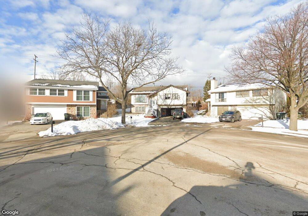
1895 Brookside Ln Unit 4 Hoffman Estates, IL 60169
South Hoffman Estates NeighborhoodEstimated Value: $344,000 - $408,000
3
Beds
2
Baths
1,376
Sq Ft
$276/Sq Ft
Est. Value
About This Home
This home is located at 1895 Brookside Ln Unit 4, Hoffman Estates, IL 60169 and is currently estimated at $379,326, approximately $275 per square foot. 1895 Brookside Ln Unit 4 is a home located in Cook County with nearby schools including Neil Armstrong Elementary School, Dwight D Eisenhower Junior High School, and Hoffman Estates High School.
Ownership History
Date
Name
Owned For
Owner Type
Purchase Details
Closed on
Aug 23, 2011
Sold by
Federal Home Loan Mortgage Corporation
Bought by
Kerio Chadi and Mateh Jilan
Current Estimated Value
Home Financials for this Owner
Home Financials are based on the most recent Mortgage that was taken out on this home.
Original Mortgage
$150,972
Outstanding Balance
$103,063
Interest Rate
4.5%
Mortgage Type
FHA
Estimated Equity
$276,263
Purchase Details
Closed on
Sep 28, 2010
Sold by
Roman Oscar
Bought by
Federal Home Loan Mortgage Corp
Purchase Details
Closed on
Jan 30, 2006
Sold by
Sternberg David J and Sternberg Kathleen Mary
Bought by
Roman Oscar and Roman Denise
Home Financials for this Owner
Home Financials are based on the most recent Mortgage that was taken out on this home.
Original Mortgage
$282,000
Interest Rate
6.3%
Mortgage Type
Fannie Mae Freddie Mac
Create a Home Valuation Report for This Property
The Home Valuation Report is an in-depth analysis detailing your home's value as well as a comparison with similar homes in the area
Home Values in the Area
Average Home Value in this Area
Purchase History
| Date | Buyer | Sale Price | Title Company |
|---|---|---|---|
| Kerio Chadi | $155,000 | None Available | |
| Federal Home Loan Mortgage Corp | -- | None Available | |
| Roman Oscar | $305,000 | Multiple |
Source: Public Records
Mortgage History
| Date | Status | Borrower | Loan Amount |
|---|---|---|---|
| Open | Kerio Chadi | $150,972 | |
| Previous Owner | Roman Oscar | $282,000 |
Source: Public Records
Tax History
| Year | Tax Paid | Tax Assessment Tax Assessment Total Assessment is a certain percentage of the fair market value that is determined by local assessors to be the total taxable value of land and additions on the property. | Land | Improvement |
|---|---|---|---|---|
| 2025 | $7,575 | $33,000 | $8,097 | $24,903 |
| 2024 | $7,575 | $28,000 | $7,361 | $20,639 |
| 2023 | $7,300 | $28,000 | $7,361 | $20,639 |
| 2022 | $7,300 | $28,000 | $7,361 | $20,639 |
| 2021 | $6,407 | $22,452 | $11,593 | $10,859 |
| 2020 | $6,331 | $22,452 | $11,593 | $10,859 |
| 2019 | $6,300 | $24,947 | $11,593 | $13,354 |
| 2018 | $7,165 | $25,408 | $10,121 | $15,287 |
| 2017 | $7,056 | $25,408 | $10,121 | $15,287 |
| 2016 | $6,826 | $25,408 | $10,121 | $15,287 |
| 2015 | $6,511 | $22,895 | $8,833 | $14,062 |
| 2014 | $6,413 | $22,895 | $8,833 | $14,062 |
| 2013 | $6,231 | $22,895 | $8,833 | $14,062 |
Source: Public Records
Map
Nearby Homes
- 1880 Bonnie Ln Unit 116
- 1880 Bonnie Ln Unit 112
- 1475 Rebecca Dr Unit 213
- 1500 Robin Cir Unit 314
- 1776 Bristol Walk Unit 1776
- 1797 Queensbury Cir Unit 5764
- 1769 Sessions Walk Unit C
- 1722 Fayette Walk Unit E
- 1840 Huntington Blvd Unit BW511
- 1840 Huntington Blvd Unit 203
- 1792 Williamsburg Dr
- 1800 Monterey Ct
- 1836 Stockton Dr Unit 3312
- 2080 Sutherland Place Unit 1
- 2222 Seaver Ln
- 1450 Meyer Rd
- 1936 Whitingham Ln Unit 1
- 2021 Kensington Ln Unit 3004
- 2027 Kensington Ln Unit 3001
- 2025 Kensington Ln Unit 3002
- 1596 Brookside Dr
- 1897 Brookside Ln Unit 4
- 1899 Brookside Ln Unit 4
- 1594 Brookside Dr
- 1901 Brookside Ln
- 1592 Brookside Dr
- 1900 Brookside Ln
- 1903 Brookside Ln
- 1590 Brookside Dr
- 1593 Brookside Dr
- 1902 Brookside Ln
- 1880 Bonnie Ln Unit 403
- 1880 Bonnie Ln Unit 218
- 1880 Bonnie Ln Unit 211
- 1880 Bonnie Ln Unit 123
- 1880 Bonnie Ln Unit 414
- 1880 Bonnie Ln Unit 405
- 1880 Bonnie Ln Unit 305
- 1880 Bonnie Ln Unit 213
- 1880 Bonnie Ln Unit 210
Your Personal Tour Guide
Ask me questions while you tour the home.