Estimated Value: $172,000 - $254,000
3
Beds
2
Baths
1,768
Sq Ft
$114/Sq Ft
Est. Value
About This Home
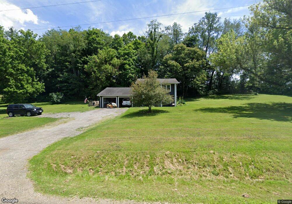
This home is located at 1895 Smart Rd, Lucas, OH 44843 and is currently estimated at $201,833, approximately $114 per square foot. 1895 Smart Rd is a home located in Richland County with nearby schools including Lucas Elementary School, Lucas Heritage Middle School, and Lucas High School.
Ownership History
Date
Name
Owned For
Owner Type
Purchase Details
Closed on
Jun 15, 2005
Sold by
Green Philip M and Green Sherry E
Bought by
Foss Ronald K and Foss Jennifer L
Current Estimated Value
Home Financials for this Owner
Home Financials are based on the most recent Mortgage that was taken out on this home.
Original Mortgage
$111,000
Interest Rate
7.8%
Mortgage Type
Fannie Mae Freddie Mac
Create a Home Valuation Report for This Property
The Home Valuation Report is an in-depth analysis detailing your home's value as well as a comparison with similar homes in the area
Purchase History
| Date | Buyer | Sale Price | Title Company |
|---|---|---|---|
| Foss Ronald K | $111,000 | Chicago Title |
Source: Public Records
Mortgage History
| Date | Status | Borrower | Loan Amount |
|---|---|---|---|
| Closed | Foss Ronald K | $111,000 |
Source: Public Records
Tax History
| Year | Tax Paid | Tax Assessment Tax Assessment Total Assessment is a certain percentage of the fair market value that is determined by local assessors to be the total taxable value of land and additions on the property. | Land | Improvement |
|---|---|---|---|---|
| 2025 | $1,700 | $41,650 | $4,900 | $36,750 |
| 2024 | $1,700 | $41,650 | $4,900 | $36,750 |
| 2023 | $1,746 | $41,650 | $4,900 | $36,750 |
| 2022 | $1,529 | $32,580 | $4,380 | $28,200 |
| 2021 | $1,532 | $32,580 | $4,380 | $28,200 |
| 2020 | $1,557 | $32,580 | $4,380 | $28,200 |
| 2019 | $1,403 | $27,600 | $3,710 | $23,890 |
| 2018 | $1,444 | $27,600 | $3,710 | $23,890 |
| 2017 | $1,454 | $27,600 | $3,710 | $23,890 |
| 2016 | $1,488 | $28,580 | $3,340 | $25,240 |
| 2015 | $1,488 | $28,580 | $3,340 | $25,240 |
| 2014 | $1,496 | $28,580 | $3,340 | $25,240 |
| 2012 | $736 | $28,580 | $3,340 | $25,240 |
Source: Public Records
Map
Nearby Homes
- 2778 Lucas Perrysville Rd
- 28 N Union St
- 1 E Main St
- St Rt 603
- 2130 State Route 39
- 0 Mount Zion Rd Unit 226009674
- 0 Mount Zion Rd Unit 9072801
- 2804 Rd
- 4281 Lucas Perrysville Rd
- St Rt 603
- 0 State Route 39 & I-71 Northeast Quadrant
- 2011 Ohio 39
- 0 State Route 39 & I-71 Southeast Quadrant
- 1715 Mansfield Lucas Rd
- 3405 Hastings Newville Rd
- 0 McBride Road Parcel # 1 Unit 9066028
- 744 E Hanley Rd
- 3386 Trumpower Rd
- 474 Biscayne Dr
- 0 Mcelroy Rd
- 1863 Smart Rd
- 1843 Smart Rd
- 1995 State Route 39
- 2881 State Route 39
- 2897 State Route 39
- 2897 State Route 39
- 2759 State Route 39
- 2785 State Route 39
- 2707 State Route 39
- 2735 State Route 39 Unit 2737
- 2904 State Route 39
- 2703 State Route 39
- 2967 State Route 39
- 3271 State Route 39
- 1588 State Route 39
- 1016 State Route 39
- 2036 Smart Rd
- 2736 State Route 39
- 2710 State Route 39
- 3035 State Route 39
Your Personal Tour Guide
Ask me questions while you tour the home.