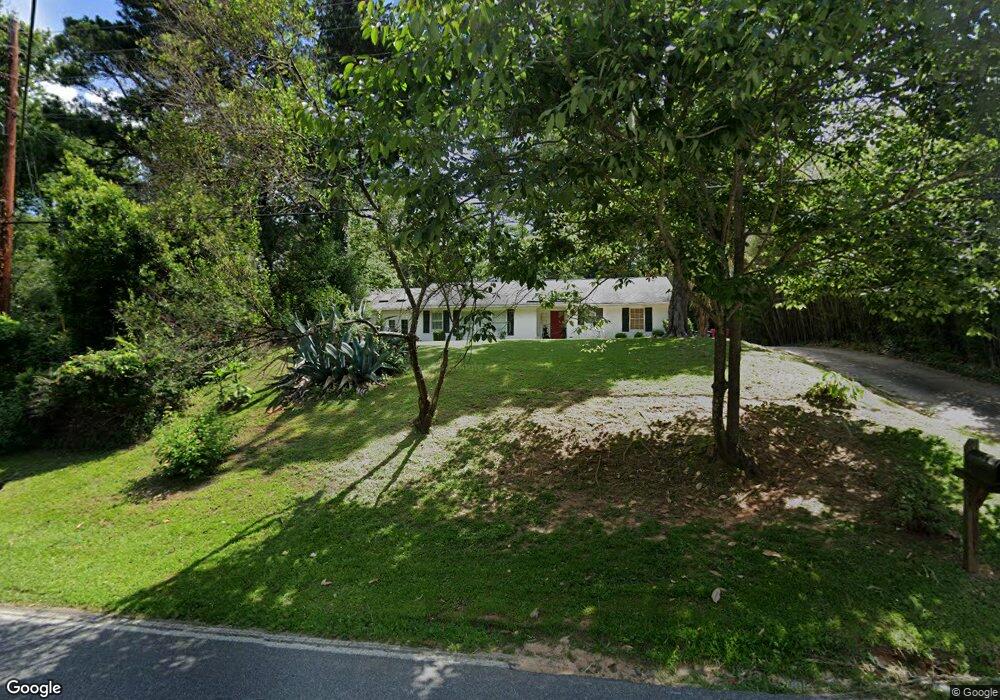
1895 Upper River Rd Macon, GA 31211
Shirley Hills Historic District NeighborhoodEstimated Value: $151,061 - $194,000
2
Beds
2
Baths
1,863
Sq Ft
$88/Sq Ft
Est. Value
About This Home
This home is located at 1895 Upper River Rd, Macon, GA 31211 and is currently estimated at $164,265, approximately $88 per square foot. 1895 Upper River Rd is a home located in Bibb County with nearby schools including Martin Luther King Jr. Elementary School, Appling Middle School, and Northeast High School.
Ownership History
Date
Name
Owned For
Owner Type
Purchase Details
Closed on
May 12, 2016
Sold by
Dominick Edward Hoyt
Bought by
Blueberry Properties Llc
Current Estimated Value
Purchase Details
Closed on
Aug 26, 2011
Sold by
Fannie Mae
Bought by
Dominick Edward Hoyt
Purchase Details
Closed on
Mar 1, 2011
Sold by
Suntrust Mortgage Inc
Bought by
Federal National Mortgage Association
Purchase Details
Closed on
Feb 22, 2002
Bought by
Blakley Tony R
Create a Home Valuation Report for This Property
The Home Valuation Report is an in-depth analysis detailing your home's value as well as a comparison with similar homes in the area
Home Values in the Area
Average Home Value in this Area
Purchase History
| Date | Buyer | Sale Price | Title Company |
|---|---|---|---|
| Blueberry Properties Llc | -- | -- | |
| Dominick Edward Hoyt | $26,000 | None Available | |
| Federal National Mortgage Association | $86,600 | -- | |
| Federal National Mortgage Association | $86,606 | None Available | |
| Suntrust Mortgage Inc | $86,606 | None Available | |
| Blakley Tony R | $68,000 | -- |
Source: Public Records
Tax History
| Year | Tax Paid | Tax Assessment Tax Assessment Total Assessment is a certain percentage of the fair market value that is determined by local assessors to be the total taxable value of land and additions on the property. | Land | Improvement |
|---|---|---|---|---|
| 2025 | $1,158 | $47,110 | $4,140 | $42,970 |
| 2024 | $1,196 | $47,110 | $4,140 | $42,970 |
| 2023 | $1,196 | $47,110 | $4,140 | $42,970 |
| 2022 | $1,574 | $45,462 | $8,970 | $36,492 |
| 2021 | $1,452 | $38,210 | $7,800 | $30,410 |
| 2020 | $1,202 | $30,958 | $6,630 | $24,328 |
| 2019 | $1,212 | $30,958 | $6,630 | $24,328 |
| 2018 | $2,036 | $30,958 | $6,630 | $24,328 |
| 2017 | $1,160 | $30,958 | $6,630 | $24,328 |
| 2016 | $1,071 | $30,958 | $6,630 | $24,328 |
| 2015 | $1,516 | $30,958 | $6,630 | $24,328 |
| 2014 | $581 | $30,958 | $6,630 | $24,328 |
Source: Public Records
Map
Nearby Homes
- 1916 Flintwood Dr
- 1825 Flintwood Dr
- 1949 Deerwood Place
- 1868 Waverland Dr
- 1485 Lone Oak Dr
- 1746 Hamilton Dr
- 1735 Foster Place
- 1715 Foster Place
- 1728 Waverland Cir
- 1825 Waverland Cir
- 1972 Wood Valley Rd
- 1954 Wood Valley Rd
- 1978 Wood Valley Rd
- 1898 Wood Valley Rd
- 1987 Long Ridge Dr
- 1976 Long Ridge Dr
- 1971 Long Ridge Dr
- 1435 Twin Pines Dr
- 1464 Twin Pines Dr
- 1158 Jackson Springs Rd
- 1903 Upper River Rd
- 1887 Upper River Rd
- 1911 Upper River Rd
- 1881 Upper River Rd
- 1892 Twin Pines Dr
- 1881 Twin Pines Dr
- 1909 Woodland Dr
- 1934 Flintwood Dr
- 1884 Twin Pines Dr
- 1926 Flintwood Dr
- 1888 Upper River Rd
- 1870 Twin Pines Dr
- 1830 Redwood Dr
- 1930 Woodland Dr
- 1865 Twin Pines Dr
- 1880 Upper River Rd
- 1858 Twin Pines Dr
- 1904 Flintwood Dr
- 1874 Upper River Rd
- 1944 Woodland Dr
Your Personal Tour Guide
Ask me questions while you tour the home.