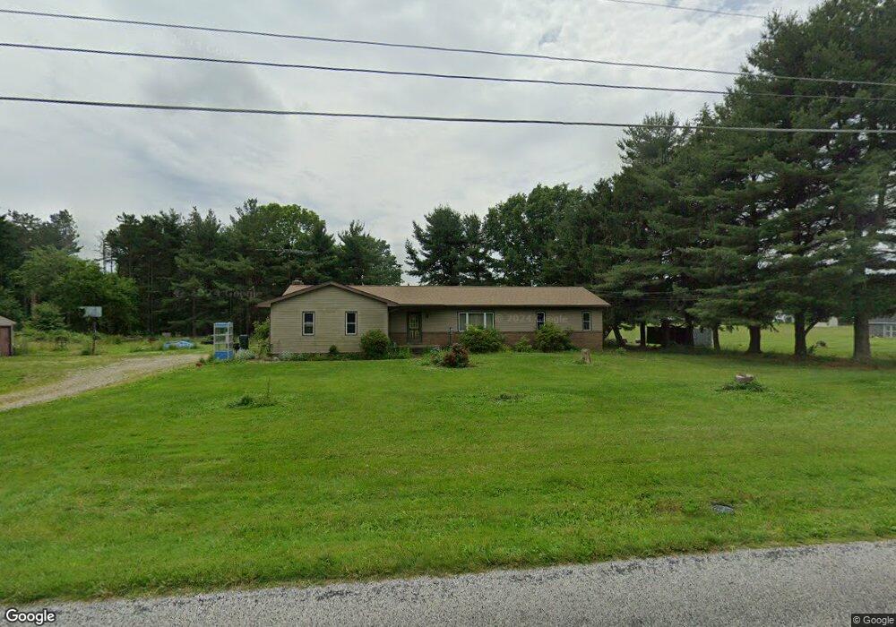
18957 Edwards Rd Doylestown, OH 44230
Estimated Value: $179,000 - $304,000
2
Beds
2
Baths
1,548
Sq Ft
$162/Sq Ft
Est. Value
About This Home
This home is located at 18957 Edwards Rd, Doylestown, OH 44230 and is currently estimated at $251,346, approximately $162 per square foot. 18957 Edwards Rd is a home located in Wayne County with nearby schools including Hazel Harvey Elementary School, Chippewa Intermediate School, and Chippewa Jr./Sr. High School.
Ownership History
Date
Name
Owned For
Owner Type
Purchase Details
Closed on
Jan 30, 2017
Sold by
D A W W Properties Llc
Bought by
Lane Coreene
Current Estimated Value
Home Financials for this Owner
Home Financials are based on the most recent Mortgage that was taken out on this home.
Original Mortgage
$103,000
Outstanding Balance
$69,252
Interest Rate
4.3%
Mortgage Type
Unknown
Estimated Equity
$182,094
Purchase Details
Closed on
Aug 31, 2016
Sold by
Spence Douglas Duane
Bought by
Daww Properties Llc
Home Financials for this Owner
Home Financials are based on the most recent Mortgage that was taken out on this home.
Interest Rate
3.43%
Purchase Details
Closed on
Jun 18, 2015
Sold by
Estate Of William R Spencer
Bought by
Spencer Kathleen and Spence Kathleen L
Purchase Details
Closed on
May 9, 2007
Sold by
Estate Of William R Spence
Bought by
Spence Kathleen L
Create a Home Valuation Report for This Property
The Home Valuation Report is an in-depth analysis detailing your home's value as well as a comparison with similar homes in the area
Home Values in the Area
Average Home Value in this Area
Purchase History
| Date | Buyer | Sale Price | Title Company |
|---|---|---|---|
| Lane Coreene | $120,000 | First Security Title | |
| Daww Properties Llc | $120,000 | -- | |
| Spencer Kathleen | -- | Attorney | |
| Spence Kathleen L | -- | Attorney |
Source: Public Records
Mortgage History
| Date | Status | Borrower | Loan Amount |
|---|---|---|---|
| Open | Lane Coreene | $103,000 | |
| Previous Owner | Daww Properties Llc | -- |
Source: Public Records
Tax History
| Year | Tax Paid | Tax Assessment Tax Assessment Total Assessment is a certain percentage of the fair market value that is determined by local assessors to be the total taxable value of land and additions on the property. | Land | Improvement |
|---|---|---|---|---|
| 2024 | $2,252 | $63,920 | $24,970 | $38,950 |
| 2023 | $1,901 | $63,920 | $24,970 | $38,950 |
| 2022 | $1,506 | $48,420 | $18,910 | $29,510 |
| 2021 | $1,509 | $48,420 | $18,910 | $29,510 |
| 2020 | $1,521 | $48,420 | $18,910 | $29,510 |
| 2019 | $1,751 | $52,930 | $17,430 | $35,500 |
| 2018 | $1,768 | $52,930 | $17,430 | $35,500 |
| 2017 | $2,102 | $52,000 | $17,430 | $34,570 |
| 2016 | $2,010 | $50,000 | $16,760 | $33,240 |
| 2015 | $1,664 | $50,000 | $16,760 | $33,240 |
| 2014 | $1,462 | $50,000 | $16,760 | $33,240 |
| 2013 | $1,638 | $53,630 | $17,160 | $36,470 |
Source: Public Records
Map
Nearby Homes
- 18592 Edwards Rd Unit 169
- 18592 Edwards Rd Unit 100
- 18592 Edwards Rd Unit 137
- 18592 Edwards Rd Unit 243
- 18592 Edwards Rd Unit 3
- 18592 Edwards Rd
- 12214 Vince Dr
- 18085 Grill Rd
- 14740 Oak Grove Dr Unit 41
- 3388 Symphony Ln
- V/L 1 Grill Rd
- 18331 William Dr
- 3179 Vanderhoof Rd
- 5813 S Cleveland Massillon Rd
- 100 Merlot Ct
- 15240 Hametown Rd
- 325 Catawba Path
- 580 Thorn Way
- 680 Thorn Way
- 620 Thorn Way
- 13132 Mike Dr
- 13266 Morgan Dr
- 13092 Mike Dr
- 13177 Kevin Dr
- 19014 Edwards Rd
- 13133 Kevin Dr
- 13308 Morgan Dr
- 19055 Edwards Rd
- 13052 Mike Dr
- 13091 Kevin Dr
- 13103 Mike Dr
- 13352 Morgan Dr
- 13178 Kevin Dr
- 19086 Edwards Rd
- 13051 Kevin Dr
- 13055 Mike Dr
- 19109 Edwards Rd
- 13351 Morgan Dr
- 13090 Kevin Dr
- 13134 Kevin Dr
Your Personal Tour Guide
Ask me questions while you tour the home.