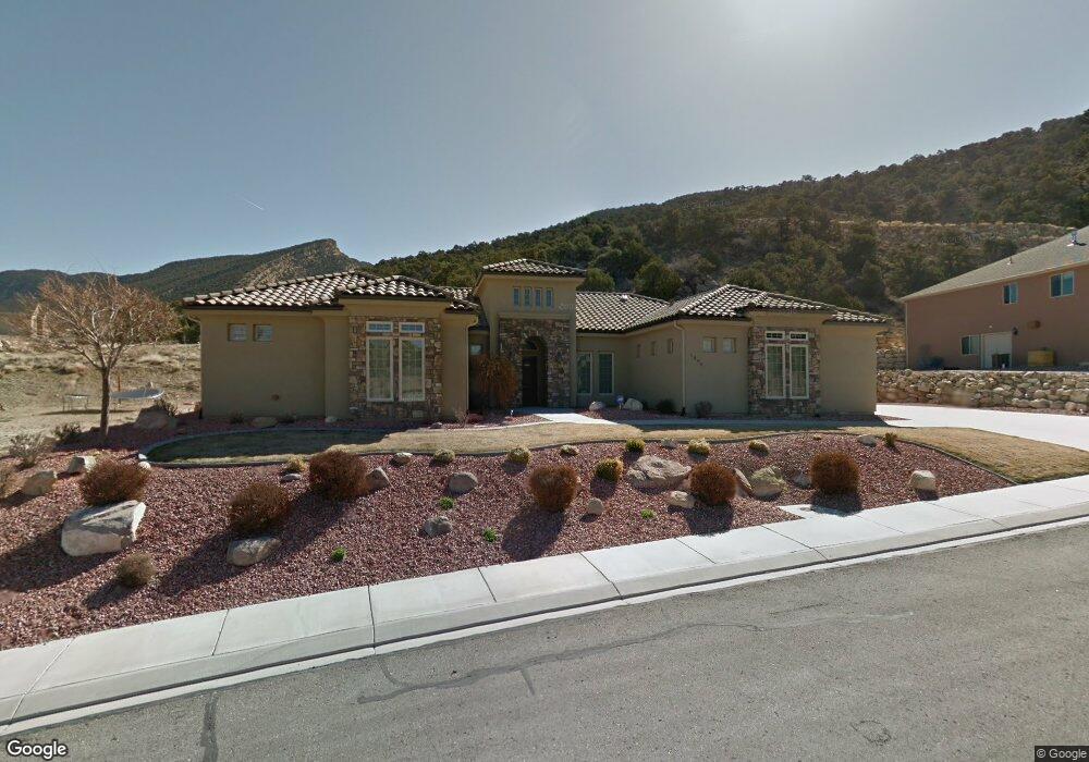
1896 N Matchstick Way Cedar City, UT 84721
Estimated Value: $553,000 - $668,000
--
Bed
--
Bath
3,036
Sq Ft
$205/Sq Ft
Est. Value
About This Home
This home is located at 1896 N Matchstick Way, Cedar City, UT 84721 and is currently estimated at $621,763, approximately $204 per square foot. 1896 N Matchstick Way is a home located in Iron County with nearby schools including Fiddlers Canyon School, Cedar Middle School, and Cedar City High School.
Ownership History
Date
Name
Owned For
Owner Type
Purchase Details
Closed on
Jun 26, 2018
Sold by
R W Anderson Construction L C
Bought by
Dreamworks Developments L L C
Current Estimated Value
Purchase Details
Closed on
Jul 25, 2006
Sold by
Dreamworks Development Llc
Bought by
Badger Christopher C and Badger Shandra L
Home Financials for this Owner
Home Financials are based on the most recent Mortgage that was taken out on this home.
Original Mortgage
$85,000
Interest Rate
6.57%
Mortgage Type
Purchase Money Mortgage
Create a Home Valuation Report for This Property
The Home Valuation Report is an in-depth analysis detailing your home's value as well as a comparison with similar homes in the area
Home Values in the Area
Average Home Value in this Area
Purchase History
| Date | Buyer | Sale Price | Title Company |
|---|---|---|---|
| Dreamworks Developments L L C | -- | Eagle Gate Title Insurance A | |
| Badger Christopher C | -- | -- |
Source: Public Records
Mortgage History
| Date | Status | Borrower | Loan Amount |
|---|---|---|---|
| Previous Owner | Badger Christopher C | $85,000 |
Source: Public Records
Tax History Compared to Growth
Tax History
| Year | Tax Paid | Tax Assessment Tax Assessment Total Assessment is a certain percentage of the fair market value that is determined by local assessors to be the total taxable value of land and additions on the property. | Land | Improvement |
|---|---|---|---|---|
| 2025 | $3,093 | $397,685 | $45,854 | $351,831 |
| 2023 | $3,071 | $381,195 | $52,105 | $329,090 |
| 2022 | $2,696 | $293,225 | $40,080 | $253,145 |
| 2021 | $2,373 | $258,110 | $27,955 | $230,155 |
| 2020 | $2,403 | $231,810 | $23,025 | $208,785 |
| 2019 | $2,372 | $218,875 | $23,025 | $195,850 |
| 2018 | $2,332 | $208,165 | $21,650 | $186,515 |
| 2017 | $2,270 | $199,485 | $18,045 | $181,440 |
| 2016 | $2,310 | $189,000 | $24,055 | $164,945 |
| 2015 | $2,137 | $165,785 | $0 | $0 |
| 2014 | $2,041 | $148,125 | $0 | $0 |
Source: Public Records
Map
Nearby Homes
- 1927 N Mahogany Cir
- 1073 E Mill Hollow Way
- 1073 E Mill Hollow Way Unit 5
- 1931 N Mahogany Cir
- 1054 E Ashdown Forest Rd
- 1824 N Splinter Wood Ln
- 1152 Smokey Trail Way
- 1093 E Smokey Trail Way
- 1918 N Pinyon Grove Cir
- 1940 N Pinyon Grove Cir
- 1937 N Pinyon Grove Cir
- 1896 N Pinyon Grove Cir
- 1952 N Pinyon Grove Cir S
- 1906 N Pinyon Grove Cir
- 1927 N Pinyon Grove Cir
- 1930 N Pinyon Grove Cir E
- 2154 N Sumack Cir
- 1945 N Pinyon Grove Cir
- 2254 Amberwood Ln
- 1884 N Pinyon Grove Cir E
- 1858 N Matchstick Way Unit 44
- 1858 N Matchstick Way
- 1880 N Matchstick Way
- 1912 N Matchstick Way
- 1918 N Mahogany Cir
- 1918 N Mahogany Cir Unit 6
- 1918 N Mahogany Cir Unit 2
- 1088 E Mill Hollow Way
- 1927 N Mahogany Cir Unit 6
- 1091 E Mill Hollow Way
- 1848 N Matchstick Way
- 1866 N Matchstick Way
- 1866 N Matchstick Way Unit LOT 23
- 1095 E Matchstick Way Unit 5
- 1095 E Matchstick Way
- 1095 E Matchstick Way Unit 19
- 1102 E Ashdown Forest Rd
- 1945 N 1125 Unit 39
- 1074 E Mill Hollow Way
- 1074 E Mill Hollow Way Unit 5