Estimated Value: $180,000 - $198,000
3
Beds
1
Bath
999
Sq Ft
$190/Sq Ft
Est. Value
About This Home
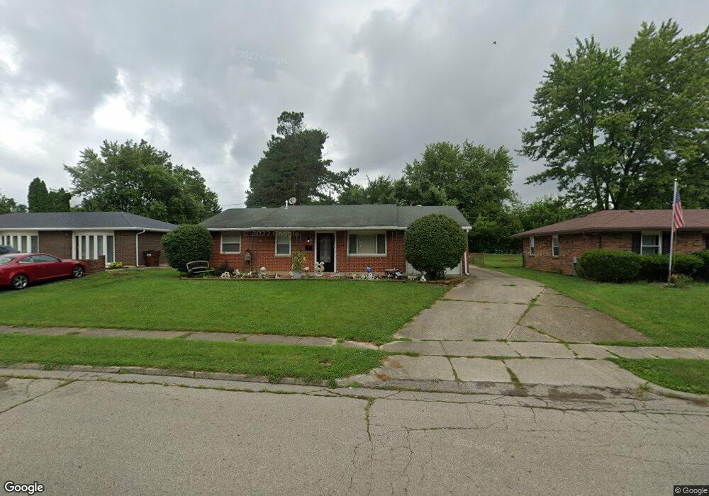
This home is located at 1896 Pueblo Dr, Xenia, OH 45385 and is currently estimated at $189,429, approximately $189 per square foot. 1896 Pueblo Dr is a home located in Greene County with nearby schools including Xenia High School, Summit Academy Community School for Alternative Learners - Xenia, and Legacy Christian Academy.
Ownership History
Date
Name
Owned For
Owner Type
Purchase Details
Closed on
Mar 4, 2022
Sold by
Farrell Fred H
Bought by
Hacker Tracey D and Farrell Tracey D
Current Estimated Value
Purchase Details
Closed on
Jun 29, 2004
Sold by
Hud
Bought by
Hacker Tracey D
Home Financials for this Owner
Home Financials are based on the most recent Mortgage that was taken out on this home.
Original Mortgage
$78,797
Interest Rate
6.37%
Mortgage Type
FHA
Purchase Details
Closed on
Mar 2, 2004
Sold by
Hahn Robert G and Hahn Charlene J
Bought by
Hud
Purchase Details
Closed on
Sep 30, 1998
Sold by
Johnson David T and Bledsoe Michelle D
Bought by
Hahn Robert G and Hahn Charlene J
Home Financials for this Owner
Home Financials are based on the most recent Mortgage that was taken out on this home.
Original Mortgage
$79,959
Interest Rate
6.98%
Mortgage Type
FHA
Create a Home Valuation Report for This Property
The Home Valuation Report is an in-depth analysis detailing your home's value as well as a comparison with similar homes in the area
Home Values in the Area
Average Home Value in this Area
Purchase History
| Date | Buyer | Sale Price | Title Company |
|---|---|---|---|
| Hacker Tracey D | -- | None Listed On Document | |
| Hacker Tracey D | $79,900 | Lakeside Title & Escrow Agen | |
| Hud | $83,000 | -- | |
| Hahn Robert G | $80,000 | -- |
Source: Public Records
Mortgage History
| Date | Status | Borrower | Loan Amount |
|---|---|---|---|
| Previous Owner | Hacker Tracey D | $78,797 | |
| Previous Owner | Hahn Robert G | $79,959 |
Source: Public Records
Tax History Compared to Growth
Tax History
| Year | Tax Paid | Tax Assessment Tax Assessment Total Assessment is a certain percentage of the fair market value that is determined by local assessors to be the total taxable value of land and additions on the property. | Land | Improvement |
|---|---|---|---|---|
| 2024 | $1,987 | $46,430 | $11,140 | $35,290 |
| 2023 | $1,987 | $46,430 | $11,140 | $35,290 |
| 2022 | $1,623 | $33,190 | $6,550 | $26,640 |
| 2021 | $1,645 | $33,190 | $6,550 | $26,640 |
| 2020 | $1,574 | $33,190 | $6,550 | $26,640 |
| 2019 | $1,374 | $27,260 | $6,370 | $20,890 |
| 2018 | $1,379 | $27,260 | $6,370 | $20,890 |
| 2017 | $1,272 | $27,260 | $6,370 | $20,890 |
| 2016 | $1,272 | $24,690 | $6,370 | $18,320 |
| 2015 | $1,276 | $24,690 | $6,370 | $18,320 |
| 2014 | $1,220 | $24,690 | $6,370 | $18,320 |
Source: Public Records
Map
Nearby Homes
- 1618 Navajo Dr
- 1778 Arapaho Dr
- 1653 Seneca Dr
- 1403 Texas Dr
- 1769 Gayhart Dr
- 1568 Cheyenne Dr
- 1829 Gayhart Dr
- 1272 Bellbrook Ave
- 1144 Rockwell Dr
- 1208 Bellbrook Ave
- 1866 Roxbury Dr
- 1908 Whitt St
- 2758 Wyoming Dr
- 161 Montana Dr
- 1255 Colorado Dr
- 2142 Michigan Dr
- 1107 Arkansas Dr
- 219 Kansas Dr
- 414 Whisper Ln
- 2257 Maryland Dr