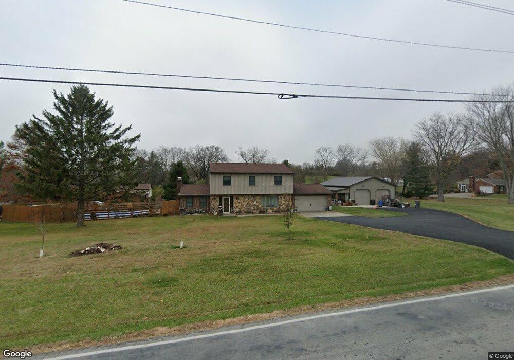
1897 Black Rd Hamilton, OH 45013
Ross Township NeighborhoodEstimated Value: $365,834 - $418,000
3
Beds
3
Baths
2,014
Sq Ft
$188/Sq Ft
Est. Value
About This Home
This home is located at 1897 Black Rd, Hamilton, OH 45013 and is currently estimated at $379,209, approximately $188 per square foot. 1897 Black Rd is a home located in Butler County with nearby schools including Ross Intermediate School, Ross Middle School, and Elda Elementary School.
Ownership History
Date
Name
Owned For
Owner Type
Purchase Details
Closed on
Nov 20, 2008
Sold by
Buck William F and Buck Deborah L
Bought by
Buck William F
Current Estimated Value
Home Financials for this Owner
Home Financials are based on the most recent Mortgage that was taken out on this home.
Original Mortgage
$126,300
Outstanding Balance
$80,242
Interest Rate
5.44%
Mortgage Type
New Conventional
Estimated Equity
$298,967
Purchase Details
Closed on
May 22, 1998
Sold by
Lacey Norman E
Bought by
Buck William F and Buck Deborah L
Home Financials for this Owner
Home Financials are based on the most recent Mortgage that was taken out on this home.
Original Mortgage
$129,200
Interest Rate
7.27%
Create a Home Valuation Report for This Property
The Home Valuation Report is an in-depth analysis detailing your home's value as well as a comparison with similar homes in the area
Home Values in the Area
Average Home Value in this Area
Purchase History
| Date | Buyer | Sale Price | Title Company |
|---|---|---|---|
| Buck William F | -- | Attorney | |
| Buck William F | $162,500 | Vintage Title Agency Inc |
Source: Public Records
Mortgage History
| Date | Status | Borrower | Loan Amount |
|---|---|---|---|
| Open | Buck William F | $126,300 | |
| Closed | Buck William F | $129,200 |
Source: Public Records
Tax History Compared to Growth
Tax History
| Year | Tax Paid | Tax Assessment Tax Assessment Total Assessment is a certain percentage of the fair market value that is determined by local assessors to be the total taxable value of land and additions on the property. | Land | Improvement |
|---|---|---|---|---|
| 2024 | $3,283 | $84,350 | $15,480 | $68,870 |
| 2023 | $3,268 | $84,350 | $15,480 | $68,870 |
| 2022 | $2,590 | $60,790 | $15,480 | $45,310 |
| 2021 | $2,477 | $60,790 | $15,480 | $45,310 |
| 2020 | $2,211 | $60,790 | $15,480 | $45,310 |
| 2019 | $2,017 | $55,490 | $15,480 | $40,010 |
| 2018 | $2,018 | $55,490 | $15,480 | $40,010 |
| 2017 | $1,958 | $55,490 | $15,480 | $40,010 |
| 2016 | $1,790 | $49,850 | $15,480 | $34,370 |
| 2015 | $1,768 | $49,850 | $15,480 | $34,370 |
| 2014 | $1,839 | $49,850 | $15,480 | $34,370 |
| 2013 | $1,839 | $53,400 | $11,910 | $41,490 |
Source: Public Records
Map
Nearby Homes
- 2189 Morrow Trail
- 2055 Little Turtle Ct
- 57 Landis Cir
- 16 Landis Cir
- 2440 Salvatore Place
- 79 Hanover Place
- 2531 Columbus Dr W
- 408 Morman Rd
- 269 Hedgington Ct
- 3398 Hamilton Scipio Rd
- 110 Fairy Dr
- 236 Fairborn Dr
- B Minton Rd
- 501 Gorham Dr
- 7 Victor Ct
- 213 Heathrow Ct
- 163 Kensington Dr
- 992 Richwood Cir
- 630 History Bridge Ln
- 1136 Briarwood Dr
- 1980 Hamilton New London Rd
- 2.89ac. New London Rd
- 3084 New London Rd Unit 2
- 3084 New London Rd Unit 3
- 3084 New London Rd Unit 1
- 1890 Black Rd
- 1927 Hamilton New London Rd
- 1965 Hamilton New London Rd
- 2004 Hamilton New London Rd
- 1867 Black Rd
- 1977 Hamilton New London Rd
- 1883 Black Rd
- 1868 Black Rd
- 1991 Hamilton New London Rd
- 2010 Hamilton New London Rd
- 1851 Black Rd
- 2003 Hamilton New London Rd
- 1850 Black Rd
- 1900 Hamilton New London Rd
- 1900 Hamilton New London Rd