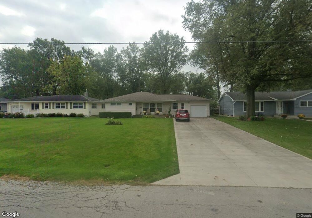
1897 Lowell Ave Lima, OH 45805
Lakewood West NeighborhoodEstimated Value: $158,059 - $221,000
3
Beds
2
Baths
1,513
Sq Ft
$131/Sq Ft
Est. Value
About This Home
This home is located at 1897 Lowell Ave, Lima, OH 45805 and is currently estimated at $197,765, approximately $130 per square foot. 1897 Lowell Ave is a home located in Allen County with nearby schools including Heritage Elementary School, Lima West Middle School, and Lima North Middle School.
Ownership History
Date
Name
Owned For
Owner Type
Purchase Details
Closed on
Jun 14, 2024
Sold by
Rhine Frances Mary and Daley Kathleen L
Bought by
Utendorf Lawrence and Utendorf Joyce A
Current Estimated Value
Home Financials for this Owner
Home Financials are based on the most recent Mortgage that was taken out on this home.
Original Mortgage
$64,000
Outstanding Balance
$62,939
Interest Rate
6.95%
Mortgage Type
New Conventional
Estimated Equity
$134,826
Purchase Details
Closed on
Jan 1, 1990
Bought by
Rhine Richard J
Create a Home Valuation Report for This Property
The Home Valuation Report is an in-depth analysis detailing your home's value as well as a comparison with similar homes in the area
Home Values in the Area
Average Home Value in this Area
Purchase History
| Date | Buyer | Sale Price | Title Company |
|---|---|---|---|
| Utendorf Lawrence | $110,000 | None Listed On Document | |
| Rhine Richard J | -- | -- |
Source: Public Records
Mortgage History
| Date | Status | Borrower | Loan Amount |
|---|---|---|---|
| Open | Utendorf Lawrence | $64,000 |
Source: Public Records
Tax History
| Year | Tax Paid | Tax Assessment Tax Assessment Total Assessment is a certain percentage of the fair market value that is determined by local assessors to be the total taxable value of land and additions on the property. | Land | Improvement |
|---|---|---|---|---|
| 2024 | $2,123 | $58,560 | $11,060 | $47,500 |
| 2023 | $1,275 | $39,840 | $7,530 | $32,310 |
| 2022 | $1,299 | $39,840 | $7,530 | $32,310 |
| 2021 | $1,375 | $39,840 | $7,530 | $32,310 |
| 2020 | $1,285 | $34,410 | $7,110 | $27,300 |
| 2019 | $1,285 | $34,410 | $7,110 | $27,300 |
| 2018 | $1,267 | $34,410 | $7,110 | $27,300 |
| 2017 | $1,289 | $34,410 | $7,110 | $27,300 |
| 2016 | $1,301 | $34,410 | $7,110 | $27,300 |
| 2015 | $1,279 | $34,410 | $7,110 | $27,300 |
| 2014 | $1,279 | $33,640 | $7,390 | $26,250 |
| 2013 | $1,244 | $33,640 | $7,390 | $26,250 |
Source: Public Records
Map
Nearby Homes
- 1880 Wendell Ave
- 161 S Cable Rd
- 1817 Hillcrest Dr
- 1700 Lowell Ave
- XXXX Spencerville Rd
- 2700 Lowell Ave
- 275 N Dale Dr
- 906 Daniels Ave
- 308 S Judkins Ave
- 2802 Lowell Ave
- 1918 Oakland Pkwy
- 784 S Judkins Ave
- 1716 Oakland Pkwy
- 1440 W Market St
- 1323 W Elm St
- 1541 Oakland Pkwy
- 2072 Arcadia Ave
- 1607 W Wayne St
- 1508 Oakland Pkwy
- 1211 W Elm St
- 1899 Lowell Ave
- 1889 Lowell Ave
- 1876 Wendell Ave
- 1874 Wendell Ave
- 1885 Lowell Ave
- 1872 Wendell Ave
- 1896 Lowell Ave
- 1892 Lowell Ave
- 1870 Wendell Ave
- 1888 Lowell Ave
- 1900 Wendell Ave
- 1881 Lowell Ave
- 1884 Lowell Ave
- 1868 Wendell Ave
- 1906 Wendell Ave
- 1877 Lowell Ave
- 1866 Wendell Ave
- 1875 Wendell Ave
- 2121 W Elm St
Your Personal Tour Guide
Ask me questions while you tour the home.