Estimated Value: $405,000 - $525,000
4
Beds
3
Baths
3,080
Sq Ft
$153/Sq Ft
Est. Value
About This Home
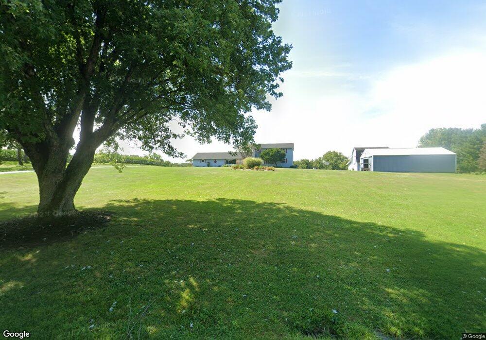
This home is located at 1897 Stone Rd, Xenia, OH 45385 and is currently estimated at $471,132, approximately $152 per square foot. 1897 Stone Rd is a home located in Greene County with nearby schools including Xenia High School.
Ownership History
Date
Name
Owned For
Owner Type
Purchase Details
Closed on
Sep 20, 2010
Sold by
Davis Kenneth R
Bought by
Davis Kenneth R and Davis Martha J
Current Estimated Value
Purchase Details
Closed on
Jun 22, 1989
Bought by
Davis Kenneth R and Davis Davis
Create a Home Valuation Report for This Property
The Home Valuation Report is an in-depth analysis detailing your home's value as well as a comparison with similar homes in the area
Home Values in the Area
Average Home Value in this Area
Purchase History
| Date | Buyer | Sale Price | Title Company |
|---|---|---|---|
| Davis Kenneth R | -- | None Available | |
| Davis Kenneth R | $94,000 | -- |
Source: Public Records
Tax History Compared to Growth
Tax History
| Year | Tax Paid | Tax Assessment Tax Assessment Total Assessment is a certain percentage of the fair market value that is determined by local assessors to be the total taxable value of land and additions on the property. | Land | Improvement |
|---|---|---|---|---|
| 2024 | $4,861 | $103,900 | $22,280 | $81,620 |
| 2023 | $4,861 | $103,900 | $22,280 | $81,620 |
| 2022 | $4,244 | $76,760 | $20,560 | $56,200 |
| 2021 | $4,296 | $76,760 | $20,560 | $56,200 |
| 2020 | $3,980 | $76,760 | $20,560 | $56,200 |
| 2019 | $3,875 | $70,310 | $18,090 | $52,220 |
| 2018 | $3,889 | $70,310 | $18,090 | $52,220 |
| 2017 | $3,750 | $70,310 | $18,090 | $52,220 |
| 2016 | $3,750 | $66,740 | $16,050 | $50,690 |
| 2015 | $3,660 | $66,740 | $16,050 | $50,690 |
| 2014 | $3,511 | $66,740 | $16,050 | $50,690 |
Source: Public Records
Map
Nearby Homes
- 1293 Gultice Rd
- 1736 Winchester Rd
- 2400 U S 68
- 2783 Us Route 68 S
- 966 U S 68
- 0 U S 68
- 841 Paintersville New Jasp Rd
- 01 Jasper Rd
- 2268 E Spring Valley Paintersville Rd
- 0 Gultice Rd Unit 940427
- 0 Jasper Rd Unit 931350
- 3710 N Lakeshore Dr
- 260 Pocahontas St
- 3620 Old Winchester Trail
- 0A Old Winchester Trail
- 0C Old Winchester Trail
- 0B Old Winchester Trail
- 1319 Arlington Dr
- 46 Lake St
- 827 Blackfoot Trail
- 1881 Stone Rd
- 1850 Stone Rd
- 1811 Ireland Rd
- 1943 Stone Rd
- 1943 Stone Rd Unit 1
- 1824 Ireland Rd
- 1827 Stone Rd
- 1783 Ireland Rd
- 1766 Needmore Rd
- 1786 Ireland Rd
- 1811 Stone Rd
- 1798 Needmore Rd
- 1788 Needmore Rd
- 0 Stone Rd Unit 2736788
- 0 Stone Rd Unit 2736785
- 0 Stone Rd Unit 2736782
- 0 Stone Rd Unit 2623430
- 0 Stone Rd Unit 2623428
- 0 Stone Rd Unit 1468516
- 1761 Needmore Rd