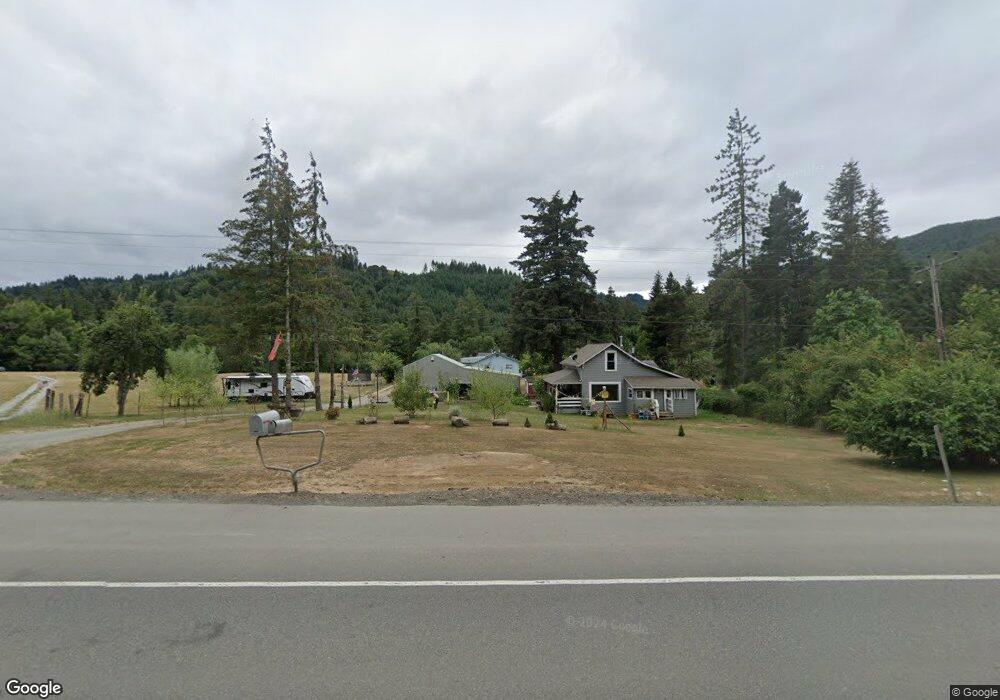
18978 Highway 42 Myrtle Point, OR 97458
Estimated Value: $312,000 - $448,000
3
Beds
2
Baths
1,410
Sq Ft
$256/Sq Ft
Est. Value
About This Home
This home is located at 18978 Highway 42, Myrtle Point, OR 97458 and is currently estimated at $360,921, approximately $255 per square foot. 18978 Highway 42 is a home located in Coos County with nearby schools including Myrtle Crest School and Myrtle Point High School.
Ownership History
Date
Name
Owned For
Owner Type
Purchase Details
Closed on
Aug 9, 2013
Sold by
Deeds John R and Deeds Carolyn E
Bought by
Barnard John A and Barnard Connie J
Current Estimated Value
Home Financials for this Owner
Home Financials are based on the most recent Mortgage that was taken out on this home.
Original Mortgage
$118,793
Outstanding Balance
$87,835
Interest Rate
4.4%
Mortgage Type
FHA
Estimated Equity
$273,086
Purchase Details
Closed on
Nov 28, 2007
Sold by
Misterly John and Misterly Staci Leanne
Bought by
Deeds John R and Deeds Carolyn E
Home Financials for this Owner
Home Financials are based on the most recent Mortgage that was taken out on this home.
Original Mortgage
$112,500
Interest Rate
6.36%
Mortgage Type
Purchase Money Mortgage
Create a Home Valuation Report for This Property
The Home Valuation Report is an in-depth analysis detailing your home's value as well as a comparison with similar homes in the area
Home Values in the Area
Average Home Value in this Area
Purchase History
| Date | Buyer | Sale Price | Title Company |
|---|---|---|---|
| Barnard John A | $121,000 | Ticor Title Insurance | |
| Deeds John R | $177,500 | Fidelity National Title Co |
Source: Public Records
Mortgage History
| Date | Status | Borrower | Loan Amount |
|---|---|---|---|
| Open | Barnard John A | $118,793 | |
| Previous Owner | Deeds John R | $112,500 |
Source: Public Records
Tax History Compared to Growth
Tax History
| Year | Tax Paid | Tax Assessment Tax Assessment Total Assessment is a certain percentage of the fair market value that is determined by local assessors to be the total taxable value of land and additions on the property. | Land | Improvement |
|---|---|---|---|---|
| 2025 | $1,682 | $172,100 | -- | -- |
| 2024 | $1,659 | $167,090 | -- | -- |
| 2023 | $1,566 | $162,230 | $0 | $0 |
| 2022 | $1,558 | $157,510 | $0 | $0 |
| 2021 | $1,523 | $152,930 | $0 | $0 |
| 2020 | $1,484 | $152,930 | $0 | $0 |
| 2019 | $1,407 | $144,160 | $0 | $0 |
| 2018 | $1,372 | $139,970 | $0 | $0 |
| 2017 | $1,341 | $135,900 | $0 | $0 |
| 2016 | $1,305 | $131,950 | $0 | $0 |
| 2015 | $1,229 | $128,110 | $0 | $0 |
| 2014 | $1,229 | $124,380 | $0 | $0 |
Source: Public Records
Map
Nearby Homes
- 51320 Myrtle Creek Rd
- 51256 Salmon Gulch Rd
- 98470 Carla Ln
- 20191 Highway 42
- 53856 Big Creek Rd
- 15779 Oregon 42
- 53621 Weekly Creek Rd
- 46255 Highway 242
- 98785 Sitkum Ln
- 1753 20th St
- 1715 20th St
- 1985 Roseburg Rd
- 1938 Maryland Ave
- 1893 Sunset Ln
- 1861 View St
- 1783 View St
- 2047 Roseburg Rd
- 1873 E Cedar St
- 1829 E Willow St
- 1434 Maryland Ave
- 18976 Highway 42
- 18976 Highway 42
- 85 Bridge (Hc)
- 115 Myrtlepoint
- 18951 Highway 42
- 51285 Hatfield Rd
- 18976 Hwy 42
- 11
- 51287 Hatfield Rd
- 19024 Highway 42
- 0 29w11w33a Tl101 Unit 329090518
- 51286 Hatfield Rd
- 51296 Hatfield Rd
- 51144 Myrtle Creek Rd
- 19040 Highway 42
- 19040 Hwy 42
- 98368 Bridge Ln
- 51220 Myrtle Creek Rd
- 98377 Bridge Ln
- 51102 Myrtle Creek Rd