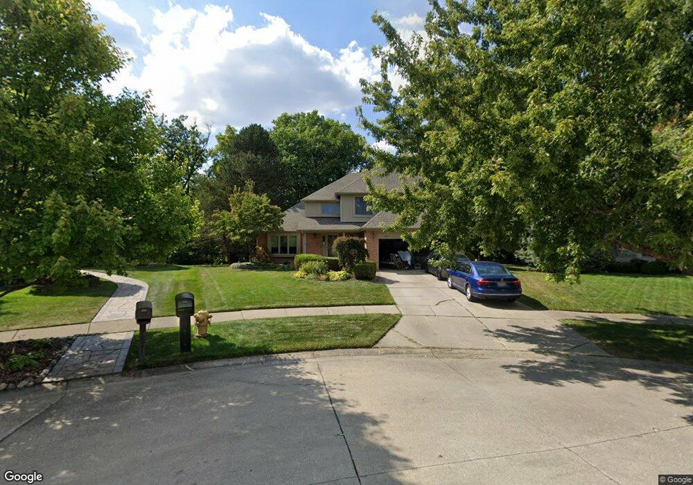
18979 Pierport Ct Clinton Township, MI 48038
Estimated Value: $453,000 - $470,000
--
Bed
1
Bath
2,450
Sq Ft
$188/Sq Ft
Est. Value
About This Home
This home is located at 18979 Pierport Ct, Clinton Township, MI 48038 and is currently estimated at $460,107, approximately $187 per square foot. 18979 Pierport Ct is a home located in Macomb County with nearby schools including Cherokee Elementary School, Wyandot Middle School, and Chippewa Valley High School.
Ownership History
Date
Name
Owned For
Owner Type
Purchase Details
Closed on
Oct 24, 2025
Sold by
Patrick Michael J and Patrick Sandra L
Bought by
Patrick Jack M
Current Estimated Value
Home Financials for this Owner
Home Financials are based on the most recent Mortgage that was taken out on this home.
Original Mortgage
$320,000
Outstanding Balance
$320,000
Interest Rate
6.35%
Mortgage Type
New Conventional
Estimated Equity
$140,107
Purchase Details
Closed on
Jul 21, 1999
Sold by
Berg Frederick A
Bought by
Patrick Michael J
Create a Home Valuation Report for This Property
The Home Valuation Report is an in-depth analysis detailing your home's value as well as a comparison with similar homes in the area
Home Values in the Area
Average Home Value in this Area
Purchase History
| Date | Buyer | Sale Price | Title Company |
|---|---|---|---|
| Patrick Michael J | $250,000 | -- |
Source: Public Records
Tax History Compared to Growth
Tax History
| Year | Tax Paid | Tax Assessment Tax Assessment Total Assessment is a certain percentage of the fair market value that is determined by local assessors to be the total taxable value of land and additions on the property. | Land | Improvement |
|---|---|---|---|---|
| 2025 | $6,043 | $227,900 | $0 | $0 |
| 2024 | $3,600 | $217,900 | $0 | $0 |
| 2023 | $3,415 | $188,000 | $0 | $0 |
| 2022 | $5,476 | $177,000 | $0 | $0 |
| 2021 | $5,325 | $168,100 | $0 | $0 |
| 2020 | $3,133 | $166,500 | $0 | $0 |
| 2019 | $4,960 | $151,800 | $0 | $0 |
| 2018 | $4,858 | $140,800 | $0 | $0 |
| 2017 | $4,814 | $133,500 | $26,300 | $107,200 |
| 2016 | $4,784 | $133,500 | $0 | $0 |
| 2015 | -- | $128,500 | $0 | $0 |
| 2014 | -- | $120,600 | $0 | $0 |
| 2011 | -- | $112,600 | $22,900 | $89,700 |
Source: Public Records
Map
Nearby Homes
- 19118 Killeen Dr
- 43852 Columbia Dr
- 43274 Hillsboro Dr
- 43673 Welland Dr
- 43373 Brooks Dr
- 43363 Herring Dr
- 44192 Rivergate Dr
- 43377 Rivergate Dr
- 44340 Thunder Bay Dr
- 43646 Pintail Dr
- 17901 Pointe Ct Unit 9
- 42407 Creekside Dr Unit 165
- 0 Clinton River Rd Unit 20251013874
- 16297 Conifer Ln
- 20465 Saint Laurence Dr
- 42680 Chippewa Dr Unit 28
- 44130 Cadburry Dr
- 19790 Westchester Dr Unit 11
- 42266 Brookview Ln Unit 1
- 44808 Rivergate Dr
- 18987 Pierport Ct Unit Bldg-Unit
- 18987 Pierport Ct
- 18971 Pierport Ct
- 18995 Pierport Ct
- 18963 Pierport Ct
- 43445 Riverway Dr
- 18974 Riverway Ct
- 43303 Riverway Dr
- 18956 Riverway Ct
- 19037 Killeen Dr
- 19044 Killeen Dr
- 19002 Riverway Ct
- 43283 Riverway Dr
- 19030 Riverway Ct
- 19053 Killeen Dr
- 43440 Riverway Dr
- 19064 Killeen Dr
- 18940 Riverway Ct
- 43263 Riverway Dr
- 19040 Livery Ct