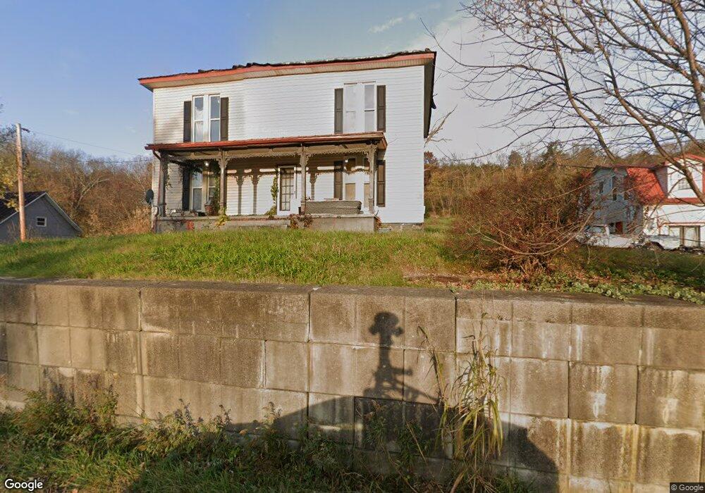
18979 State Route 41 Peebles, OH 45660
Estimated Value: $87,000 - $266,000
4
Beds
2
Baths
1,890
Sq Ft
$90/Sq Ft
Est. Value
About This Home
This home is located at 18979 State Route 41, Peebles, OH 45660 and is currently estimated at $169,195, approximately $89 per square foot. 18979 State Route 41 is a home located in Adams County with nearby schools including North Adams Elementary School and North Adams High School.
Ownership History
Date
Name
Owned For
Owner Type
Purchase Details
Closed on
Jul 21, 2022
Sold by
Harry Miller Jr Family Truit
Bought by
Clark Julia L and Sell Robert B
Current Estimated Value
Home Financials for this Owner
Home Financials are based on the most recent Mortgage that was taken out on this home.
Original Mortgage
$66,400
Interest Rate
5.23%
Mortgage Type
New Conventional
Purchase Details
Closed on
Mar 25, 2021
Sold by
Chaney Robert A and Chaney Elsie J
Bought by
Miller Harry and Miller Leah
Purchase Details
Closed on
May 15, 2014
Sold by
Roades Jeff and Roades Dovie M
Bought by
Chaney Robert A and Chaney Elsie
Home Financials for this Owner
Home Financials are based on the most recent Mortgage that was taken out on this home.
Original Mortgage
$24,000
Interest Rate
4.41%
Mortgage Type
Purchase Money Mortgage
Purchase Details
Closed on
Jun 28, 1993
Bought by
Gibson Michael P
Create a Home Valuation Report for This Property
The Home Valuation Report is an in-depth analysis detailing your home's value as well as a comparison with similar homes in the area
Home Values in the Area
Average Home Value in this Area
Purchase History
| Date | Buyer | Sale Price | Title Company |
|---|---|---|---|
| Clark Julia L | $83,000 | None Listed On Document | |
| Miller Harry | $107,000 | None Available | |
| Chaney Robert A | $140,000 | None Available | |
| Gibson Michael P | $25,000 | -- |
Source: Public Records
Mortgage History
| Date | Status | Borrower | Loan Amount |
|---|---|---|---|
| Previous Owner | Clark Julia L | $66,400 | |
| Previous Owner | Chaney Robert A | $24,000 |
Source: Public Records
Tax History Compared to Growth
Tax History
| Year | Tax Paid | Tax Assessment Tax Assessment Total Assessment is a certain percentage of the fair market value that is determined by local assessors to be the total taxable value of land and additions on the property. | Land | Improvement |
|---|---|---|---|---|
| 2024 | $3,375 | $35,420 | $6,090 | $29,330 |
| 2023 | $1,342 | $33,780 | $4,450 | $29,330 |
| 2022 | $1,272 | $30,390 | $3,330 | $27,060 |
| 2021 | $1,242 | $30,390 | $3,330 | $27,060 |
| 2020 | $1,269 | $30,390 | $3,330 | $27,060 |
| 2019 | $1,208 | $30,390 | $3,330 | $27,060 |
| 2018 | $1,011 | $25,870 | $3,330 | $22,540 |
| 2017 | $983 | $25,870 | $3,330 | $22,540 |
| 2016 | $981 | $25,870 | $3,330 | $22,540 |
| 2015 | $1,040 | $28,320 | $3,470 | $24,850 |
| 2014 | $1,030 | $28,040 | $3,470 | $24,570 |
Source: Public Records
Map
Nearby Homes
- 19004 State Route 41
- 0 Paradise Valley Rd Unit 1852764
- 668 Fawcett Rd
- 210 Walt Alsgood Rd
- 363 Crystal Rd
- 292 Larry Baynum Rd
- 3460 Logans Ln
- 1064 Hafer Rd
- 1011 Hafer Rd
- 13465 State Route 41
- 3551 Unity Rd
- 4016 Unity Rd
- 108 Chirsdon Ln
- 1286 Steam Furnace Rd
- 2991 Cedar Mills Rd
- 4603 Wheat Ridge Rd
- 2030 Cedar Mills Rd
- 0 State Route 41 Unit 1830107
- 831 Tom Brown Rd
- 0 Lawshe Rd Unit 1854673
- 18957 State Route 41
- 18940 State Route 41
- 18940 State Route 41
- 19004 State Route 41
- 19028 State Route 41
- 19004 State Rte 41
- 0 Wheat Ridge Rd Unit 1582139
- 0 Wheat Ridge Rd Unit 1637133
- 19040 State Route 41
- 38 Wheat Ridge Rd
- 19060 State Route 41
- 18970 State Route 41
- 18970 State Route 41
- 19031 State Route 41
- 18885 State Route 41
- 18885 State Route 41
- 18860 State Route 41
- 19101 State Route 41
- 18825 State Route 41
- 18888 State Route 41