Estimated Value: $385,000 - $434,000
4
Beds
3
Baths
2,238
Sq Ft
$183/Sq Ft
Est. Value
About This Home
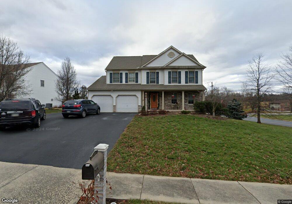
This home is located at 1899 Arthurs Ct, York, PA 17408 and is currently estimated at $409,411, approximately $182 per square foot. 1899 Arthurs Ct is a home located in York County with nearby schools including West York Area High School, York Adventist Christian School, and Christian School of York.
Ownership History
Date
Name
Owned For
Owner Type
Purchase Details
Closed on
Jun 26, 2006
Sold by
Fox Carol F
Bought by
Fox Carol F and Wilkinson Richard Brett
Current Estimated Value
Purchase Details
Closed on
May 5, 2005
Sold by
Orchard Hills Real Estate Inc
Bought by
Fox Carol F
Home Financials for this Owner
Home Financials are based on the most recent Mortgage that was taken out on this home.
Original Mortgage
$120,000
Outstanding Balance
$63,411
Interest Rate
6.05%
Mortgage Type
Fannie Mae Freddie Mac
Estimated Equity
$346,000
Create a Home Valuation Report for This Property
The Home Valuation Report is an in-depth analysis detailing your home's value as well as a comparison with similar homes in the area
Home Values in the Area
Average Home Value in this Area
Purchase History
| Date | Buyer | Sale Price | Title Company |
|---|---|---|---|
| Fox Carol F | -- | None Available | |
| Fox Carol F | $260,820 | -- |
Source: Public Records
Mortgage History
| Date | Status | Borrower | Loan Amount |
|---|---|---|---|
| Open | Fox Carol F | $120,000 |
Source: Public Records
Tax History Compared to Growth
Tax History
| Year | Tax Paid | Tax Assessment Tax Assessment Total Assessment is a certain percentage of the fair market value that is determined by local assessors to be the total taxable value of land and additions on the property. | Land | Improvement |
|---|---|---|---|---|
| 2025 | $7,787 | $230,920 | $43,290 | $187,630 |
| 2024 | $7,591 | $230,920 | $43,290 | $187,630 |
| 2023 | $7,591 | $230,920 | $43,290 | $187,630 |
| 2022 | $7,591 | $230,920 | $43,290 | $187,630 |
| 2021 | $7,360 | $230,920 | $43,290 | $187,630 |
| 2020 | $7,360 | $230,920 | $43,290 | $187,630 |
| 2019 | $7,222 | $230,920 | $43,290 | $187,630 |
| 2018 | $7,164 | $230,920 | $43,290 | $187,630 |
| 2017 | $6,944 | $230,920 | $43,290 | $187,630 |
| 2016 | $0 | $230,920 | $43,290 | $187,630 |
| 2015 | -- | $230,920 | $43,290 | $187,630 |
| 2014 | -- | $230,920 | $43,290 | $187,630 |
Source: Public Records
Map
Nearby Homes
- 1945 Normandie Dr
- 2020 Parkton Ln
- 2200 Parkton Ln
- 1837 Downing St
- 103 Winston Dr
- 1031 Willow Ridge Dr
- 123 Winston Dr
- 1965 Niagara Ln
- 2553 Roosevelt Ave
- 1879 Trolley Rd
- 857 Willow Ridge Ct
- 2481 Broad St
- 2094 Winding Rd
- 0 Colony Rd
- 2248 Heather Rd
- 2325 Middle St
- 868 Greenbriar Rd
- 1625 Haviland Rd
- 2633 Grandview Park Dr Unit 39
- 2711 Rosebay Dr
- 1889 Arthurs Ct
- 1879 Arthurs Ct
- 1890 Arthurs Ct
- 2270 Roosevelt Ave
- 1880 Arthurs Ct
- 2217 Roosevelt Ave
- 1509 Lilac Rd
- 1510 Church Rd
- 2205 Roosevelt Ave
- 1520 Church Rd
- 1519 Lilac Rd
- 2193 Roosevelt Ave
- 1530 Church Rd
- 1530 Lilac Rd
- 1540 Church Rd
- 1529 Lilac Rd
- 1540 Lilac Rd
- 1550 Church Rd
- 2181 Roosevelt Ave
- 1539 Lilac Rd