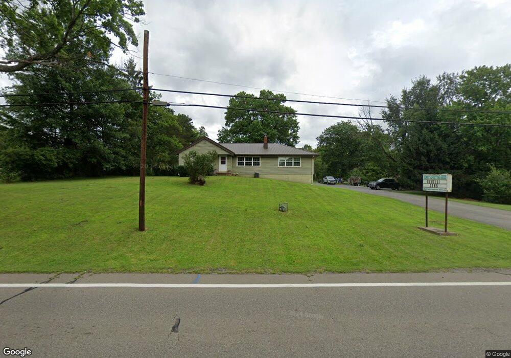
1899 Brookfield Rd Hubbard, OH 44425
Estimated Value: $231,000 - $279,000
3
Beds
2
Baths
1,771
Sq Ft
$142/Sq Ft
Est. Value
About This Home
This home is located at 1899 Brookfield Rd, Hubbard, OH 44425 and is currently estimated at $251,120, approximately $141 per square foot. 1899 Brookfield Rd is a home located in Trumbull County with nearby schools including Hubbard Elementary School, Hubbard Middle School, and Hubbard High School.
Ownership History
Date
Name
Owned For
Owner Type
Purchase Details
Closed on
Jul 28, 2023
Sold by
Day Dennis E and Day Carol J
Bought by
Carol J Day Declaration Of Trust and Day
Current Estimated Value
Purchase Details
Closed on
Feb 2, 1994
Sold by
John John A A and John S
Bought by
Carol Dennis E and Day S Carol J
Purchase Details
Closed on
Jan 1, 1990
Bought by
John John A and John S
Create a Home Valuation Report for This Property
The Home Valuation Report is an in-depth analysis detailing your home's value as well as a comparison with similar homes in the area
Home Values in the Area
Average Home Value in this Area
Purchase History
| Date | Buyer | Sale Price | Title Company |
|---|---|---|---|
| Carol J Day Declaration Of Trust | -- | None Listed On Document | |
| Carol Dennis E | $78,000 | -- | |
| John John A | -- | -- |
Source: Public Records
Tax History Compared to Growth
Tax History
| Year | Tax Paid | Tax Assessment Tax Assessment Total Assessment is a certain percentage of the fair market value that is determined by local assessors to be the total taxable value of land and additions on the property. | Land | Improvement |
|---|---|---|---|---|
| 2024 | $4,029 | $71,020 | $4,340 | $66,680 |
| 2023 | $4,029 | $71,020 | $4,340 | $66,680 |
| 2022 | $3,315 | $52,020 | $3,960 | $48,060 |
| 2021 | $3,329 | $52,020 | $3,960 | $48,060 |
| 2020 | $3,342 | $52,020 | $3,960 | $48,060 |
| 2019 | $3,083 | $45,470 | $3,680 | $41,790 |
| 2018 | $2,992 | $45,470 | $3,680 | $41,790 |
| 2017 | $2,984 | $45,470 | $3,680 | $41,790 |
| 2016 | $2,588 | $41,410 | $3,680 | $37,730 |
| 2015 | $2,597 | $41,410 | $3,680 | $37,730 |
| 2014 | $2,546 | $41,410 | $3,680 | $37,730 |
| 2013 | $2,542 | $41,410 | $3,680 | $37,730 |
Source: Public Records
Map
Nearby Homes
- 7111 Pine Grove Dr
- 1911 Hubbard Thomas Rd
- 1952 Hubbard Masury Rd
- 132 Drummond Ave
- 6855 Stewart Sharon Rd
- 1354 Stevenson Rd
- 764 Jones St
- 7737 Elm St
- 784 Elmwood Dr
- 462 Elizabeth St
- 395 Elizabeth St
- 138 Moore St
- 5910 Chestnut Ridge Rd
- 7847 Chestnut St
- 611 Moore St
- 248 Myron St
- 7822 2nd St
- 430 E Park Ave
- 5950 Mount Everett Rd
- 110 School St
- 1915 Brookfield Rd
- 1888 Brookfield Rd
- 1923 Brookfield Rd
- 1904 Brookfield Rd
- 1916 Brookfield Rd
- 1854 Brookfield Rd
- 1937 Brookfield Rd
- 1940 Brookfield Rd
- 6968 Chestnut Ridge Rd
- 0 Chestnut-Ridge Rd Unit 1116478
- 0 Chestnut-Ridge Rd Unit 4306015
- 0 Chestnut-Ridge Rd Unit 4182627
- 1932 Brookfield Rd
- 1955 Brookfield Rd
- 6884 Chestnut Ridge Rd
- 1952 Brookfield Rd
- 1931 Brookfield Rd
- 1958 Brookfield Rd
- 1837 Brookfield Rd
- 6882 Chestnut Ridge Rd