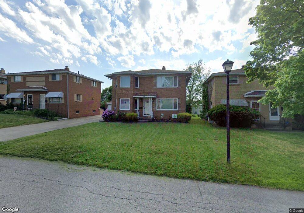
1899 Carter Ave Unit 1901 Akron, OH 44301
Firestone Park NeighborhoodEstimated Value: $182,000 - $201,000
4
Beds
2
Baths
2,106
Sq Ft
$91/Sq Ft
Est. Value
About This Home
This home is located at 1899 Carter Ave Unit 1901, Akron, OH 44301 and is currently estimated at $192,367, approximately $91 per square foot. 1899 Carter Ave Unit 1901 is a home located in Summit County with nearby schools including Kenmore Garfield Community Learning Center, Main Preparatory Academy, and Eagle Elementary.
Ownership History
Date
Name
Owned For
Owner Type
Purchase Details
Closed on
Sep 15, 2022
Sold by
Fiehn Robert J and Fiehn Justine M
Bought by
Trares Eric Paul
Current Estimated Value
Home Financials for this Owner
Home Financials are based on the most recent Mortgage that was taken out on this home.
Original Mortgage
$120,000
Outstanding Balance
$114,403
Interest Rate
4.99%
Mortgage Type
New Conventional
Estimated Equity
$77,964
Purchase Details
Closed on
Feb 8, 1999
Sold by
Fiehn Nick and Fiehn Beverly
Bought by
Fiehn Robert J and Fiehn Justine M
Home Financials for this Owner
Home Financials are based on the most recent Mortgage that was taken out on this home.
Original Mortgage
$87,000
Interest Rate
6.81%
Mortgage Type
Seller Take Back
Create a Home Valuation Report for This Property
The Home Valuation Report is an in-depth analysis detailing your home's value as well as a comparison with similar homes in the area
Home Values in the Area
Average Home Value in this Area
Purchase History
| Date | Buyer | Sale Price | Title Company |
|---|---|---|---|
| Trares Eric Paul | $151,000 | None Listed On Document | |
| Fiehn Robert J | $87,000 | Chicago Title Insurance Comp |
Source: Public Records
Mortgage History
| Date | Status | Borrower | Loan Amount |
|---|---|---|---|
| Open | Trares Eric Paul | $120,000 | |
| Previous Owner | Fiehn Robert J | $87,000 |
Source: Public Records
Tax History
| Year | Tax Paid | Tax Assessment Tax Assessment Total Assessment is a certain percentage of the fair market value that is determined by local assessors to be the total taxable value of land and additions on the property. | Land | Improvement |
|---|---|---|---|---|
| 2025 | $3,060 | $56,519 | $8,677 | $47,842 |
| 2024 | $3,060 | $56,519 | $8,677 | $47,842 |
| 2023 | $3,060 | $56,519 | $8,677 | $47,842 |
| 2022 | $2,859 | $41,426 | $6,286 | $35,140 |
| 2021 | $2,862 | $41,426 | $6,286 | $35,140 |
| 2020 | $2,819 | $41,430 | $6,290 | $35,140 |
| 2019 | $2,488 | $33,070 | $6,290 | $26,780 |
| 2018 | $2,455 | $33,070 | $6,290 | $26,780 |
| 2017 | $2,495 | $33,070 | $6,290 | $26,780 |
| 2016 | $2,497 | $33,070 | $6,290 | $26,780 |
| 2015 | $2,495 | $33,070 | $6,290 | $26,780 |
| 2014 | $2,475 | $33,070 | $6,290 | $26,780 |
| 2013 | $2,230 | $30,320 | $6,290 | $24,030 |
Source: Public Records
Map
Nearby Homes
- 502 E Woodsdale Ave
- 1810 Carter Ave
- 416 Rockys Run Rd
- 1699 Redwood Ave
- 1835 Thornapple Ave
- 1726 Coventry St
- 1708 Highview Ave
- 231 E Dresden Ave
- 2162 Canterbury Cir
- 2069 Penguin Ave
- 1645 Hammel St
- 0 Woodview Dr
- 248 E Catawba Ave
- 244 E Catawba Ave
- 1646 Highview Ave
- 1612 Oakwood Ave
- 361 Mission Dr
- 1595 Redwood Ave
- 457 S Firestone Blvd
- 1620 Highview Ave
- 1895 Carter Ave Unit 1897
- 1905 Carter Ave Unit 1907
- 1905 1907 Carter Ave
- 1893 Carter Ave
- 1891 Carter Ave Unit 1893
- 1910 Brown St
- 1900 Carter Ave Unit 1902
- 1896 Carter Ave Unit 1898
- 1906 Carter Ave Unit 1908
- 1892 Carter Ave Unit 1894
- 1888 Carter Ave Unit 1890
- 1881 Carter Ave
- 1881 Carter Ave
- 0 Brown St Unit 3090381
- 1882 Carter Ave Unit 1884
- 1903 Brown St
- 1880 Carter Ave
- 1878 Carter Ave Unit 1880
- 755 S Firestone Blvd Unit 757
- 755 757 S Firestone Blvd
Your Personal Tour Guide
Ask me questions while you tour the home.