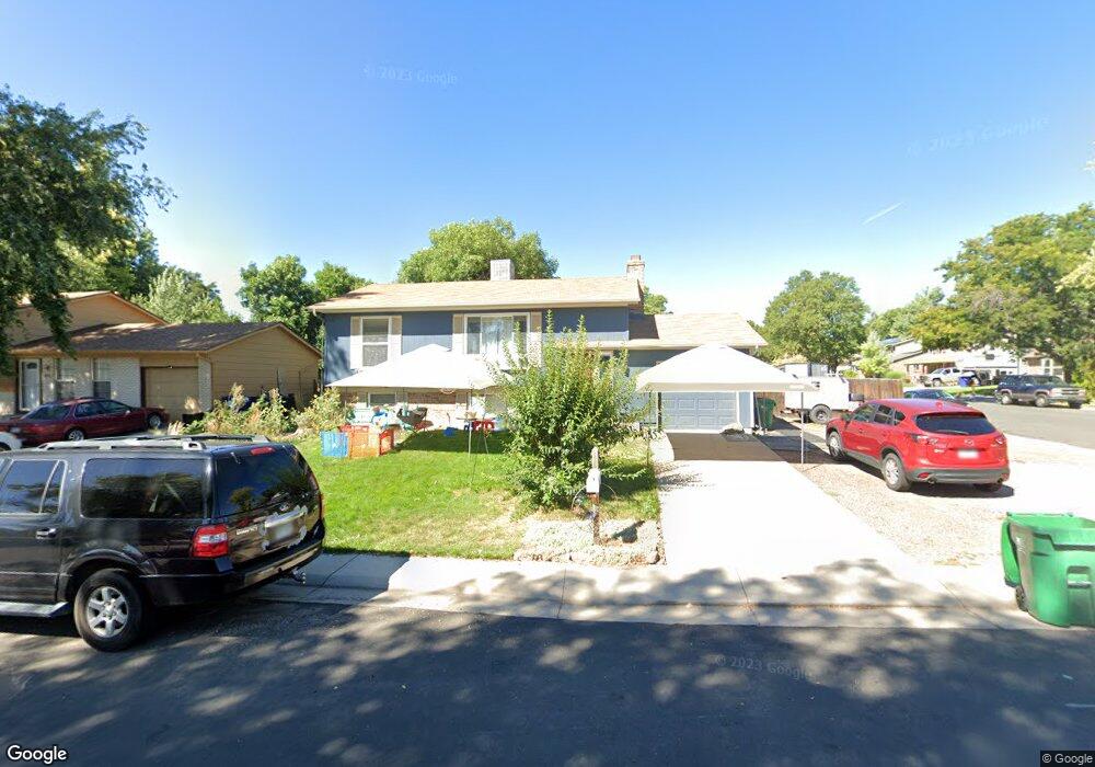
1899 Cedar St Broomfield, CO 80020
Northmoor Estates NeighborhoodEstimated Value: $516,000 - $566,000
4
Beds
2
Baths
1,782
Sq Ft
$302/Sq Ft
Est. Value
About This Home
This home is located at 1899 Cedar St, Broomfield, CO 80020 and is currently estimated at $537,987, approximately $301 per square foot. 1899 Cedar St is a home located in Broomfield County with nearby schools including Aspen Creek K-8 School, Birch Elementary School, and Broomfield High School.
Ownership History
Date
Name
Owned For
Owner Type
Purchase Details
Closed on
Aug 7, 2018
Sold by
Morrison Mark and Morrison Deseree
Bought by
Cino Vince and Cino Karen
Current Estimated Value
Home Financials for this Owner
Home Financials are based on the most recent Mortgage that was taken out on this home.
Original Mortgage
$288,000
Outstanding Balance
$250,116
Interest Rate
4.5%
Mortgage Type
New Conventional
Estimated Equity
$287,871
Purchase Details
Closed on
Jul 1, 2015
Sold by
Caneva Johnnie Ray and Caneva Tonia Lynn
Bought by
Morrison Mark and Morrison Deseree
Home Financials for this Owner
Home Financials are based on the most recent Mortgage that was taken out on this home.
Original Mortgage
$275,025
Interest Rate
3.87%
Mortgage Type
FHA
Purchase Details
Closed on
May 2, 1994
Purchase Details
Closed on
Jul 15, 1991
Purchase Details
Closed on
Aug 22, 1975
Create a Home Valuation Report for This Property
The Home Valuation Report is an in-depth analysis detailing your home's value as well as a comparison with similar homes in the area
Home Values in the Area
Average Home Value in this Area
Purchase History
| Date | Buyer | Sale Price | Title Company |
|---|---|---|---|
| Cino Vince | $360,000 | Homestead Title & Escrow | |
| Morrison Mark | $285,000 | Fidelity National Title Ins | |
| -- | $104,700 | -- | |
| -- | $75,000 | -- | |
| -- | $3,000 | -- |
Source: Public Records
Mortgage History
| Date | Status | Borrower | Loan Amount |
|---|---|---|---|
| Open | Cino Vince | $288,000 | |
| Previous Owner | Morrison Mark | $275,025 |
Source: Public Records
Tax History Compared to Growth
Tax History
| Year | Tax Paid | Tax Assessment Tax Assessment Total Assessment is a certain percentage of the fair market value that is determined by local assessors to be the total taxable value of land and additions on the property. | Land | Improvement |
|---|---|---|---|---|
| 2025 | $2,838 | $33,860 | $8,710 | $25,150 |
| 2024 | $2,838 | $30,290 | $7,770 | $22,520 |
| 2023 | $2,833 | $35,690 | $9,040 | $26,650 |
| 2022 | $2,408 | $24,910 | $5,910 | $19,000 |
| 2021 | $2,396 | $25,630 | $6,080 | $19,550 |
| 2020 | $2,327 | $24,740 | $5,720 | $19,020 |
| 2019 | $2,323 | $24,910 | $5,760 | $19,150 |
| 2018 | $2,074 | $21,970 | $4,320 | $17,650 |
| 2017 | $2,042 | $24,290 | $4,780 | $19,510 |
| 2016 | $1,657 | $17,570 | $5,450 | $12,120 |
Source: Public Records
Map
Nearby Homes
- 583 Redstone Dr
- 13924 Quail Ridge Dr
- 1490 Saint Andrews Dr
- 1201 Dover Ct
- 13980 Willow Wood Dr
- 1732 Peregrine Ln
- 13774 Sagar Dr
- 13951 Brookside Ct
- 4915 Sage Brush Dr
- Torrey Plan at Dillon Pointe
- Evans Plan at Dillon Pointe
- Antero Plan at Dillon Pointe
- 5704 W 141st Place
- 114 E 14th Ct
- 37 E 14th Place
- 14111 Blue Stem St
- 14115 Blue Stem St
- 13971 Telluride Dr
- 1747 Whistlepig Ln
- 1757 Whistlepig Ln
- 1859 Cedar St
- 1890 Birch St
- 1850 Birch St
- 1809 Cedar St
- 1105 E 19th Ave
- 1095 E 19th Ave
- 1800 Birch St
- 1868 Cedar St
- 1808 Cedar St
- 1908 Cedar St
- 1085 E 19th Ave
- 1790 Birch St
- 1938 Cedar St
- 1798 Cedar St
- 1075 E 19th Ave
- 1839 Cottonwood St
- 1709 Cedar St
- 1869 Cottonwood St
- 1809 Cottonwood St
- 1895 Birch St