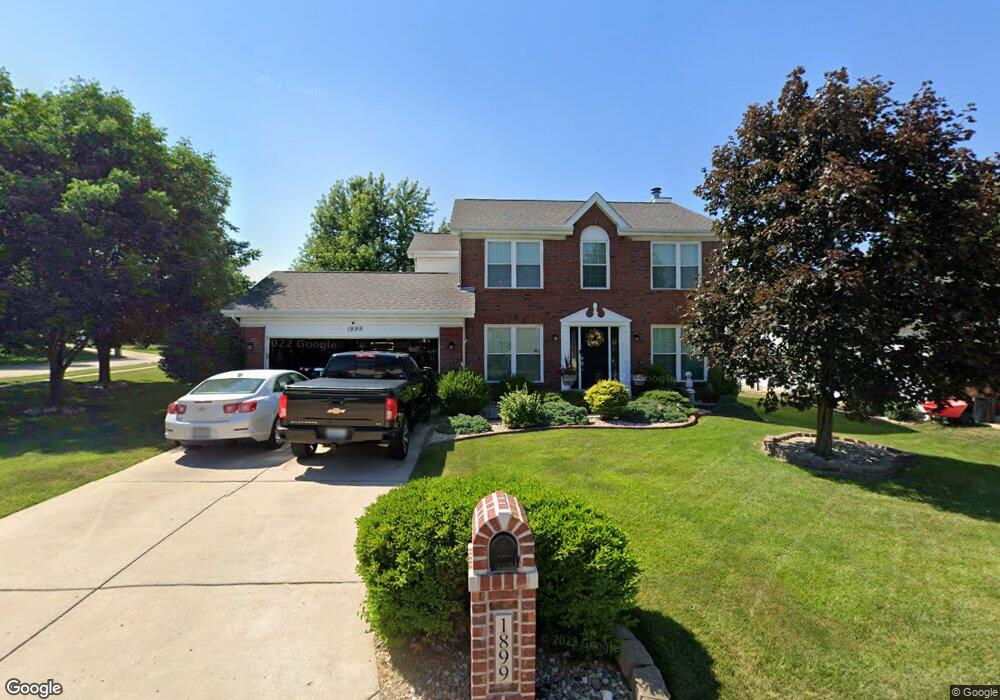
1899 Lunenburg Dr Saint Peters, MO 63376
Estimated Value: $401,273 - $460,000
4
Beds
4
Baths
2,125
Sq Ft
$201/Sq Ft
Est. Value
About This Home
This home is located at 1899 Lunenburg Dr, Saint Peters, MO 63376 and is currently estimated at $426,068, approximately $200 per square foot. 1899 Lunenburg Dr is a home located in St. Charles County with nearby schools including Progress South Elementary School, Fort Zumwalt South Middle School, and Fort Zumwalt South High School.
Ownership History
Date
Name
Owned For
Owner Type
Purchase Details
Closed on
Oct 31, 1997
Sold by
Mayer Enterprises Inc
Bought by
King Joseph W and King Laura L
Current Estimated Value
Home Financials for this Owner
Home Financials are based on the most recent Mortgage that was taken out on this home.
Original Mortgage
$127,200
Outstanding Balance
$20,857
Interest Rate
7.27%
Mortgage Type
Assumption
Estimated Equity
$405,211
Create a Home Valuation Report for This Property
The Home Valuation Report is an in-depth analysis detailing your home's value as well as a comparison with similar homes in the area
Home Values in the Area
Average Home Value in this Area
Purchase History
| Date | Buyer | Sale Price | Title Company |
|---|---|---|---|
| King Joseph W | $145,200 | -- |
Source: Public Records
Mortgage History
| Date | Status | Borrower | Loan Amount |
|---|---|---|---|
| Open | King Joseph W | $127,200 |
Source: Public Records
Tax History Compared to Growth
Tax History
| Year | Tax Paid | Tax Assessment Tax Assessment Total Assessment is a certain percentage of the fair market value that is determined by local assessors to be the total taxable value of land and additions on the property. | Land | Improvement |
|---|---|---|---|---|
| 2025 | $3,770 | $63,884 | -- | -- |
| 2023 | $3,771 | $56,965 | $0 | $0 |
| 2022 | $3,060 | $42,918 | $0 | $0 |
| 2021 | $3,062 | $42,918 | $0 | $0 |
| 2020 | $3,302 | $44,905 | $0 | $0 |
| 2019 | $3,310 | $44,905 | $0 | $0 |
| 2018 | $3,221 | $41,721 | $0 | $0 |
| 2017 | $3,181 | $41,721 | $0 | $0 |
| 2016 | $2,946 | $38,488 | $0 | $0 |
| 2015 | $2,739 | $38,488 | $0 | $0 |
| 2014 | $2,581 | $35,657 | $0 | $0 |
Source: Public Records
Map
Nearby Homes
- 2 Laura Hill Rd
- 2068 Williamstown Dr
- 114 Knaust Rd
- 2 Oak Point Ct
- 42 Kingspointe Dr
- 28 Steiert Dr
- 8201 Bristol Valley Dr
- 67 Oakridge West Dr
- 5 Wood Oaks Dr
- 146 Huntington Crossing Dr
- Adams Plan at Strawberry Farms - Liberty Series
- Franklin Plan at Strawberry Farms - Liberty Series
- Madison Plan at Strawberry Farms - Liberty Series
- Hamilton II Plan at Strawberry Farms - Liberty Series
- Washington Plan at Strawberry Farms - Liberty Series
- 9 Donna Dr
- Fairground - Interior Townhome Plan at Birdie Hill Crossing - Townhome Collection
- Fairground - Exterior Townhome Plan at Birdie Hill Crossing - Townhome Collection
- Dover Plan at Birdie Hill Crossing - Cottage Collection
- Windsor Plan at Birdie Hill Crossing - Cottage Collection
- 1895 Lunenburg Dr
- 1890 Williamstown Dr
- 1886 Williamstown Dr
- 1911 Lunenburg Dr
- 1891 Lunenburg Dr
- 1892 Lunenburg Dr
- 1882 Williamstown Dr
- 1906 Lunenburg Dr
- 44 Chance Dr
- 1888 Lunenburg Dr
- 1876 Williamstown Dr
- 1915 Lunenburg Dr
- 1912 Lunenburg Dr
- 1906 Williamstown Dr
- 7 Constable Ct
- 5 Constable Ct
- 1893 Williamstown Dr
- 1889 Williamstown Dr
- 1885 Williamstown Dr
- 1884 Lunenburg Dr