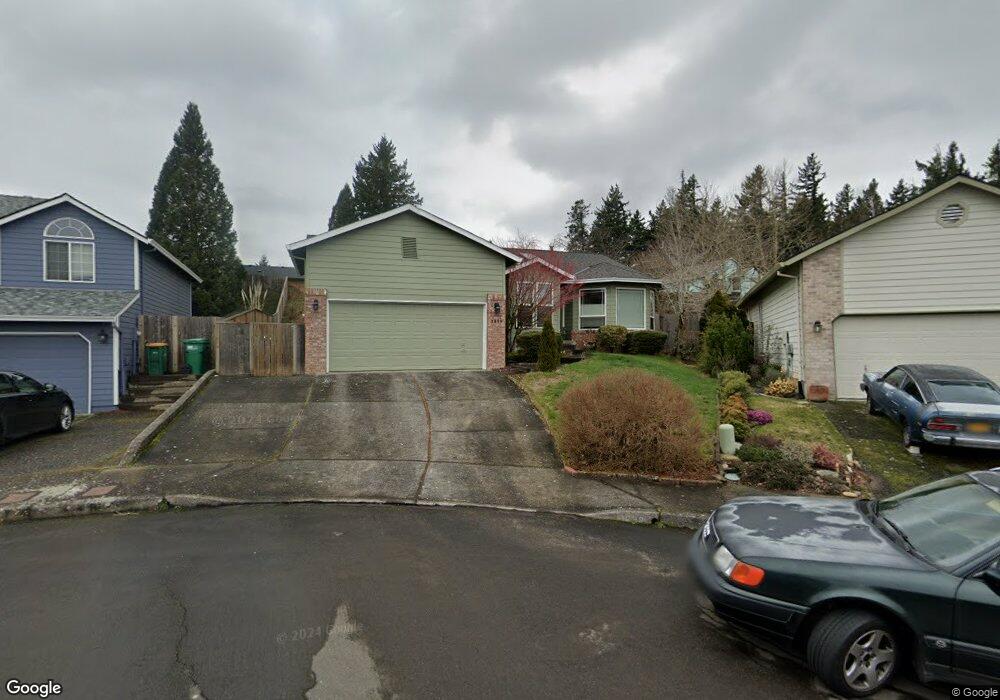
1899 SW Haskins Ct Reduced Troutdale, OR 97060
Sunrise NeighborhoodEstimated Value: $513,000 - $577,000
3
Beds
2
Baths
1,814
Sq Ft
$298/Sq Ft
Est. Value
About This Home
This home is located at 1899 SW Haskins Ct Reduced, Troutdale, OR 97060 and is currently estimated at $540,429, approximately $297 per square foot. 1899 SW Haskins Ct Reduced is a home located in Multnomah County with nearby schools including Troutdale Elementary School, Walt Morey Middle School, and Reynolds High School.
Ownership History
Date
Name
Owned For
Owner Type
Purchase Details
Closed on
Sep 28, 2020
Sold by
Coppin Robert E
Bought by
Coppin Robert E and Coppin Livin Gtrust
Current Estimated Value
Purchase Details
Closed on
Mar 25, 2005
Sold by
Hall David J
Bought by
Coppin Robert E and Coppin Kathleen W
Purchase Details
Closed on
Mar 22, 2000
Sold by
Miller Cary
Bought by
Hall David J and Hall Teresa A
Home Financials for this Owner
Home Financials are based on the most recent Mortgage that was taken out on this home.
Original Mortgage
$174,131
Interest Rate
8.34%
Mortgage Type
FHA
Create a Home Valuation Report for This Property
The Home Valuation Report is an in-depth analysis detailing your home's value as well as a comparison with similar homes in the area
Home Values in the Area
Average Home Value in this Area
Purchase History
| Date | Buyer | Sale Price | Title Company |
|---|---|---|---|
| Coppin Robert E | -- | None Available | |
| Coppin Robert E | $250,000 | Chicago Title Insurance Co | |
| Hall David J | $175,300 | Oregon Title Insurance Co |
Source: Public Records
Mortgage History
| Date | Status | Borrower | Loan Amount |
|---|---|---|---|
| Previous Owner | Hall David J | $174,131 |
Source: Public Records
Tax History Compared to Growth
Tax History
| Year | Tax Paid | Tax Assessment Tax Assessment Total Assessment is a certain percentage of the fair market value that is determined by local assessors to be the total taxable value of land and additions on the property. | Land | Improvement |
|---|---|---|---|---|
| 2025 | $5,570 | $302,260 | -- | -- |
| 2024 | $5,263 | $293,460 | -- | -- |
| 2023 | $5,125 | $284,920 | $0 | $0 |
| 2022 | $5,002 | $276,630 | $0 | $0 |
| 2021 | $4,886 | $268,580 | $0 | $0 |
| 2020 | $4,570 | $260,760 | $0 | $0 |
| 2019 | $4,386 | $253,170 | $0 | $0 |
| 2018 | $4,357 | $245,800 | $0 | $0 |
| 2017 | $4,347 | $238,650 | $0 | $0 |
| 2016 | $4,201 | $231,700 | $0 | $0 |
| 2015 | $4,096 | $224,960 | $0 | $0 |
| 2014 | $3,981 | $218,410 | $0 | $0 |
Source: Public Records
Map
Nearby Homes
- 2020 SW Laura Ct
- 839 SW Grant Way
- 2154 SE Sandy Ct
- 665 SW 24th St
- 1226 SW Hensley Rd
- 821 SW 14th St
- 1021 SW 24th St
- 2511 S Troutdale Rd
- 809 SW Crestview Way
- 735 SW Sunset Way
- 621 SE 11th Cir
- 724 SW 28th St
- 1212 SW Edgefield Ave
- 1427 SW 24th St
- 2505 SE Clark Ct
- 2326 SW Mcginnis Ave
- 2846 SW Faith Ct
- 2521 SE Clark Ct
- 1019 SE 27th St
- 1648 SE Lewellyn Ave
- 1899 SW Haskins Ct
- 1887 SW Haskins Ct
- 1852 SW Kings Byway
- 444 SW 18th St
- 1896 SW Haskins Ct
- 1860 SW Kings Byway
- 1875 SW Haskins Ct
- 1848 SW Kings Byway
- 1851 SW Kings Byway Bom
- 1884 SW Haskins Ct
- 426 SW 18th St
- 469 SW 18th St
- 1872 SW Haskins Ct
- 1863 SW Haskins Ct
- 1851 SW Kings Byway
- 384 SW 19th Place
- 1822 SW Kings Byway
- 2076 SW Sunrise Cir
- 1825 SW Haskins Ct
- 1860 SW Haskins Ct