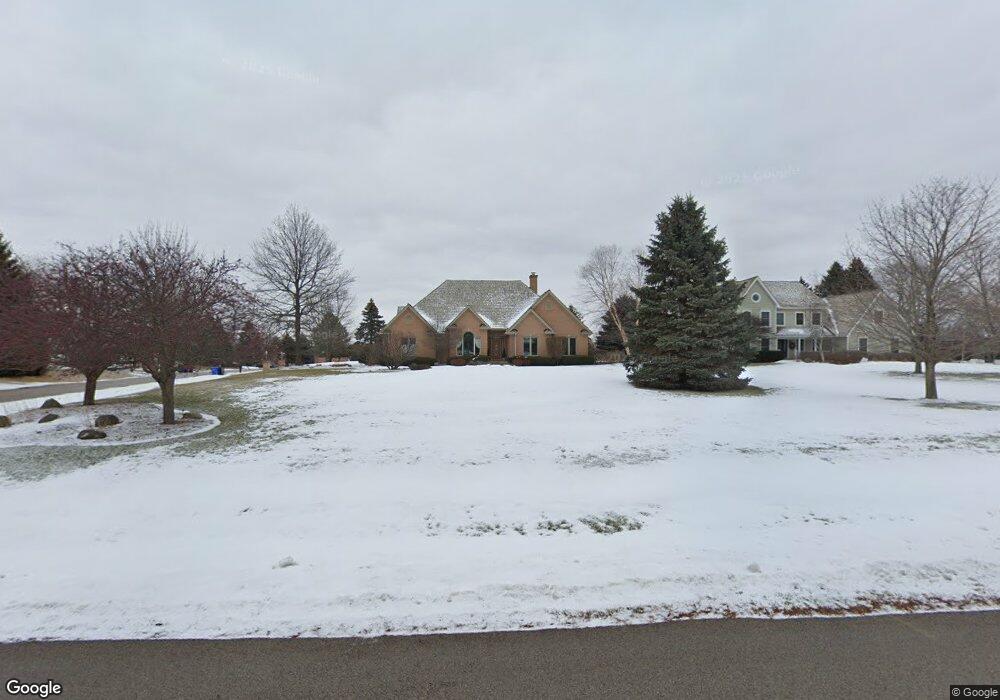
18N425 Sawyer Rd Dundee, IL 60118
Estimated Value: $704,685 - $798,000
4
Beds
4
Baths
4,664
Sq Ft
$163/Sq Ft
Est. Value
About This Home
This home is located at 18N425 Sawyer Rd, Dundee, IL 60118 and is currently estimated at $762,421, approximately $163 per square foot. 18N425 Sawyer Rd is a home located in Kane County with nearby schools including Liberty Elementary School, Dundee Middle School, and Harry D Jacobs High School.
Ownership History
Date
Name
Owned For
Owner Type
Purchase Details
Closed on
Jan 8, 2008
Sold by
Stennett Todd
Bought by
Stennett Todd and Stennett Amy
Current Estimated Value
Purchase Details
Closed on
Nov 3, 2005
Sold by
Deutsche Bank National Trust Co
Bought by
Stennett Todd
Home Financials for this Owner
Home Financials are based on the most recent Mortgage that was taken out on this home.
Original Mortgage
$351,111
Interest Rate
5.99%
Mortgage Type
Fannie Mae Freddie Mac
Purchase Details
Closed on
Jul 8, 2005
Sold by
Sclafani Joseph P
Bought by
Deutsche Bank National Trust Co and Long Beach Mortgage Loan Trust 2004-1
Purchase Details
Closed on
Jul 22, 1998
Sold by
Houlberg Bradley C and Houlberg Debra L
Bought by
Sclafani Joseph P and Sclafani Renee A
Create a Home Valuation Report for This Property
The Home Valuation Report is an in-depth analysis detailing your home's value as well as a comparison with similar homes in the area
Home Values in the Area
Average Home Value in this Area
Purchase History
| Date | Buyer | Sale Price | Title Company |
|---|---|---|---|
| Stennett Todd | -- | None Available | |
| Stennett Todd | $551,500 | Multiple | |
| Deutsche Bank National Trust Co | -- | -- | |
| Sclafani Joseph P | $67,000 | Chicago Title Insurance Co |
Source: Public Records
Mortgage History
| Date | Status | Borrower | Loan Amount |
|---|---|---|---|
| Previous Owner | Stennett Todd | $351,111 |
Source: Public Records
Tax History Compared to Growth
Tax History
| Year | Tax Paid | Tax Assessment Tax Assessment Total Assessment is a certain percentage of the fair market value that is determined by local assessors to be the total taxable value of land and additions on the property. | Land | Improvement |
|---|---|---|---|---|
| 2024 | $14,746 | $216,043 | $37,548 | $178,495 |
| 2023 | $14,017 | $194,388 | $33,784 | $160,604 |
| 2022 | $13,469 | $181,093 | $33,784 | $147,309 |
| 2021 | $13,070 | $170,988 | $31,899 | $139,089 |
| 2020 | $12,807 | $167,144 | $31,182 | $135,962 |
| 2019 | $14,306 | $181,448 | $29,601 | $151,847 |
| 2018 | $15,374 | $189,403 | $30,984 | $158,419 |
| 2017 | $14,735 | $177,178 | $28,984 | $148,194 |
| 2016 | $15,119 | $171,552 | $28,064 | $143,488 |
| 2015 | -- | $160,750 | $26,297 | $134,453 |
| 2014 | -- | $156,311 | $25,571 | $130,740 |
| 2013 | -- | $161,096 | $26,354 | $134,742 |
Source: Public Records
Map
Nearby Homes
- 6415 Grassmere Ln
- 18N732 Westhill Rd
- 1681 Highmeadow Ln
- 3404 Green Pastures Rd
- 6109 Dunroven Lakes Ct
- 5610 Heartland Ct
- 6 Greyshire Ct
- 35W543 Miller Rd
- 3835 Parsons Rd
- 5 Lancaster Ct
- 1551 Westbourne Pkwy
- 7349 Grandview Ct Unit 103
- 1540 Westbourne Pkwy
- 1530 Westbourne Pkwy
- lot 009 Huntley Rd
- 6850 Huntley Rd
- 11 Bitter Spring Ct Unit 162
- 7412 Grandview Ct Unit 196
- 2705 Westwood Cir
- 0000 State Route 31
- 18N423 Sawyer Rd
- 18N418 Sawyer Rd
- 18N518 Spring Bluff Dr
- 3526 Blue Ridge Ct
- 3514 Blue Ridge Ct
- 3536 Blue Ridge Ct
- 3528 Blue Ridge Ct
- 3530 Blue Ridge Ct
- 3534 Blue Ridge Ct
- 3532 Blue Ridge Ct
- 3532 Blue Ridge Ct Unit 3532
- 3522 Blue Ridge Ct
- 3524 Blue Ridge Ct
- 3518 Blue Ridge Ct
- 3516 Blue Ridge Ct
- 3520 Blue Ridge Ct
- 3520 Blue Ridge Ct Unit 3520
- 3538 Blue Ridge Ct
- 18N419 Sawyer Rd
- 3546 Blue Ridge Ct