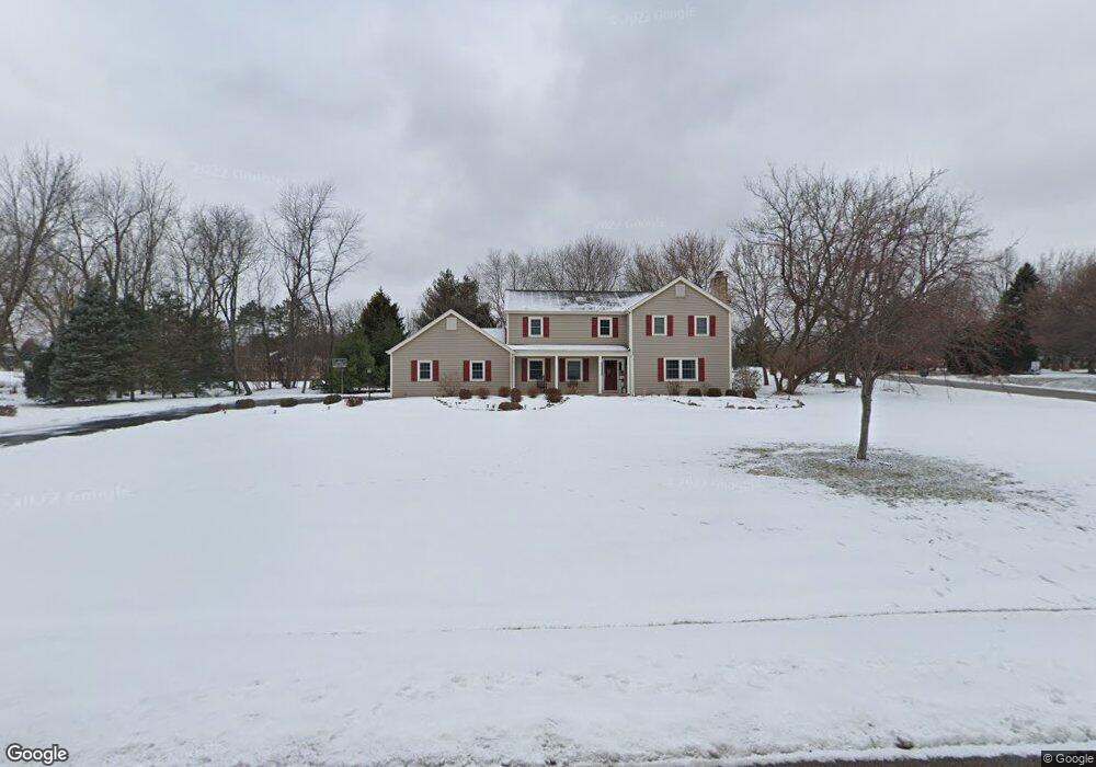
18N630 Spring Bluff Dr Dundee, IL 60118
Estimated Value: $483,000 - $526,000
4
Beds
--
Bath
2,878
Sq Ft
$175/Sq Ft
Est. Value
About This Home
This home is located at 18N630 Spring Bluff Dr, Dundee, IL 60118 and is currently estimated at $502,708, approximately $174 per square foot. 18N630 Spring Bluff Dr is a home located in Kane County with nearby schools including Liberty Elementary School, Dundee Middle School, and Harry D Jacobs High School.
Ownership History
Date
Name
Owned For
Owner Type
Purchase Details
Closed on
Feb 14, 2019
Sold by
Wright Jeffrey W and Wright Pamela K
Bought by
Wright Jeffrey W and Wright Pamela K
Current Estimated Value
Purchase Details
Closed on
Sep 28, 2000
Sold by
Mertel Cary W and Mertel Dorine M
Bought by
Wright Jeffrey W and Wright Pamela K
Home Financials for this Owner
Home Financials are based on the most recent Mortgage that was taken out on this home.
Original Mortgage
$215,000
Outstanding Balance
$78,800
Interest Rate
7.99%
Estimated Equity
$423,908
Create a Home Valuation Report for This Property
The Home Valuation Report is an in-depth analysis detailing your home's value as well as a comparison with similar homes in the area
Home Values in the Area
Average Home Value in this Area
Purchase History
| Date | Buyer | Sale Price | Title Company |
|---|---|---|---|
| Wright Jeffrey W | -- | Attorney | |
| Wright Jeffrey W | $274,000 | Attorneys Title Guaranty Fun |
Source: Public Records
Mortgage History
| Date | Status | Borrower | Loan Amount |
|---|---|---|---|
| Open | Wright Jeffrey W | $215,000 |
Source: Public Records
Tax History
| Year | Tax Paid | Tax Assessment Tax Assessment Total Assessment is a certain percentage of the fair market value that is determined by local assessors to be the total taxable value of land and additions on the property. | Land | Improvement |
|---|---|---|---|---|
| 2024 | $10,465 | $155,646 | $36,018 | $119,628 |
| 2023 | $9,930 | $140,045 | $32,408 | $107,637 |
| 2022 | $9,765 | $132,939 | $32,408 | $100,531 |
| 2021 | $9,469 | $125,521 | $30,600 | $94,921 |
| 2020 | $9,275 | $122,699 | $29,912 | $92,787 |
| 2019 | $9,633 | $124,138 | $28,396 | $95,742 |
| 2018 | $9,499 | $119,313 | $30,984 | $88,329 |
| 2017 | $9,091 | $111,612 | $28,984 | $82,628 |
| 2016 | $9,029 | $104,867 | $28,064 | $76,803 |
| 2015 | -- | $98,264 | $26,297 | $71,967 |
| 2014 | -- | $95,551 | $25,571 | $69,980 |
| 2013 | -- | $98,476 | $26,354 | $72,122 |
Source: Public Records
Map
Nearby Homes
- 3355 Blue Ridge Dr
- 3701 Blue Ridge Dr
- 9 Greyshire Ct
- 1240 Glenmont St
- 3125 Shenandoah Dr
- 2313 Barrett Dr
- 1460 Lancaster Ln
- 1540 Westbourne Pkwy
- 1530 Westbourne Pkwy
- 1201 Waterford St
- 2224 Barrett Dr
- 1211 Waterford St
- 1101 Waterford St
- 1231 Waterford St
- 2010 Cosman Way
- 120 Newburgh Ln
- 35W543 Miller Rd
- 301 Cold Spring St
- 2030 Cosman Way
- 2040 Cosman Way
- 18N622 Spring Bluff Dr
- 23 Hollowside Dr
- 36W121 Hollowside Dr
- 18N655 Spring Bluff Dr
- 18N635 Field Ct
- 36W070 Hollowside Dr
- 18N580 Spring Bluff Dr
- 36W098 Hollowside Dr
- 36W044 Hollowside Dr
- 18N649 Field Ct
- 36W016 Hollowside Dr
- 36W128 Hollowside Dr
- 36W169 Hollowside Dr
- 18N611 Spring Bluff Dr
- 18N568 Spring Bluff Dr
- 1640 Southridge Trail
- 1630 Southridge Trail
- 18N640 Field Ct
- 1650 Southridge Trail
- 18N617 Field Ct
Your Personal Tour Guide
Ask me questions while you tour the home.