Estimated Value: $210,302 - $258,000
Studio
1
Bath
1,728
Sq Ft
$130/Sq Ft
Est. Value
About This Home
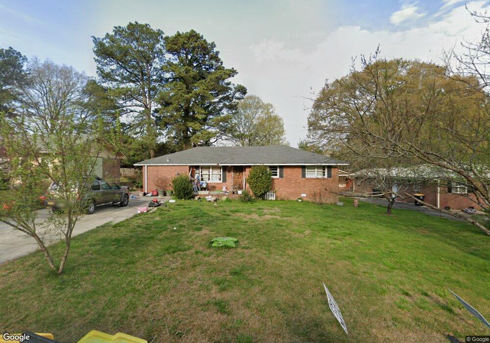
This home is located at 19 Anders Rd SW, Rome, GA 30165 and is currently estimated at $224,076, approximately $129 per square foot. 19 Anders Rd SW is a home located in Floyd County with nearby schools including Rome High School.
Ownership History
Date
Name
Owned For
Owner Type
Purchase Details
Closed on
Aug 28, 2020
Sold by
Hix Dianne A
Bought by
Williams Melissa Dianne and Pool Diana Morgan
Current Estimated Value
Purchase Details
Closed on
Jan 21, 2009
Sold by
Hix Dianne A
Bought by
Hix Dianne A As Trustee Under The Self-D
Purchase Details
Closed on
May 19, 1998
Sold by
Powell Mildred H
Bought by
Hix Dianne A
Purchase Details
Closed on
Jul 3, 1997
Sold by
Powell Harold R and Powell Mildred H
Bought by
Powell Mildred H
Purchase Details
Closed on
Nov 15, 1993
Sold by
Hannon William Franklin
Bought by
Powell Harold R and Powell Mildred H
Purchase Details
Closed on
Jan 18, 1991
Bought by
Hannon William Franklin
Create a Home Valuation Report for This Property
The Home Valuation Report is an in-depth analysis detailing your home's value as well as a comparison with similar homes in the area
Home Values in the Area
Average Home Value in this Area
Purchase History
| Date | Buyer | Sale Price | Title Company |
|---|---|---|---|
| Williams Melissa Dianne | -- | -- | |
| Hix Dianne A As Trustee Under The Self-D | -- | -- | |
| Hix Dianne A | $78,600 | -- | |
| Powell Mildred H | -- | -- | |
| Powell Harold R | $69,900 | -- | |
| Hannon William Franklin | $65,000 | -- |
Source: Public Records
Tax History
| Year | Tax Paid | Tax Assessment Tax Assessment Total Assessment is a certain percentage of the fair market value that is determined by local assessors to be the total taxable value of land and additions on the property. | Land | Improvement |
|---|---|---|---|---|
| 2025 | $2,940 | $82,236 | $7,260 | $74,976 |
| 2024 | $2,940 | $75,688 | $6,600 | $69,088 |
| 2023 | $2,680 | $72,112 | $6,000 | $66,112 |
| 2022 | $1,895 | $51,921 | $4,800 | $47,121 |
| 2021 | $1,737 | $46,806 | $4,800 | $42,006 |
| 2020 | $1,673 | $44,718 | $3,750 | $40,968 |
| 2019 | $1,558 | $42,087 | $3,750 | $38,337 |
| 2018 | $1,458 | $39,398 | $3,750 | $35,648 |
| 2017 | $1,181 | $37,541 | $3,750 | $33,791 |
| 2016 | $1,376 | $37,055 | $3,720 | $33,335 |
| 2015 | $1,299 | $37,055 | $3,720 | $33,335 |
| 2014 | $1,299 | $37,055 | $3,720 | $33,335 |
Source: Public Records
Map
Nearby Homes
- 9 Ladonna Place SW
- 15 Ladonna Place SW
- 30 Westover Dr SW
- 3 Lovell Ln SW
- 17 Glenda Dr SW
- 52 Glenda Dr SW
- 106 Kenwood Dr SW
- 109 Chief Vann Dr SW
- 0 Westlyn Dr Unit 10599621
- 0 Westlyn Dr Unit 7645405
- 105 Brown Fox Dr SW
- 108 Deerbrook Dr SW
- 1 Westlyn Dr SW
- 614 Burnett Ferry Rd SW
- 15 Grandberry Ct SW
- 3 Oak Ridge Ct NE
- 1861 Burnett Ferry Rd SW
- 78 Willowrun Dr SW
- 6 Bayberry Cir SW
- 85 Willowrun Dr SW
- 21 Anders Rd SW
- 15 Anders Rd SW
- 23 Anders Rd SW
- 5 W Brook Dr SW
- 16 Anders Rd SW
- 18 Anders Rd SW
- 13 Anders Rd SW
- 3 W Brook Dr SW
- 7 W Brook Dr SW
- 14 Anders Rd SW
- 25 Anders Rd SW
- 20 Anders Rd SW
- 12 Anders Rd SW
- 9 W Brook Dr SW
- 11 Anders Rd SW
- 27 Anders Rd SW
- 112 Lovell Ln SW
- 113 Lovell Ln SW
- 9 Westbrook Dr Drse
- 357 Billy Pyle Rd SW
Your Personal Tour Guide
Ask me questions while you tour the home.