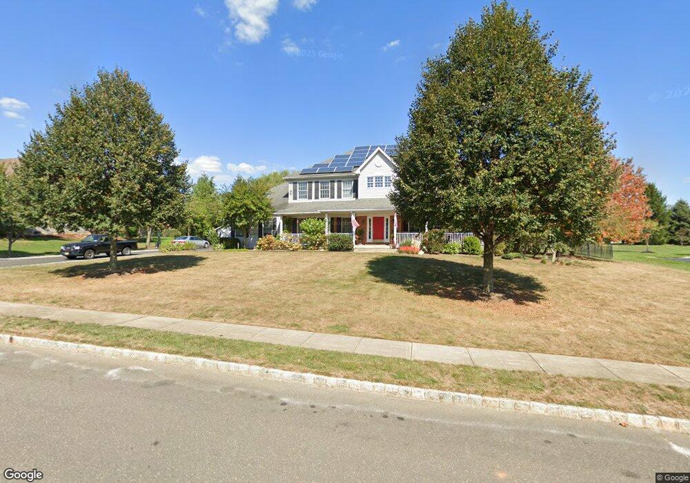
19 Anderson Way Monmouth Junction, NJ 08852
Estimated Value: $1,084,000 - $1,347,000
--
Bed
--
Bath
3,449
Sq Ft
$342/Sq Ft
Est. Value
About This Home
This home is located at 19 Anderson Way, Monmouth Junction, NJ 08852 and is currently estimated at $1,180,194, approximately $342 per square foot. 19 Anderson Way is a home located in Middlesex County with nearby schools including Monmouth Junction Elementary School, Crossroads North Middle School, and South Brunswick High School.
Ownership History
Date
Name
Owned For
Owner Type
Purchase Details
Closed on
Jul 23, 2010
Sold by
Pane Mark P and Pane Vickie Lynn
Bought by
Pane Mark P and Pane Vickie Lynn
Current Estimated Value
Home Financials for this Owner
Home Financials are based on the most recent Mortgage that was taken out on this home.
Original Mortgage
$511,250
Outstanding Balance
$352,711
Interest Rate
5.5%
Mortgage Type
FHA
Estimated Equity
$827,483
Purchase Details
Closed on
Dec 2, 1999
Sold by
Wbe Inc
Bought by
Province R N and Province Antia
Create a Home Valuation Report for This Property
The Home Valuation Report is an in-depth analysis detailing your home's value as well as a comparison with similar homes in the area
Home Values in the Area
Average Home Value in this Area
Purchase History
| Date | Buyer | Sale Price | Title Company |
|---|---|---|---|
| Pane Mark P | -- | Stewart Title Guaranty Co | |
| Province R N | $423,498 | -- |
Source: Public Records
Mortgage History
| Date | Status | Borrower | Loan Amount |
|---|---|---|---|
| Open | Pane Mark P | $511,250 |
Source: Public Records
Tax History Compared to Growth
Tax History
| Year | Tax Paid | Tax Assessment Tax Assessment Total Assessment is a certain percentage of the fair market value that is determined by local assessors to be the total taxable value of land and additions on the property. | Land | Improvement |
|---|---|---|---|---|
| 2025 | $18,426 | $341,100 | $100,000 | $241,100 |
| 2024 | $17,764 | $341,100 | $100,000 | $241,100 |
| 2023 | $17,764 | $341,100 | $100,000 | $241,100 |
| 2022 | $17,236 | $341,100 | $100,000 | $241,100 |
| 2021 | $17,168 | $341,100 | $100,000 | $241,100 |
| 2020 | $17,342 | $341,100 | $100,000 | $241,100 |
| 2019 | $17,498 | $341,100 | $100,000 | $241,100 |
| 2018 | $16,940 | $341,400 | $100,000 | $241,400 |
| 2017 | $16,916 | $341,400 | $100,000 | $241,400 |
| 2016 | $16,739 | $341,400 | $100,000 | $241,400 |
| 2015 | $16,227 | $341,400 | $100,000 | $241,400 |
| 2014 | $15,964 | $341,400 | $100,000 | $241,400 |
Source: Public Records
Map
Nearby Homes
- 6 Monet Ct
- 3 Gramercy Rd
- 2502 Pheasant Run
- 6 Donner Ct
- 4 Donner Ct
- 836 Ridge Rd
- 61 Stouts Ln
- 45 Old New Rd
- 49 Krebs Rd
- 802 Schindler Dr N
- 260 Friendship Rd
- 5903 Schindler Dr S
- 254 Friendship Rd
- 149 Parker Rd
- 4 Drinking Brook Rd
- 3242 Cypress Ct Unit 3242
- 78 Bellan Dr
- 11 Griffen Ln
- 76 Bellan Dr
- 72 Bellan Dr
- 21 Anderson Way
- 17 Anderson Way
- 39 Anderson Way
- 20 Anderson Way
- 37 Anderson Way
- 41 Anderson Way
- 18 Anderson Way
- 22 Anderson Way
- 15 Anderson Way
- 25 Anderson Way
- 29 Anderson Way
- 43 Anderson Way
- 33 Anderson Way
- 16 Anderson Way
- 35 Wexford Dr
- 33 Wexford Dr
- 38 Anderson Way
- 37 Wexford Dr
- 31 Wexford Dr
- 36 Anderson Way