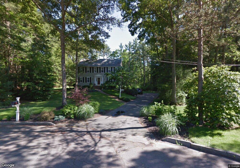
19 Arend Cir Hanover, MA 02339
Estimated Value: $905,443 - $1,098,000
4
Beds
3
Baths
2,432
Sq Ft
$416/Sq Ft
Est. Value
About This Home
This home is located at 19 Arend Cir, Hanover, MA 02339 and is currently estimated at $1,010,611, approximately $415 per square foot. 19 Arend Cir is a home located in Plymouth County with nearby schools including Hanover High School, Cadence Academy Preschool - Hanover, and The Master's Academy.
Ownership History
Date
Name
Owned For
Owner Type
Purchase Details
Closed on
Apr 13, 2023
Sold by
Power David R and Power Carolyn K
Bought by
Powers Ft
Current Estimated Value
Purchase Details
Closed on
Jul 15, 2015
Sold by
Brady Jane A
Bought by
Powers David R and Powers Carolyn K
Home Financials for this Owner
Home Financials are based on the most recent Mortgage that was taken out on this home.
Original Mortgage
$320,000
Interest Rate
3.88%
Mortgage Type
New Conventional
Purchase Details
Closed on
Jul 19, 2006
Sold by
Lee Donald P and Lee Phyllis M
Bought by
Brady Jane A
Create a Home Valuation Report for This Property
The Home Valuation Report is an in-depth analysis detailing your home's value as well as a comparison with similar homes in the area
Home Values in the Area
Average Home Value in this Area
Purchase History
| Date | Buyer | Sale Price | Title Company |
|---|---|---|---|
| Powers Ft | -- | None Available | |
| Powers David R | $595,000 | -- | |
| Brady Jane A | $592,000 | -- |
Source: Public Records
Mortgage History
| Date | Status | Borrower | Loan Amount |
|---|---|---|---|
| Previous Owner | Powers David R | $320,000 | |
| Previous Owner | Brady Jane A | $485,557 |
Source: Public Records
Tax History Compared to Growth
Tax History
| Year | Tax Paid | Tax Assessment Tax Assessment Total Assessment is a certain percentage of the fair market value that is determined by local assessors to be the total taxable value of land and additions on the property. | Land | Improvement |
|---|---|---|---|---|
| 2025 | $10,384 | $840,800 | $336,100 | $504,700 |
| 2024 | $10,164 | $791,600 | $336,100 | $455,500 |
| 2023 | $9,850 | $730,200 | $305,800 | $424,400 |
| 2022 | $9,800 | $642,600 | $267,600 | $375,000 |
| 2021 | $9,627 | $589,500 | $243,400 | $346,100 |
| 2020 | $9,364 | $574,100 | $243,400 | $330,700 |
| 2019 | $9,257 | $564,100 | $254,900 | $309,200 |
| 2018 | $8,977 | $551,400 | $266,500 | $284,900 |
| 2017 | $8,837 | $534,900 | $258,600 | $276,300 |
| 2016 | $8,484 | $503,200 | $235,100 | $268,100 |
| 2015 | $8,127 | $503,200 | $235,100 | $268,100 |
Source: Public Records
Map
Nearby Homes
- 62 Larchmont Ln
- 265 Silver St
- 116 Spring Meadow Ln
- 53 Chestnut St
- 8 Old Farm Rd
- 14 Longwood Ln Unit 14
- 118 Bates Way
- 250 Center St
- 276 Woodland Dr
- 51 Cervelli Farm Dr
- 37 Dr
- 23 Cervelli Farm Dr
- 38 Cervelli Farm Dr
- 9 Cervelli Farm Dr
- 70 Dillingham Way
- 436 Center St
- 375 Webster St
- 67 School St
- 21 King St
- 216 Whiting St