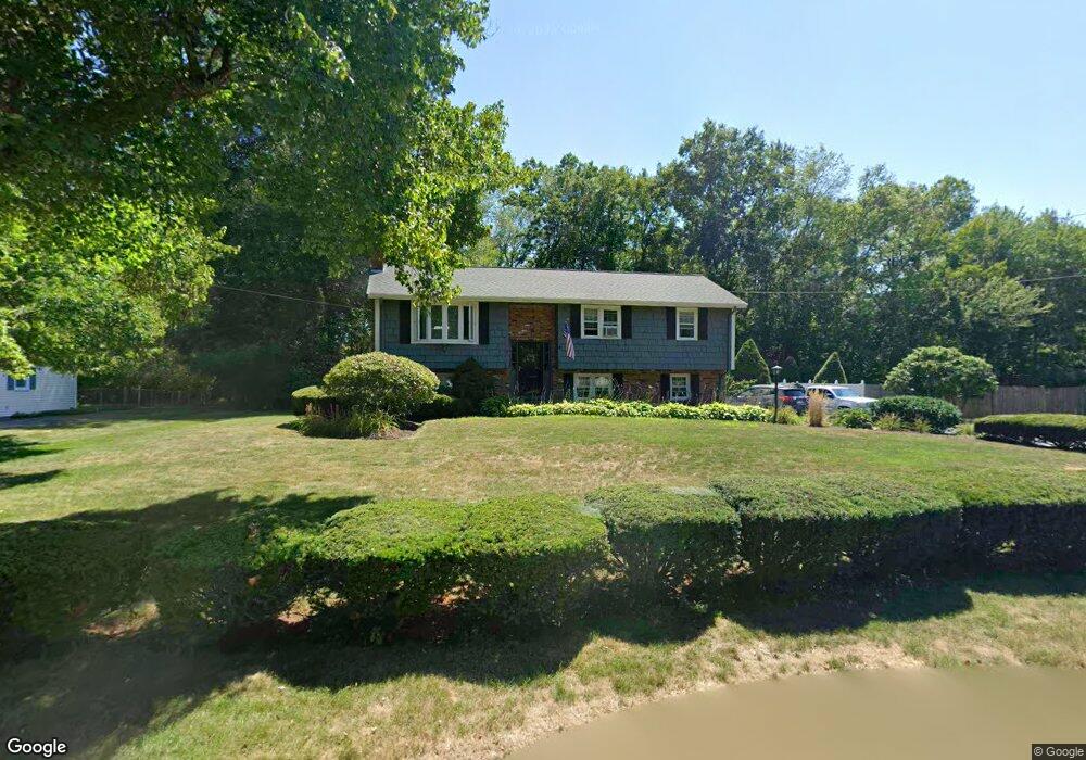
19 Armstrong Dr North Attleboro, MA 02760
Estimated Value: $532,728 - $604,000
3
Beds
2
Baths
1,132
Sq Ft
$506/Sq Ft
Est. Value
About This Home
This home is located at 19 Armstrong Dr, North Attleboro, MA 02760 and is currently estimated at $572,682, approximately $505 per square foot. 19 Armstrong Dr is a home located in Bristol County with nearby schools including North Attleboro High School, Cadence Academy Preschool - North Attleborough, and St John The Evangelist School.
Ownership History
Date
Name
Owned For
Owner Type
Purchase Details
Closed on
Mar 10, 1989
Sold by
Williams Wayne D
Bought by
Donnelly Stephen J
Current Estimated Value
Purchase Details
Closed on
Jan 5, 1988
Sold by
Kuhlmann Inc
Bought by
Williams Wayne
Create a Home Valuation Report for This Property
The Home Valuation Report is an in-depth analysis detailing your home's value as well as a comparison with similar homes in the area
Home Values in the Area
Average Home Value in this Area
Purchase History
| Date | Buyer | Sale Price | Title Company |
|---|---|---|---|
| Williams Wayne | $65,000 | -- | |
| Donnelly Stephen J | $158,000 | -- |
Source: Public Records
Mortgage History
| Date | Status | Borrower | Loan Amount |
|---|---|---|---|
| Open | Williams Wayne | $155,000 | |
| Closed | Williams Wayne | $30,000 | |
| Closed | Williams Wayne | $135,000 |
Source: Public Records
Tax History Compared to Growth
Tax History
| Year | Tax Paid | Tax Assessment Tax Assessment Total Assessment is a certain percentage of the fair market value that is determined by local assessors to be the total taxable value of land and additions on the property. | Land | Improvement |
|---|---|---|---|---|
| 2025 | $5,491 | $465,700 | $151,800 | $313,900 |
| 2024 | $5,254 | $455,300 | $151,800 | $303,500 |
| 2023 | $5,358 | $418,900 | $151,800 | $267,100 |
| 2022 | $5,193 | $372,800 | $151,800 | $221,000 |
| 2021 | $5,087 | $356,500 | $151,800 | $204,700 |
| 2020 | $4,958 | $345,500 | $151,800 | $193,700 |
| 2019 | $4,723 | $331,700 | $138,000 | $193,700 |
| 2018 | $4,215 | $316,000 | $138,000 | $178,000 |
| 2017 | $4,032 | $305,000 | $138,000 | $167,000 |
| 2016 | $3,967 | $300,100 | $153,300 | $146,800 |
| 2015 | $3,713 | $282,600 | $153,300 | $129,300 |
| 2014 | $3,487 | $263,400 | $134,600 | $128,800 |
Source: Public Records
Map
Nearby Homes
- 255 Mckeon Dr
- 11 Buckthorn Ln
- 115 Westfield Dr
- 196 Donald Tennant Cir
- 21 Shady Ln
- 20 Sperry Ln
- 150 Gilbert St
- 57 Vine St
- 11 Landry Ave
- 747 N Main St
- 451R Gilbert St
- 59 Laurelwood Dr
- Lot 2 Jeffrey Dr
- 678 N Main St
- 158 Ivy St
- Lot 5 Jeffrey Dr
- 71 Richardson Ave
- 10 Hazelwood Ct
- 12 Houde St
- 5 Old Wood Rd